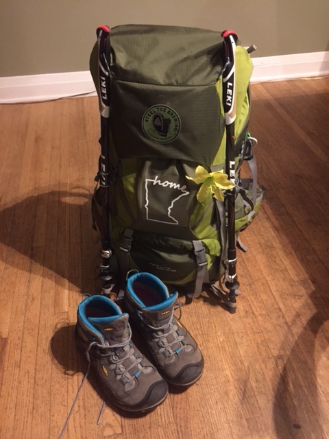
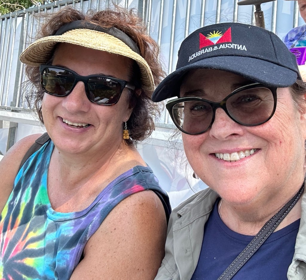
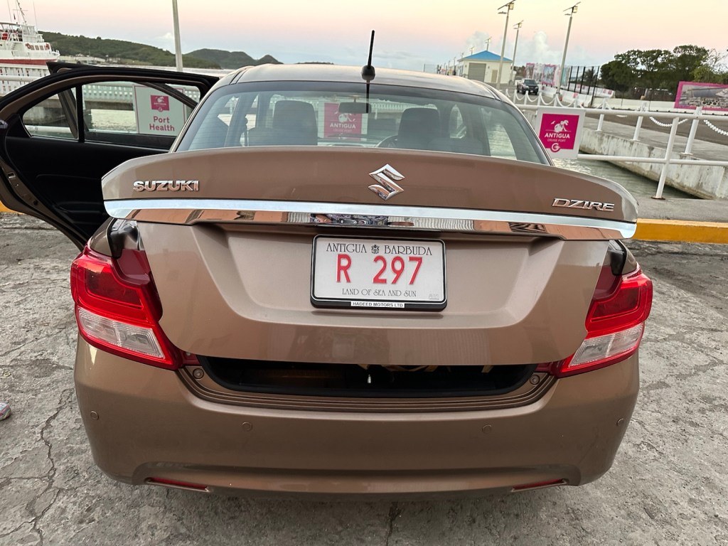
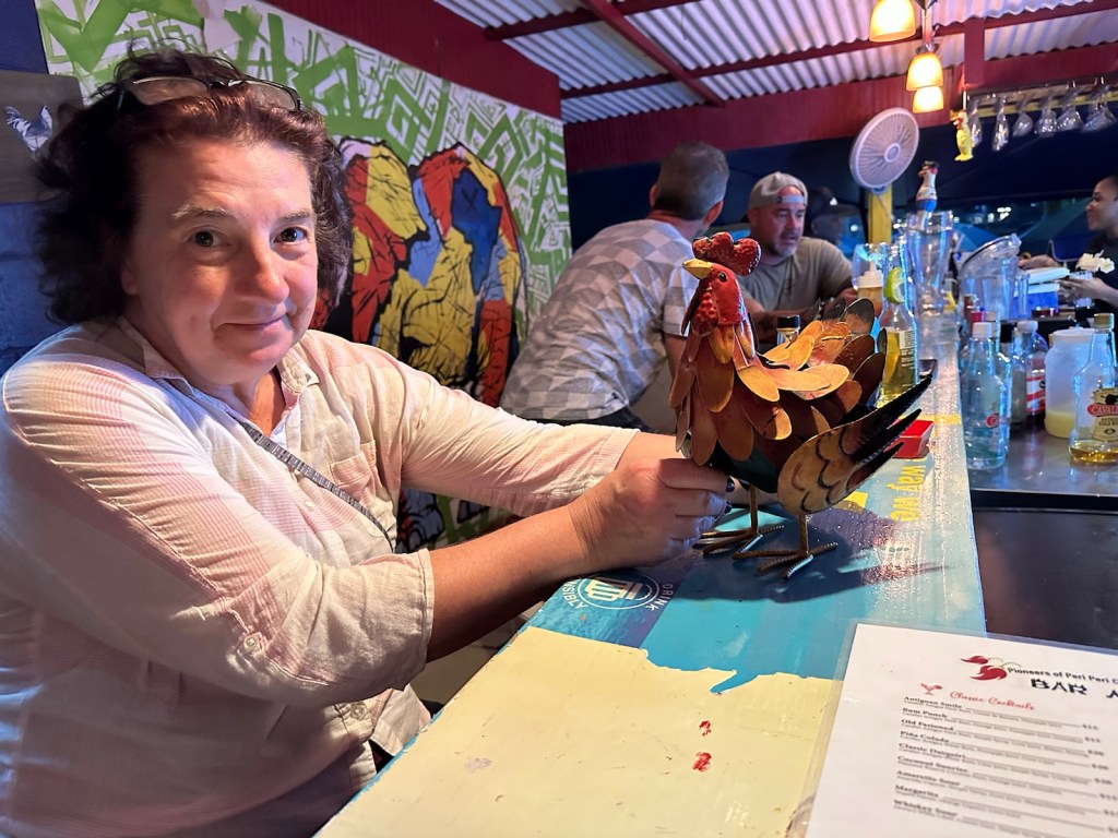
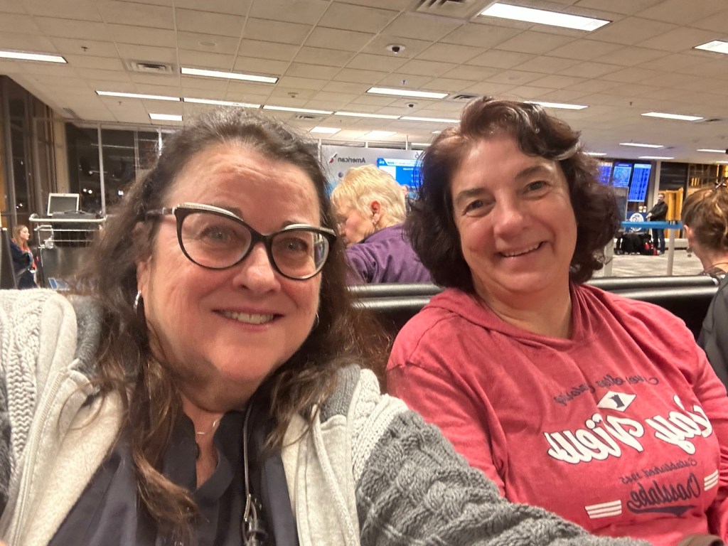
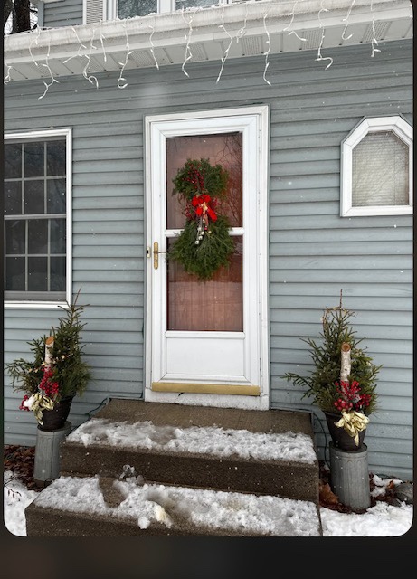
I will be catching a plane today along with my ‘sole’ sister and longtime friend Theresa. Join us as we walk, talk, eat, think & drink our way up the coast of Portugal and into Spain.
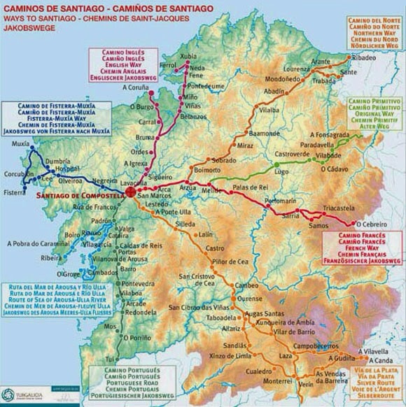
We have become seasoned (and seasonal) walkers since our first adventure in 2017. Living in Minnesota makes it a challenge to get your steps in during the winter months. Our Camino accomplishments are summarized below and documented throughout this blog.
2021 Camino Frances Maseta: About 100 miles from Burgos to Leon. In 2017 we skipped the Maseta segment of Camino Frances to have a timely arrival in Santiago. We often pondered what we missed and just had to find out. Afterward, we flew to the island of Majorca for a few days before heading home.
2019 Camino Inglés: 60 miles walked from A Coruna to Santiago. In addition, we spent a couple weeks as volunteer hosts at an Albuergue in Ribadiso.
2018 Camino Finisterre: 130 miles walked from Santiago to Finisterre to Muxia and back to Santiago.
2017 Francais: 550 miles walked from St. Jean Pied ‘d Port, France through the Pyrenees to Spain and on to Santiago.
The European Camino Network
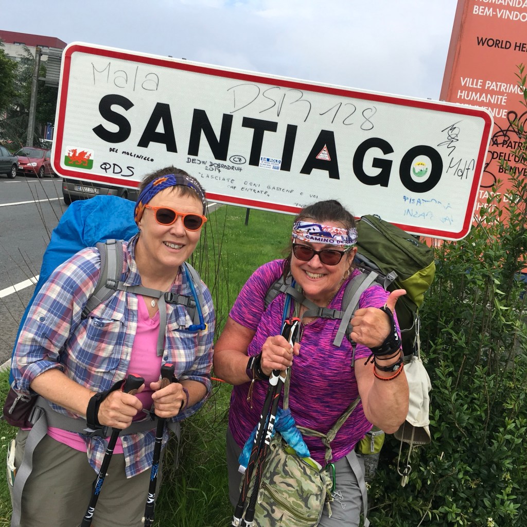
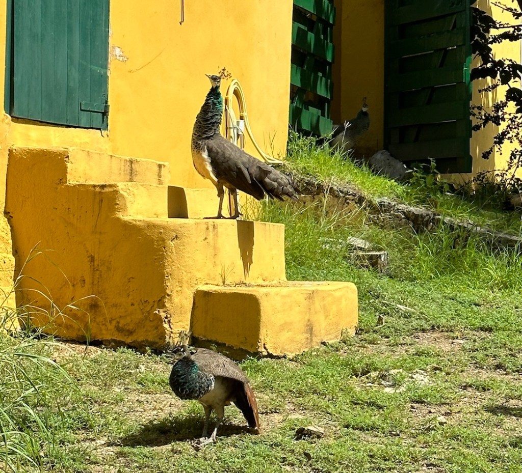
All camino routes end at the shrine of the apostle Saint James the Great in the Cathedral of Santiago. Many walk the Camino for religious devotion, self-discovery, or adventure, enjoying its mix of stunning landscapes, historic towns, and camaraderie among fellow travelers.
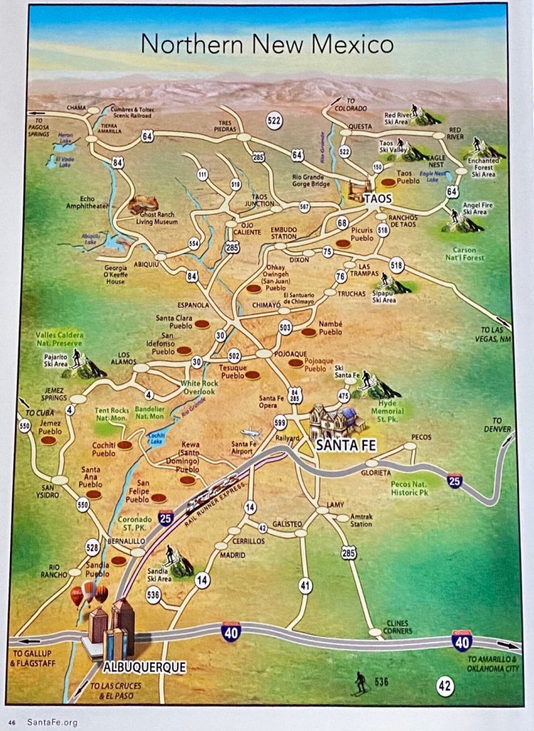
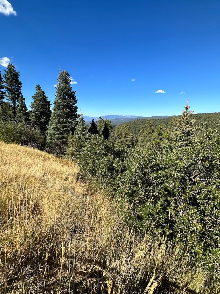
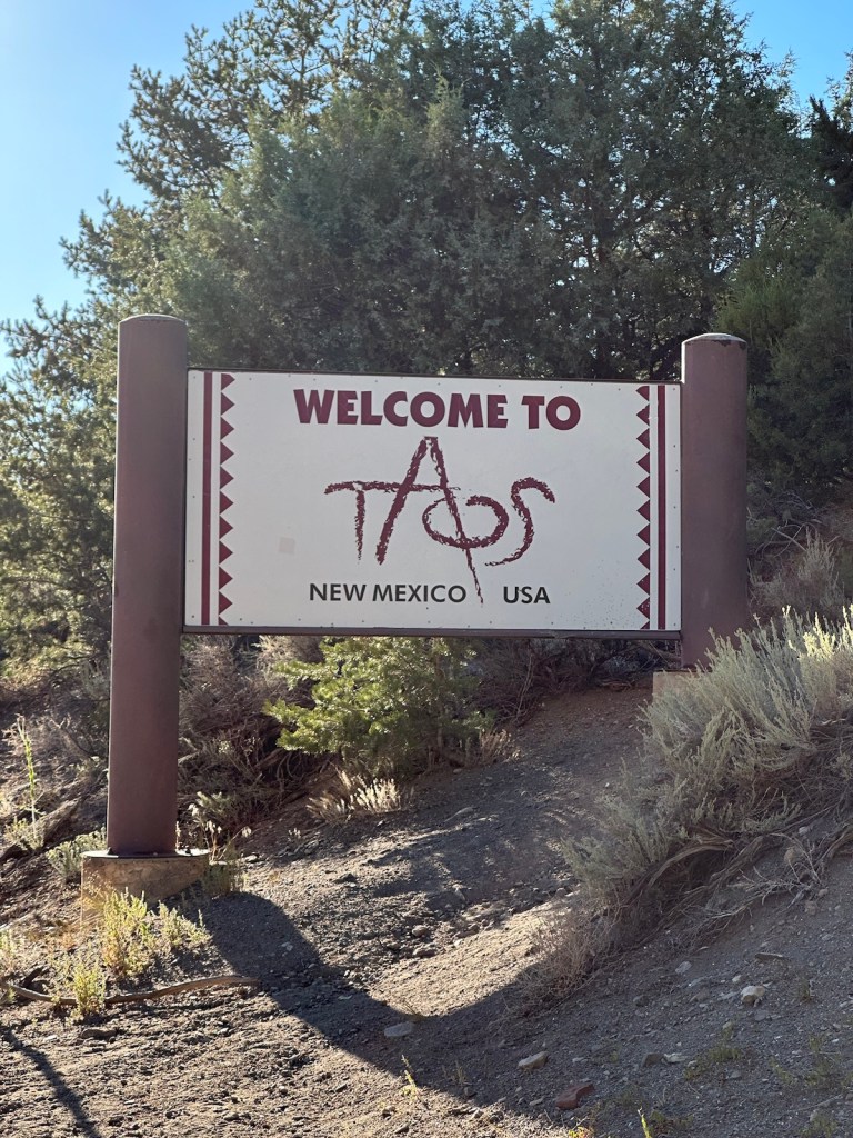
Today’s journey takes us to the spiritual haven of Chimayo on a 56-mile scenic byway called the ‘High Road to Taos.’ It winds through the Sangre de Christo Mountains between Santa Fe and Taos offering alpine views dotted with centuries-old Spanish villages. We returned on the ‘Low Road’ which is a beautiful drive through valleys as it follows along the Rio Grande.
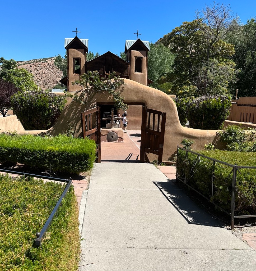
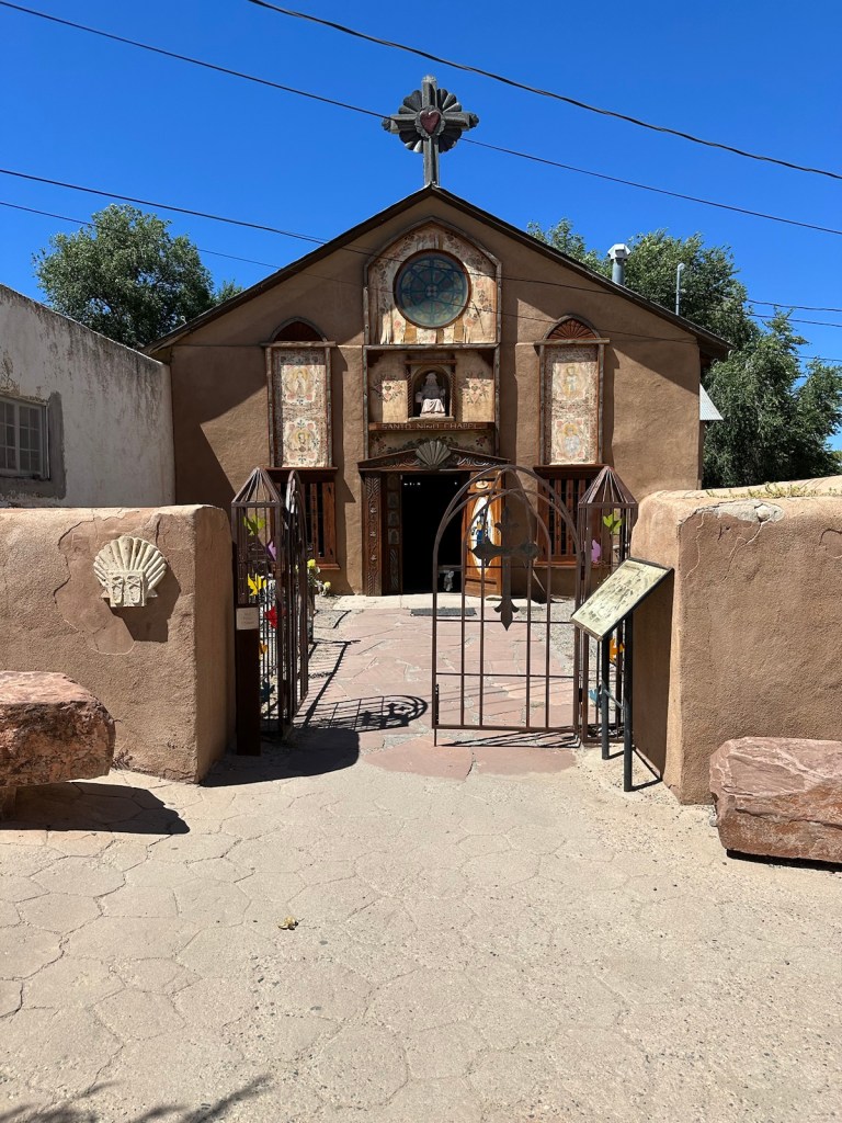
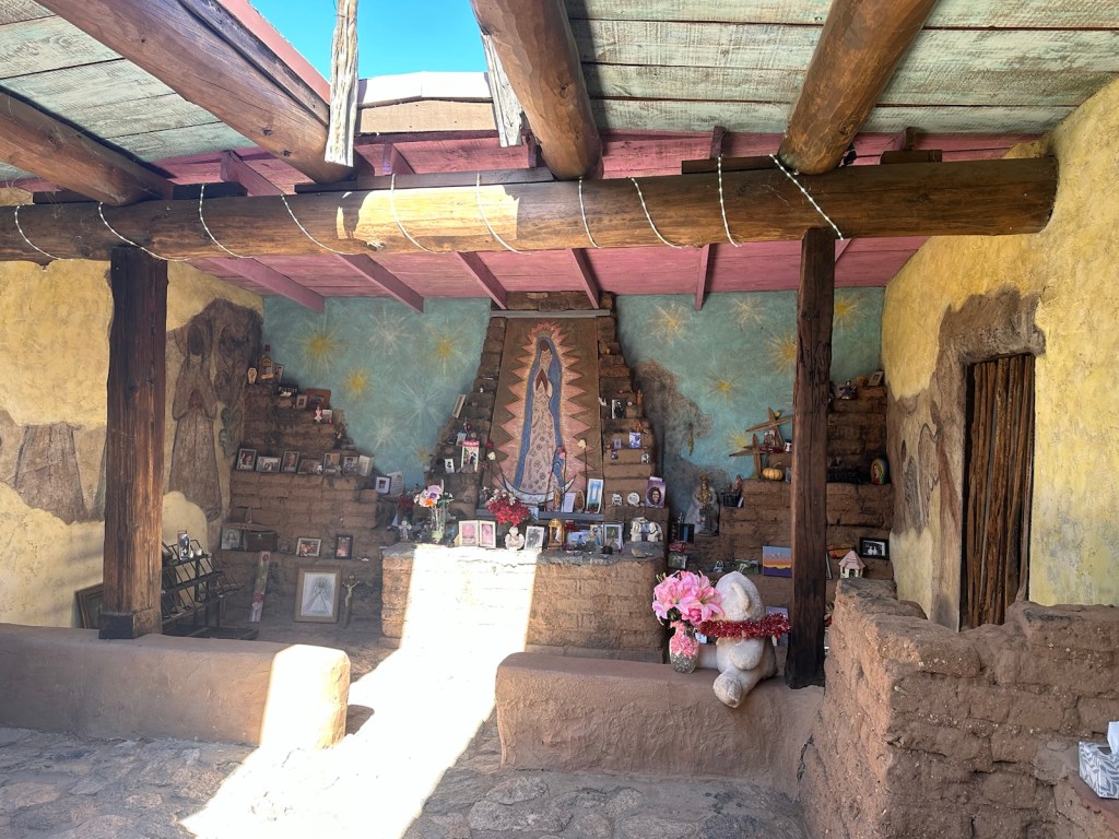
Chimayo has a history that dates back hundreds of years. One of the well known legends is about dirt that comes with a claim of healing abilities. Whether you’re a believer or not, there’s something about the serenity of small churches that makes them inviting. With its thick adobe walls, two bell towers, and six-foot crucifix, the church is considered a prime example of Spanish colonial architecture. But it’s probably best known for the supposedly curative powers of the “holy dirt” that’s found in a side chapel.
National Historic Landmark –– El Santuario de Chimayo
Chimayo legend has it that in 1810 a farmer witnessed light shining from a hillside which was coming from a cross buried in the dirt. After taking the crucifix to a neighboring town, on three separate occasions it went missing, only to be found again in its original location. A chapel was built on that spot and miraculous healings have been attributed to the dirt where the crucifix was found. Now, the church El Santuario de Chimayo is a National Historic Landmark with ‘Holy Dirt’ being sought by thousands of people each year making this site the “Lourdes of North America.”
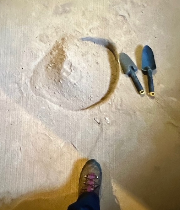
Many visitors seek El Pocito, a small pit of holy dirt found in a side chapel. Some come out of curiosity while others are hoping to find miracle cures. This photo is a screenshot. Photos not allowed in the church.
The Pueblo Indians have inhabited the Chimayo area since the 12th century — long before the initial Spanish conquest of New Mexico. The Pueblo Indians believed that they shared their land with supernatural beings. The natives thought the healing spirits were to be found in the form of hot springs, which ultimately dried up leaving the healing earth. The Pueblo and Tewa used the site of El Santuario de Chimayo for healing long before Spanish occupation.
Supposedly, the small pit of holy dirt is the spot where the crucifix was found and where an ancient pool of mud used by the Indians stored healing powers. Although both the crucifix and the mud have been lost to time, the hole is now filled with Chimayo dirt that has been blessed.
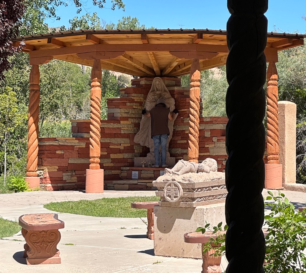
Nearby Santo Niño Chapel
Just a short distance away is the Santo Niño (Holy Child) Chapel, The sign out front instructs you to enter with “the heart of a child” to fully appreciate the chapel. The Holy Child of Atocha is said to roam the hills and valleys, particularly at night, bringing aid and comfort to the needy, and thereby wearing out his shoes.
The Holy Child of Atocha
Photos are not allowed inside the quiet and peaceful chapel. The room down the hall from the chapel is mysterious and endearing at the same time with countless pictures of babies and hundreds of pairs of children’s shoes filling shelves and hanging from the ceiling. The shoes and other offerings have been left for Santo Niño, who is said to be in constant need of new shoes because of his long journeys on foot.
In 1945, US servicemen who survived the Bataan Death March began a tradition of walking to El Santuario to thank Santo Niño de Atocha for “delivering them from evil.” Over 900 New Mexicans from the 200th Coast Artillery died during the Bataan Death march. The tradition of pilgrimages has grown stronger over the years, and now many thousands of people begin or end pilgrimages at El Santuario.
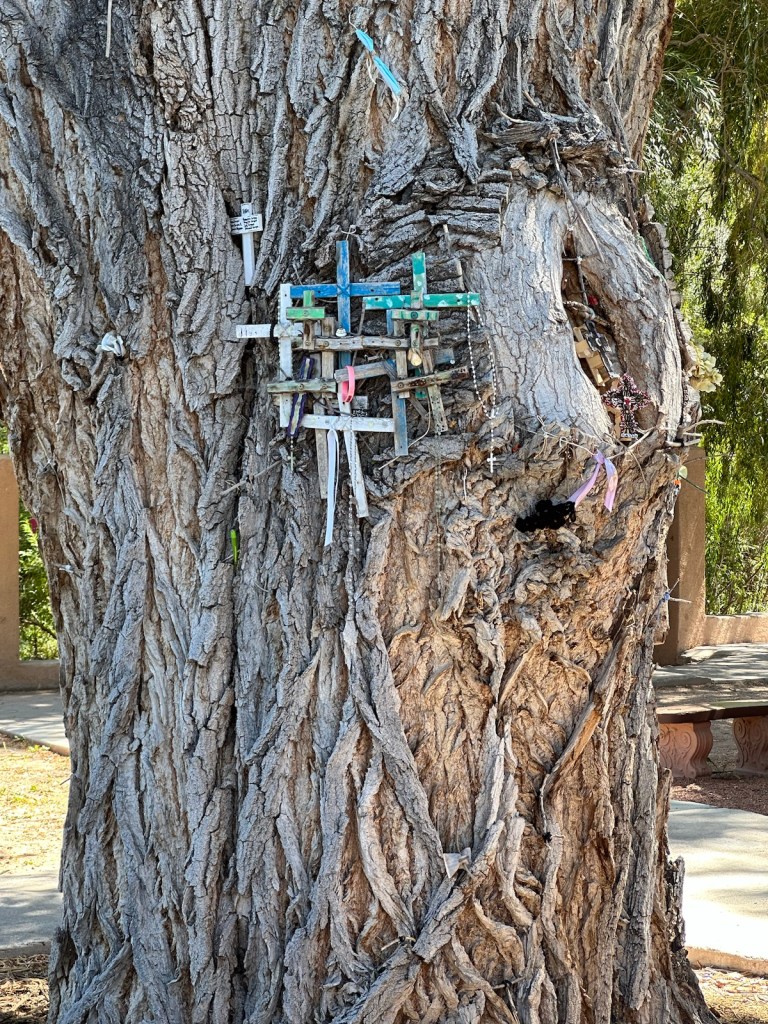
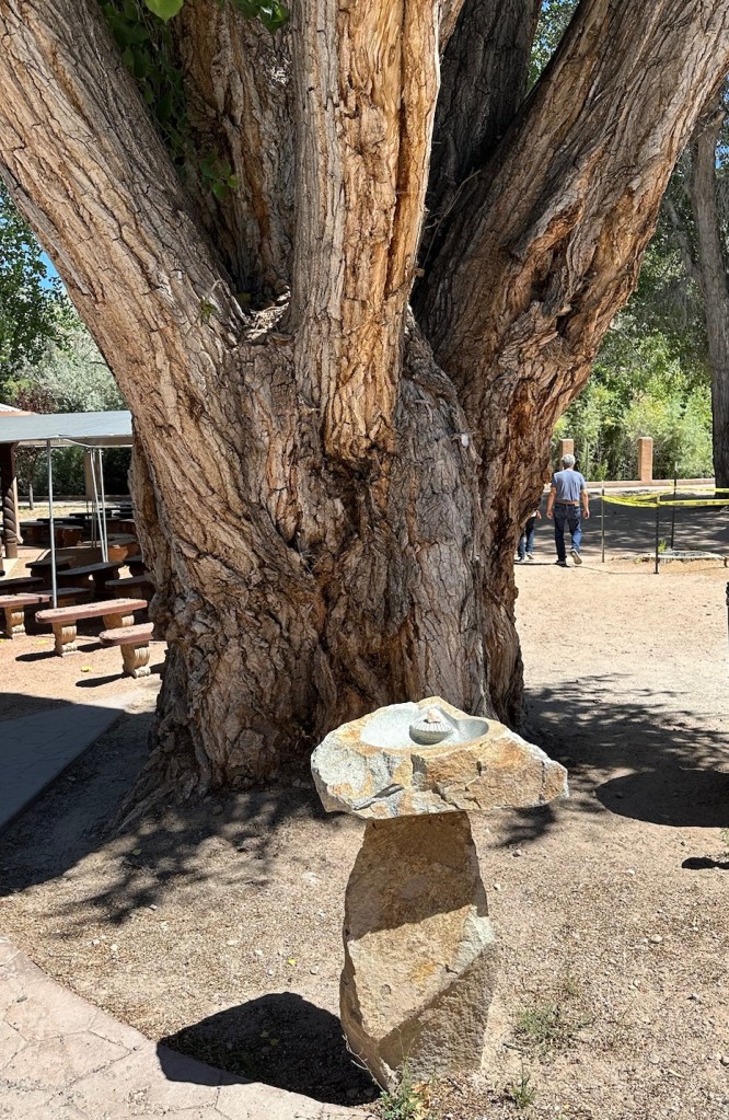
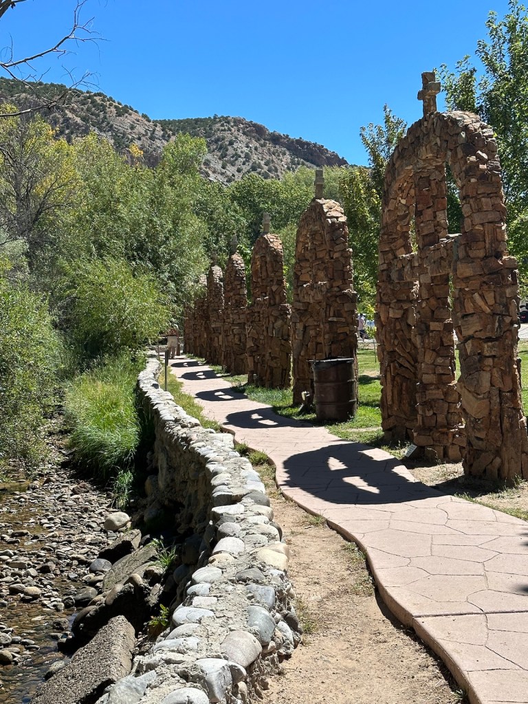
One could spend quite a bit of time wandering the property of El Sanctuario de Chimayo. Pathways lead in various directions and some went down to a pleasant green space filled with beautiful gardens, shrines, grand old trees, a creek and view of the mountains. Over 300,000 people visit this National Historic Landmark each year, many are on pilgrimages.
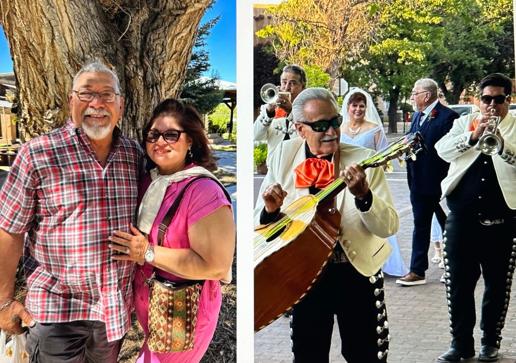
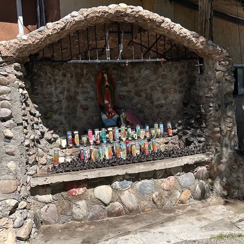
Many restful spots for contemplation.Beautifully carved wooden doors adorn an adobe building.We crossed paths with Damascio and Patricia — they are the newly weds we saw in the Mariachi procession around the square in Santa Fe. These delightful people from San Antonio have quite the dramatic story about their road to the wedding chapel. It had a very happy ending!Several grottos are covered with candles and religious mementos.Crosses and personal items are found everywhere, left by pilgrims in loving memory or in hopes that their prayers for healing may be answered.A stone birdbath or holy water font? Either way I’m sure the birds inhabiting this grand old tree enjoy it. A devotional walkway follows the river bed.
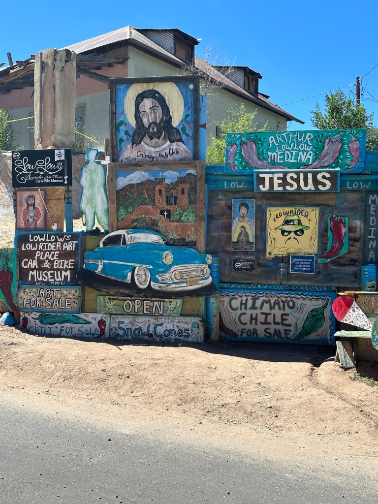
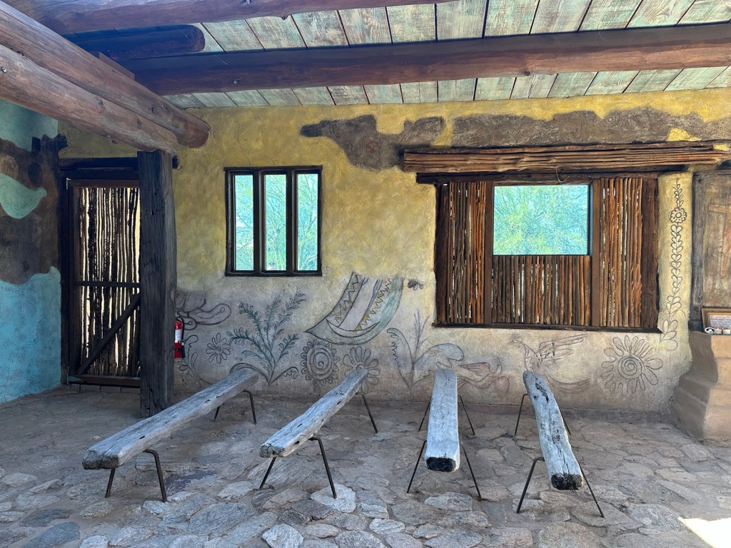
Perusing these two amazingly ornate adobe churches and their gift shops, could easily fill half a day on their own. But there’s even more to Chimayo, including art galleries, historic weaving shops and chile vendors.
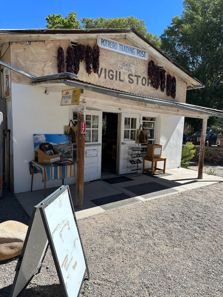
The dusty streets of Chimayo are filled with public artwork.El Potrero Trading Post sits between the two churches at Chimayo.
Another gem … just footsteps away from the churches is the El Potrero Trading Post, a family-owned business loaded with local treasures.
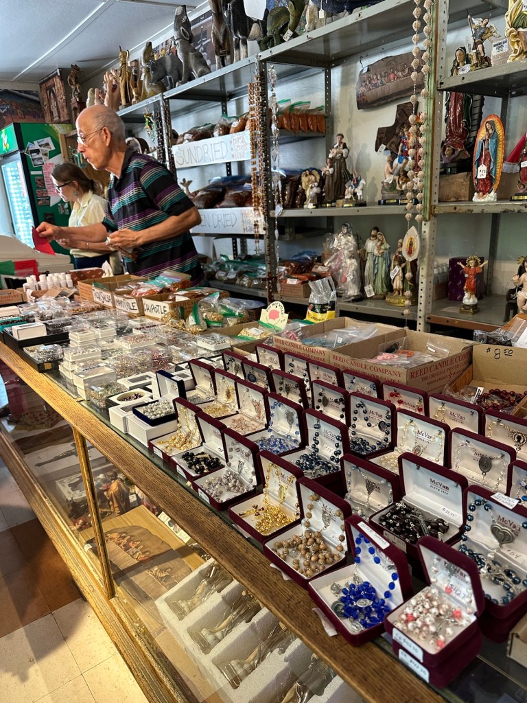
The trading post also features Milagros (miracles) small metal religious charms. These charms are often used as offerings and act as good luck charms for pilgrims.
Many treasures to be discovered here.
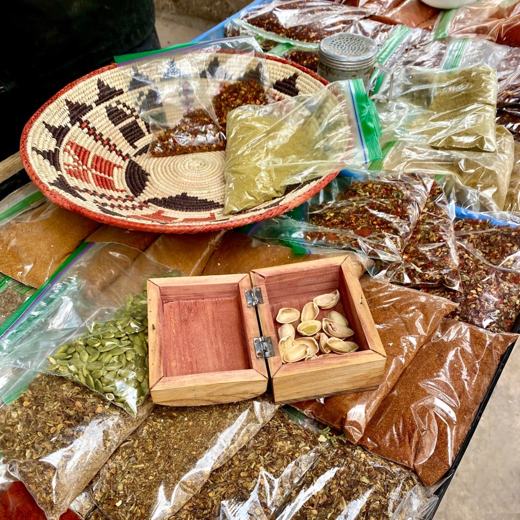
Smells wafting through the post hint at an abundance of chile to choose from; ground, crushed, sundried, red, green, heritage and standard.
The Chimayo chile is sought after for its signature combination of spice and sweetness that is rare in chiles. It is accentuated by a deep richness that some describe as smoky. The demand for Chimayo chile is further boosted by over 300,000 tourists that are drawn to El Santuario de Chimayo each year.
On the road again … After several hours in the Chimayo area, we hit the high road to Taos. Authentic old Spain is evident in the small villages we passed. There were many small galleries, shops and restaurants that appeared to be closed. We either hit the wrong day or the end of the season. Many pueblos and businesses had major festivities over Labor Day weekend which we just missed.
The mountainous high road to Taos reaches 9,300 ft.
Along the remote areas, we saw signs warning of elk, deer and also cows. You can see hawks and eagles soaring above the mountains.
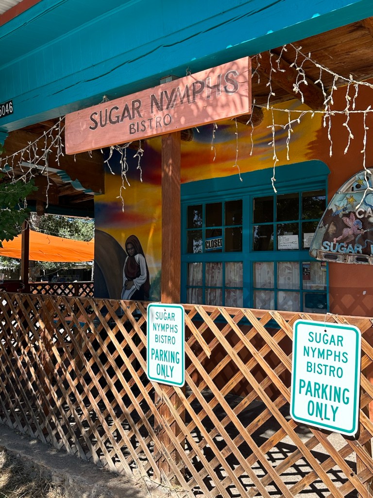
By mid-afternoon, we stumbled onto a roadside restaurant in the sleepy town of Peñasco. The ‘Sugar Nymphs ’ parking lot was full but starting to empty. At the time, we didn’t realize that most restaurants close at 3:00 pm and reopen around 5:00 pm. I think we were the very last of the lunch crowd.
Sugar Nymphs near Peñasco was an awesome find.
The Sugar Nymphs tagline is ‘country atmosphere, city cuisine’. Everything is farm-to-table fare and made from scratch.
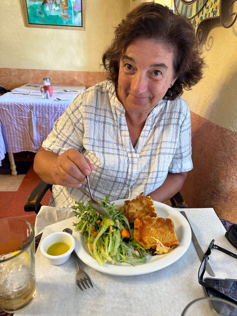
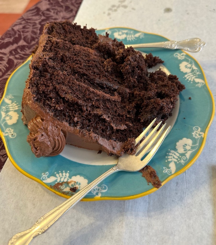
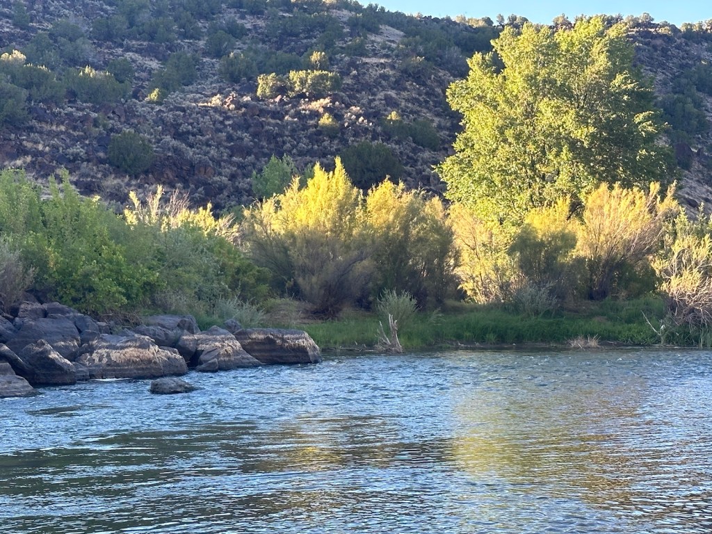
The food is diverse and original with baked goods that are the best ever!The food was so amazing we opted to share a slice of homemade triple-chocolate cake. No regrets.Coming out the mountains and heading for the Rio Grande — very scenic.The Rio Grande was flowing briskly — June is a big month for rafting.Five miles of the Rio Grande is a class III whitewater segment.A beautiful drive along peaceful and relaxing waters.
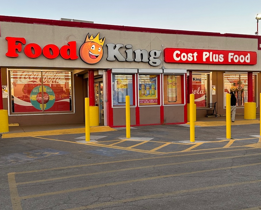
Enroute back to our Santa Fe rental property, we stopped at Food King to forage for some type of frozen entree and a bag of salad for dinner. It had been a long day and we were ready to kick-back and enjoy a restful evening while digesting the day.
Information taken from, New Mexico by Moon, Zora O’Neill’ Official Visitors Guide, Sante Fe; nps.gov/chimayo; moretimetotravel.com; santafe.org; talesofatelecommuter.com; photosphere.com; slowfoodusa.com
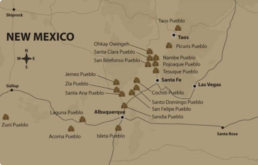
Coming from the Midwest I rarely if ever use the word Pueblo. Arriving in New Mexico for the first time, I discovered that a Pueblo wasn’t exactly what I thought it was … specifically, some type of Adobe building. I needed to do a little research for clarification because it became more confusing as we explored New Mexico.
Pueblo Indians are North American Indian people known for living in permanent settlements called Pueblos. Some of the other tribes were more nomadic and and always on the move. Most Pueblo Indians live in northeastern Arizona and northwestern New Mexico.
Going back a bit in history, the Ancestral Puebloans, also known as the Anasazi, were an ancient Native American culture that spanned the present-day “Four Corners” region which includes southeastern Utah, northeastern Arizona, northwestern New Mexico and southwestern Colorado.
The Ancestral Puebloans, known as the Anasazi, lived in the area where the four corners of these states meet.
Pueblo is another word for an Indian village. A “reservation” is the same thing except that it is the legal term for land managed by a federally recognized tribe under the US Bureau of Indian Affairs. In New Mexico, most of the reservations are called Pueblos.
Typically, the Pueblo (people) still inhabit their ancestral lands and their culture has not undergone much change.
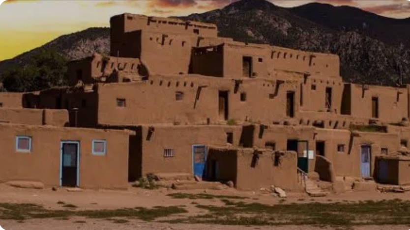
The word Pueblo is also used to describe housing. Traditional Pueblo architecture is found in the southwest, especially New Mexico. This type of structure is usually made of adobe and has multi-level buildings with rooms that touch each other or share a boundary wall. They have flat roofs supported by wooden beams called vigas which typically protrude beyond the building structure.
The Taos Pueblo is a multi-level adobe structure.*
Some pueblos were very large with more than 100 rooms. The rooms were built in long rows and could house many families, kind of like an apartment complex. Today, most Pueblo people live in traditional houses in Pueblo villages.
To summarize the Pueblo world … the Pueblo people belong to various Pueblos and lived in Pueblo structures.
In the early years of the current era (1000 CE) the Puebloan people would build their village on a cliff-top Mesa (flat area) for defense purposes. High above the canyon floor, they could watch for raiding parties from the neighboring tribes. Rather than build a wall around their cities, the cliff dwellings relied on a single means of egress, a ladder or rope that could be pulled up in the event of an attack. Their agriculture assets would also be protected high on the cliffs. It is also theorized that this move to the cliffs was done as a way to shelter from wind in the winter and draw heat from the sun.
Archaeological evidence suggests that most of the region inhabited by the Ancestral Pueblo experienced a severe drought that lasted several decades at the end of the 13th century. This in turn made the traditional method of mesa-top farming unsustainable and they were forced to seek wetter areas elsewhere. This move to find more suitable living environments eventually broke the Ancestral Puebloans into the modern Pueblo tribes. **
More about ancient cliff dwellings to come in a future post describing a visit to the Puye Cliff dwelling in the Santa Clara Pueblo.
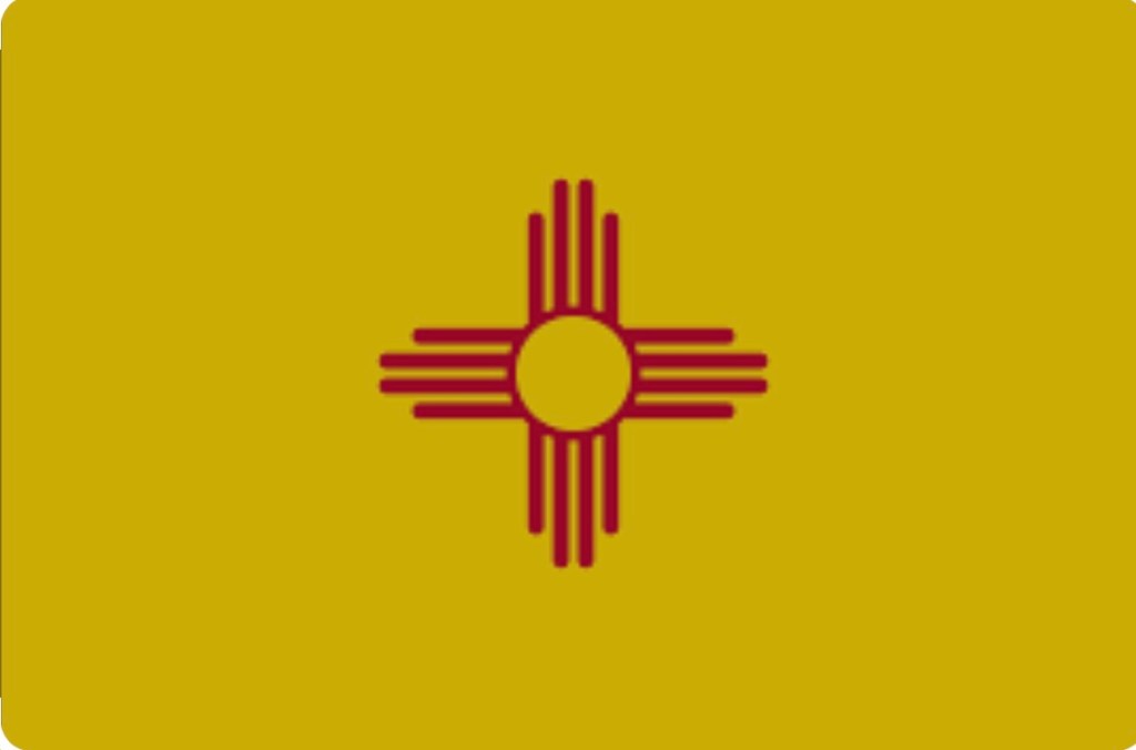
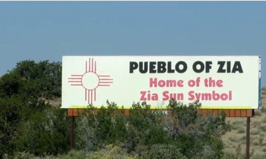
When arriving in New Mexico, I was also fascinated with a prominent symbol that shows up on many things. It’s a powerful red and yellow graphic which is even seen on the state flag and the license plates on cars.
I learned that the Zia sun symbol is what I had been seeing throughout New Mexico. It represents the four cardinal directions, the four seasons of the year, the four periods of each day (morning, noon, evening and night), and the four seasons of life (childhood, youth, middle age, and old age) The center of the sun symbol stands for life itself.
I also learned that in 1925, the state of Mexico adopted a design for its flag featuring the sun symbol belonging to the Zia people. According to the tribe, the symbol was secret and stolen from the Zia, who lost both ownership and control over it, and were left to contemplate the sun symbol being widely used and sometimes desecrated. It later became public domain, still without consent from the Zia secret society which used it for healing and wellness processes.***
For a first time visitor to New Mexico, there is a lot of history to discover that makes the journey more compelling.
* Taos Pueblo photo taken from Advisory Council on Historic Preservation; Josemaria Toscano, Fotolia.
** Zia information and Zia Pueblo photo taken from an article by Catherine Saez, “Indigenous Knowledge Misappropriation: The Case of the Zia Sun Symbol Explained at WIPO.
*** Information taken from Mesas, Cliffs, and the Ancestral Pueblo by Luke Carothers. Also, csengineermag.com
This week’s adventure led my friend Peggy and me to the enchanting state of New Mexico where stunning landscapes, diverse cultures, authentic art and rich traditions prevail.
There is more than 500 years of Hispanic history in New Mexico which is enough to satisfy my ‘Jane In Spain’ passion for the Spanish culture. It is evident in the cuisine, the missions, the architecture, the churches and the artwork. Combine this with the Native American grandeur which dominates the region –– 23 Indian Tribes and 19 Pueblos — that adds up to an exciting week with countless avenues for exploration.
Our hub city Santa Fe is the capital which sits in the Sangre de Christo foothills. It is the oldest capital city in the United States and it is the country’s first UNESCO-designated Creative City which means it is teeming with artists, writers and musicians. Some are renown like Georgia O’Keeffe and George RR Martin, writer of Game of Thrones and many of the lesser known ones fill the parks and streets of Santa Fe.
Join Peggy and me as we tour, explore, eat and shop our way through Santa Fe and New Mexico.
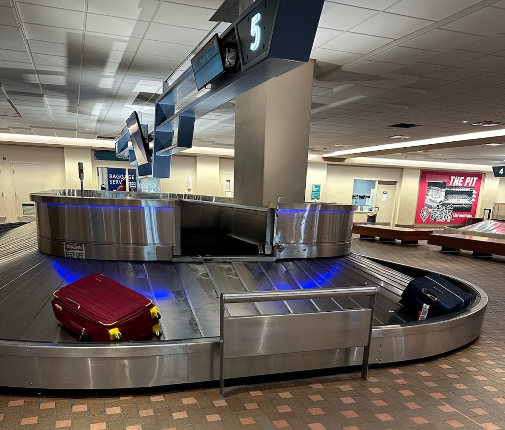
Peggy and I will try to leave no stone unturned on this adventure.Easy to find our bags at Albuquerque International Airport — they were the only two on the carousel.
It’s a Beautiful Day in Santa Fe!
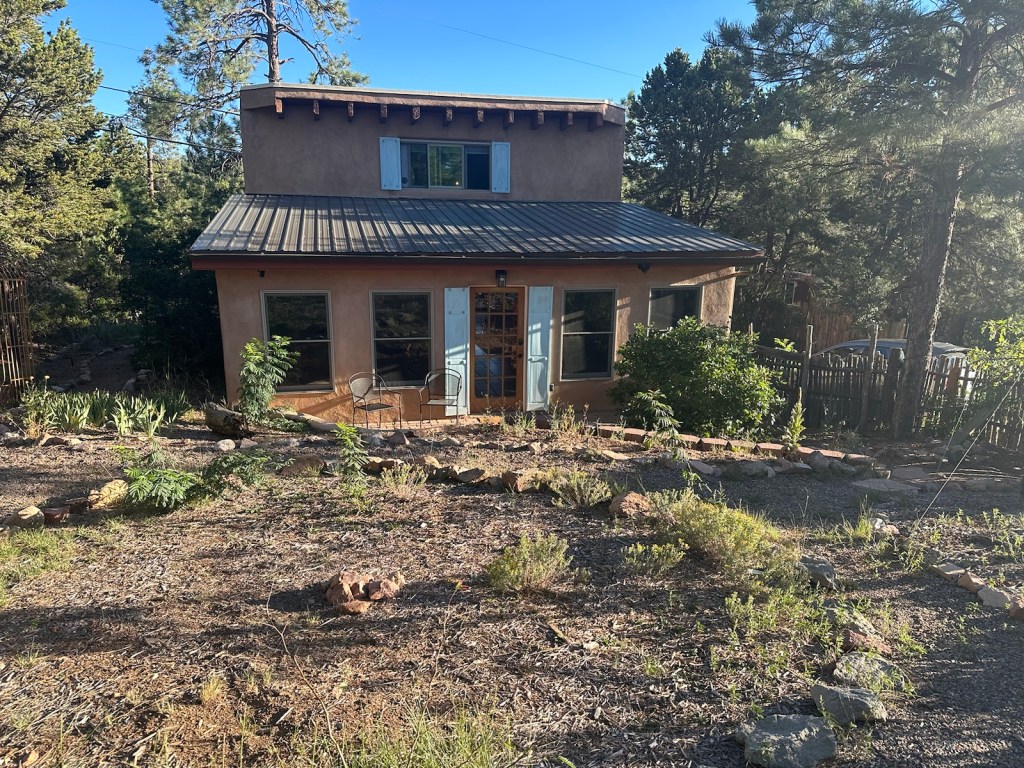
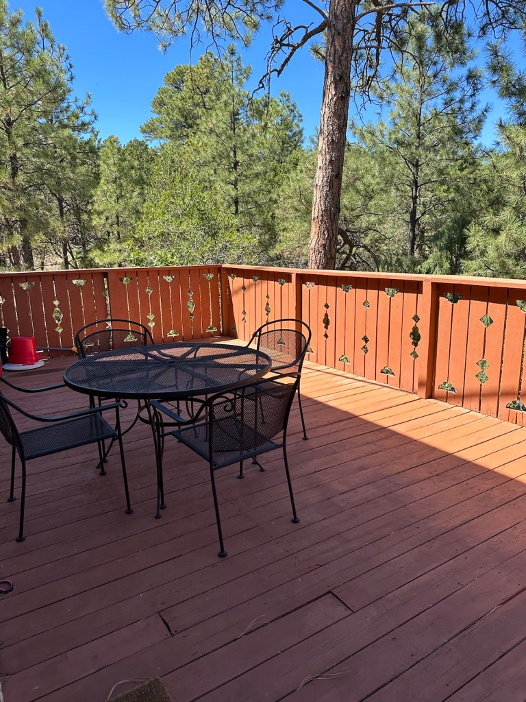
An hour or so from Albuquerque is our rental property nestled in the woods about seven miles south of Santa Fe.
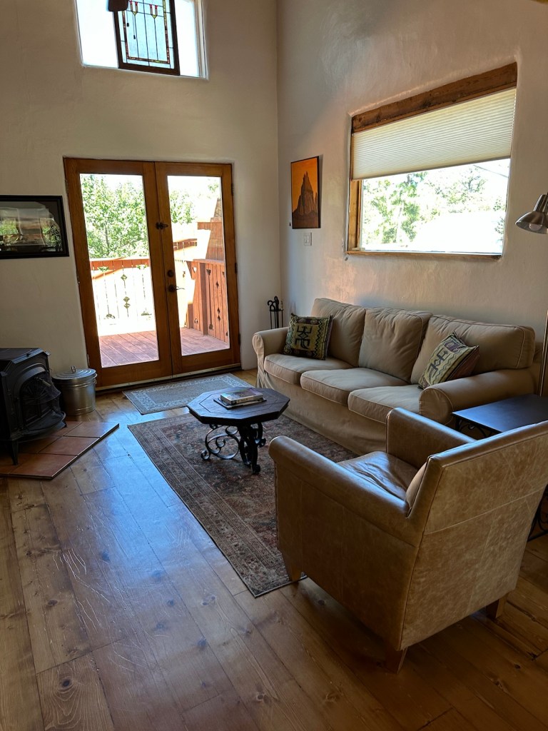
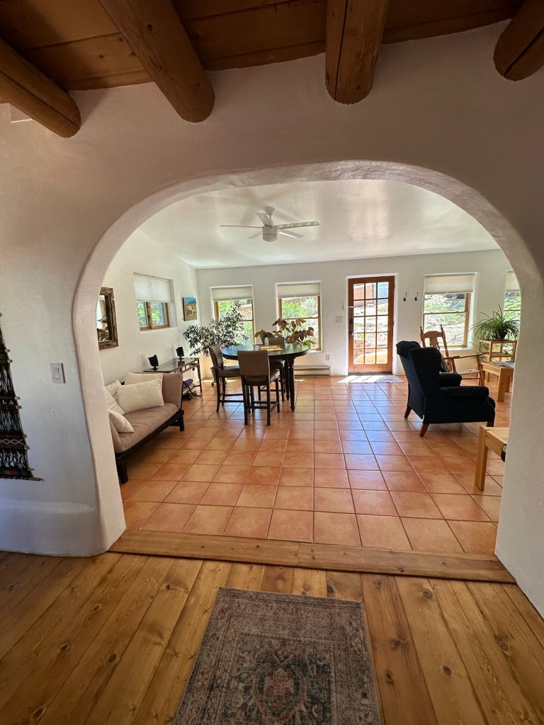
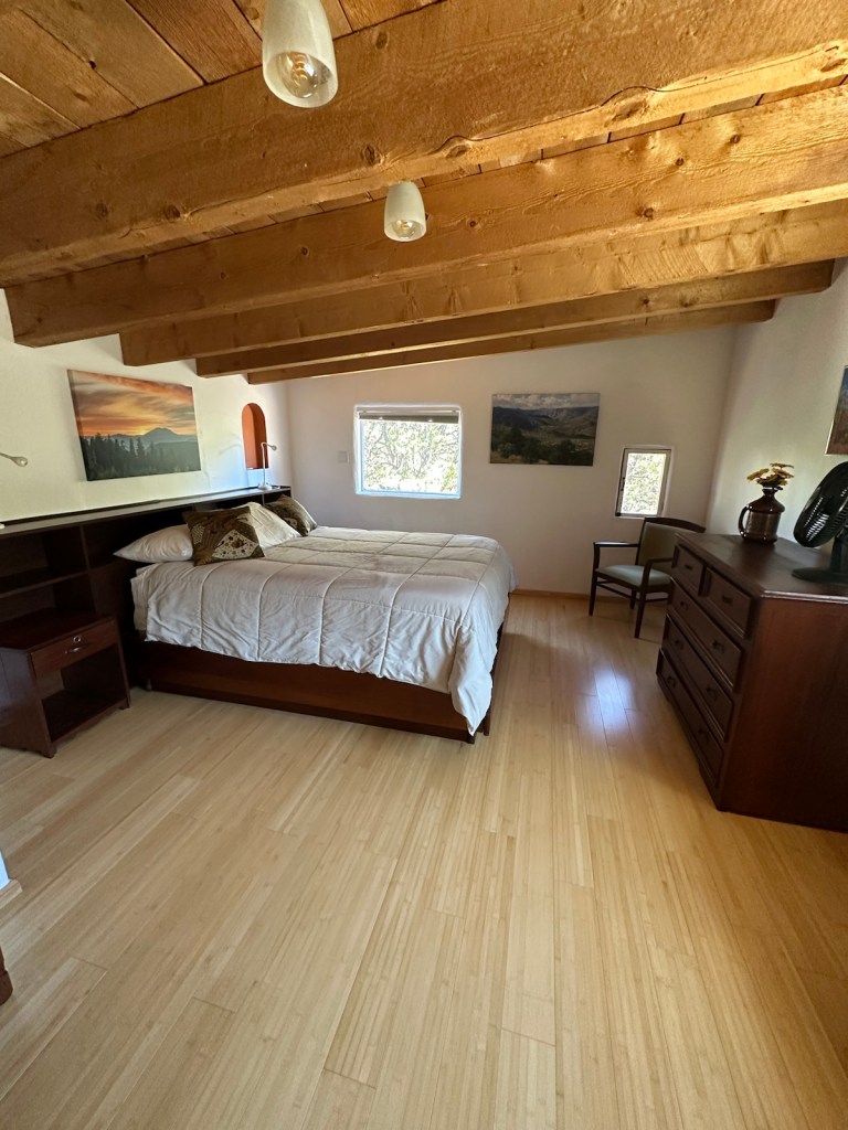
We opted for a rental property rather than a hotel.
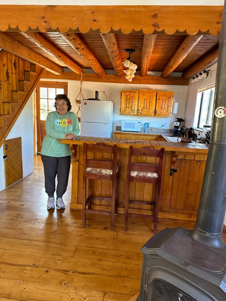
This very charming two-bedroom house features exposed timber ceiling beams and wood floors.
A full-size kitchen made quick breakfasts easy.High ceilings & comfortable furniture –– perfect for relaxing and feeling at home.We love the outdoor patio — smells like pine trees with countless birds at home in the trees. Lots of hummingbirds.
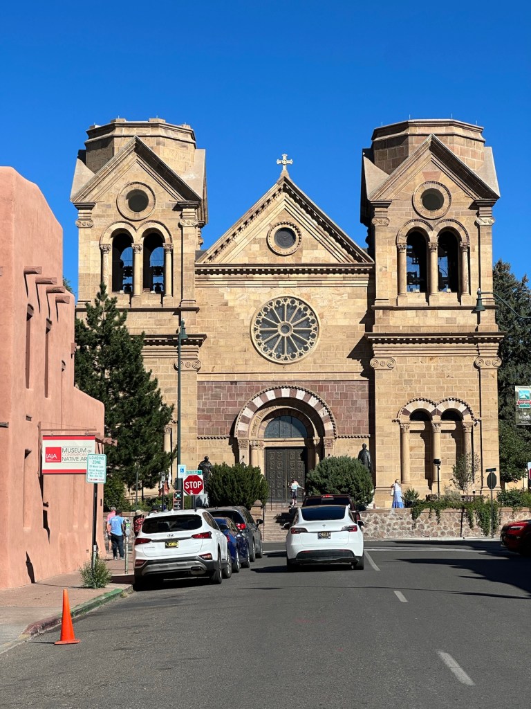
On our first afternoon, we drove to Santa Fe, a city that was founded in 1610. That same year the first church was built and later replaced with a larger adobe church which was destroyed by the Pueblo Indian revolt in 1680. The expelled Spaniards returned and rebuilt the church in 1714. On this same site, the current Cathedral was completed and dedicated in 1887. The Cathedral was elevated to a Basilica by Pope Benedict in 2005.*
* Information taken from the Cathedral Basilica of St. Francis of Assisi website.
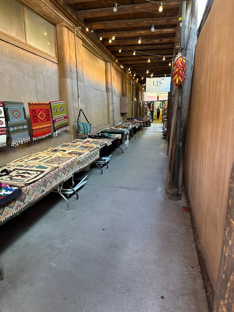
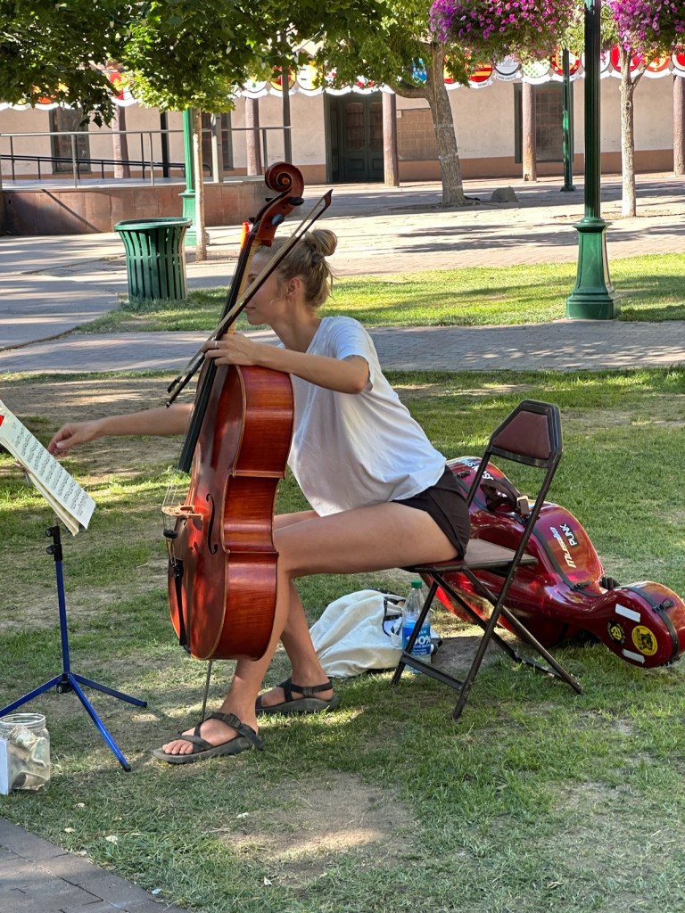
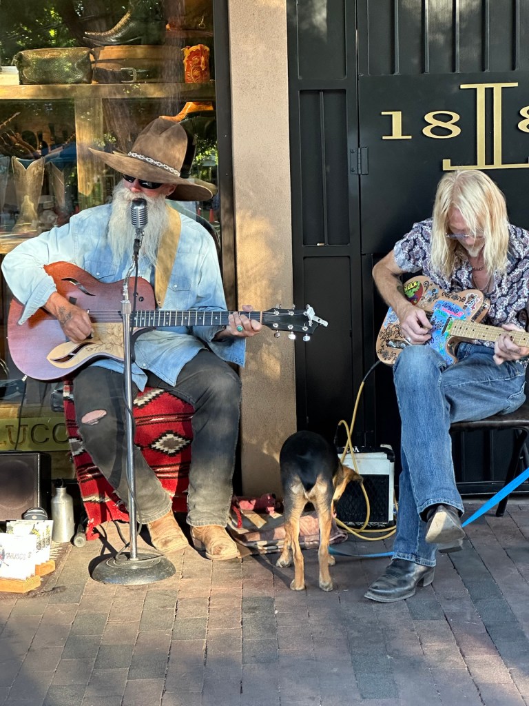
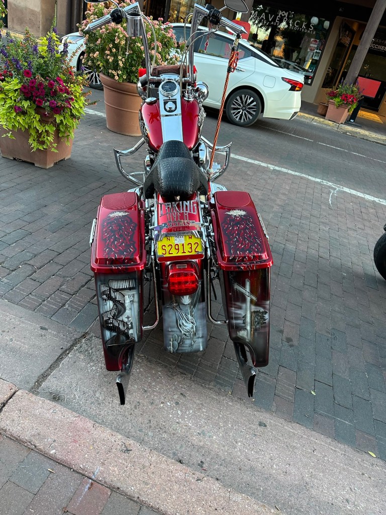
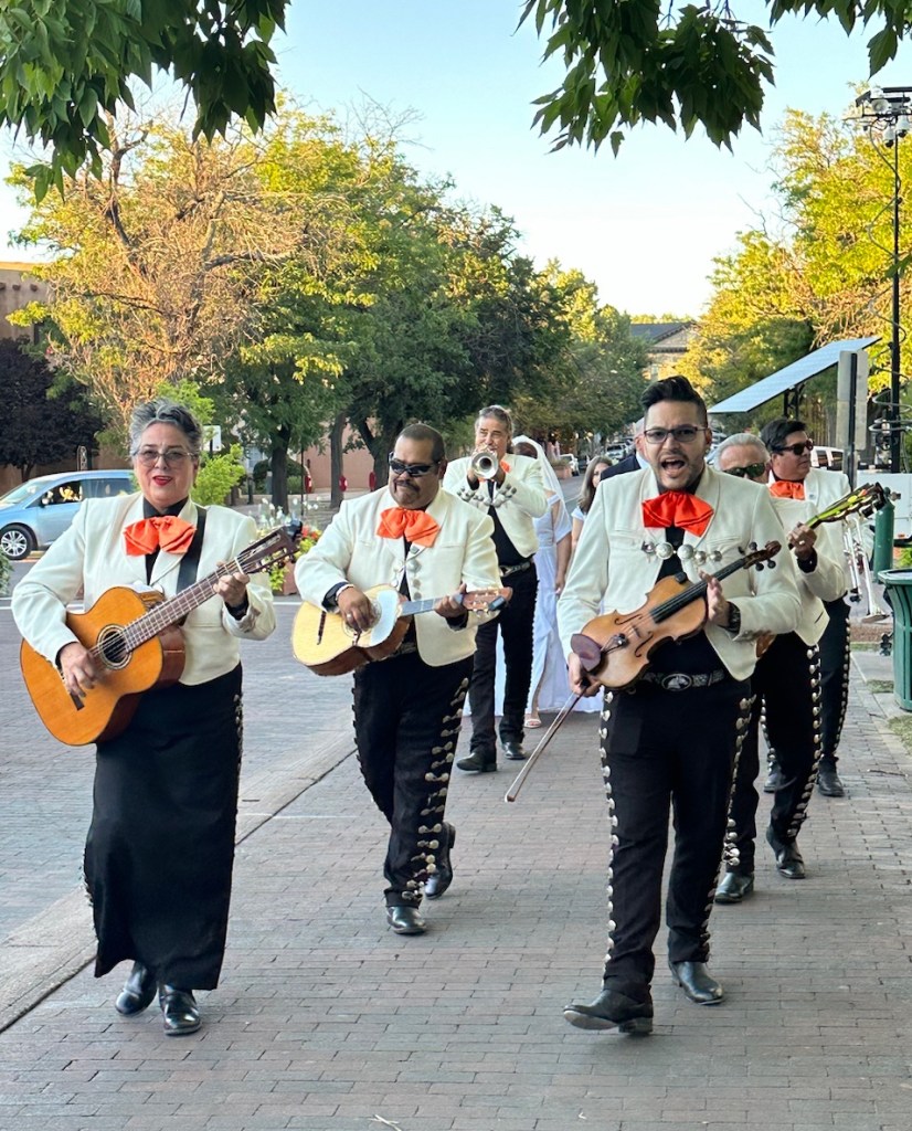
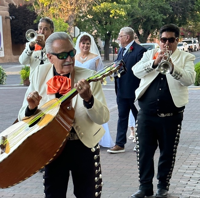
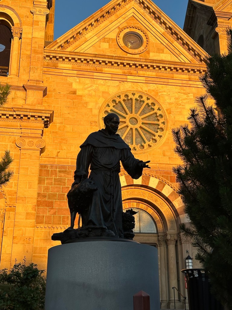
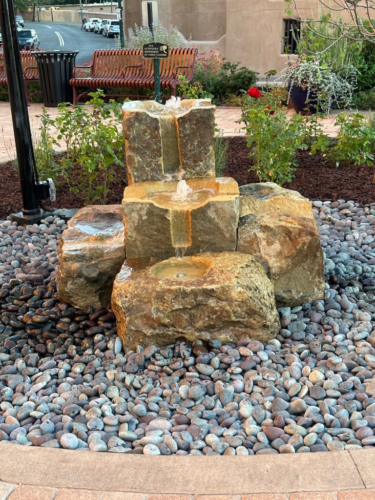
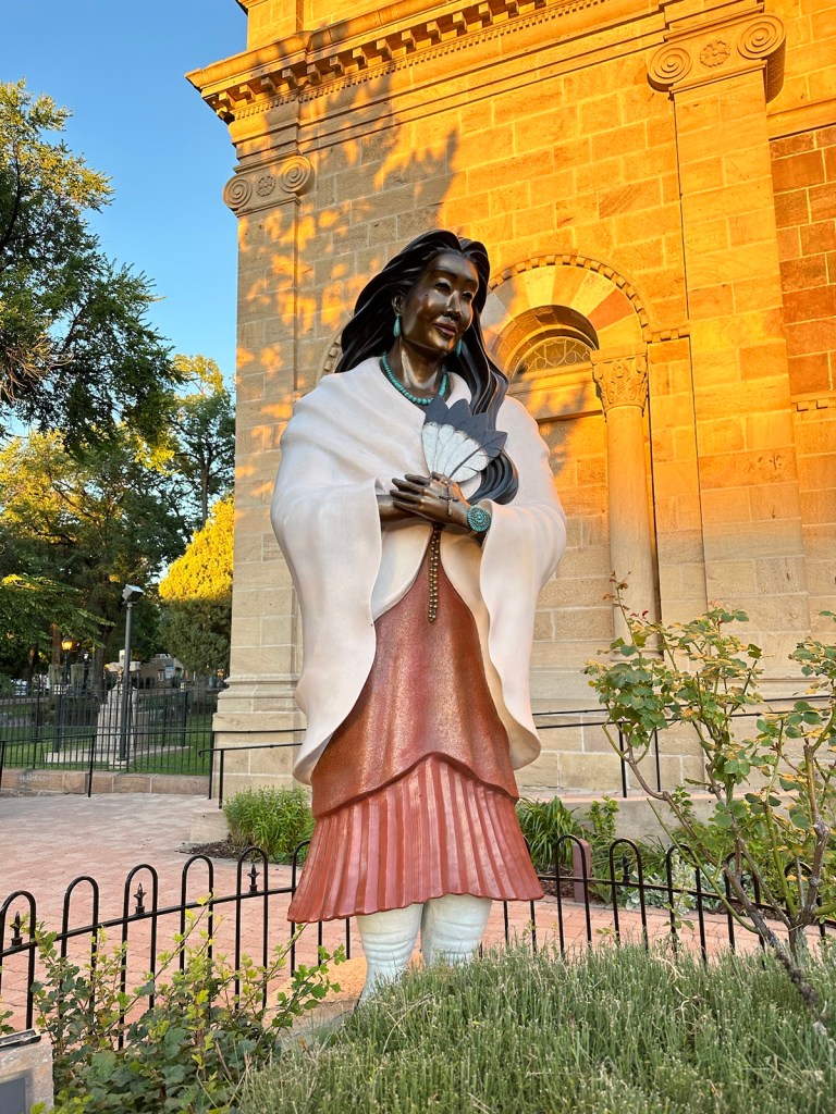
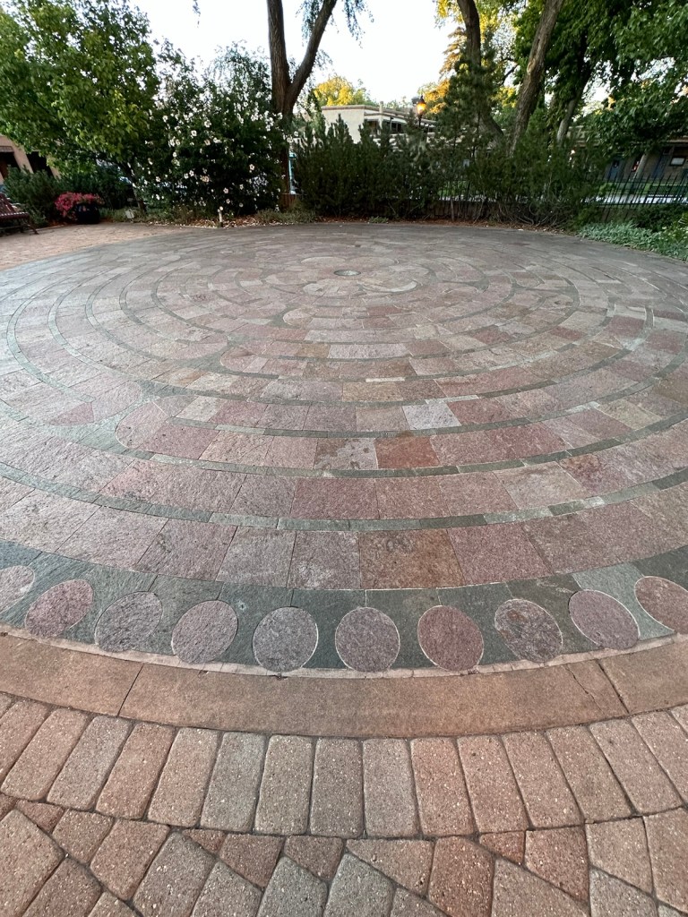
The Cathedral Basilica of St. Francis of Assisi is a prominent site in downtown Santa Fe.A shopping alley filled with weaving and other creative items.After an extremely long day, we strolled through town square. It was very relaxing to listen to a cellist perform.Willie Nelson songs and sounds filled the air.Daniel, the ‘engineer of words’ had my heart. He wrote some licks about my cat Biscuit and her compatriots Pat-Rick, Purrsey and Atlas. The best words were, “cats prolong the life of their owners for the cat caretaker is loved more than anyone knows.”Even this Harley Davidson screams of Santa Fe with the chili pepper artwork in addition to the staircase of Loretto.Singing Mariachis led a newlywed couple in a promenade around the town square.What a joyous occasion to see this beautiful bride and her handsome husband being escorted around by the Mariachi musicians. This is not a sight you see very often. The setting sun cast a dramatic glow on the Basilica Cathedral and statue of St. Francis of Assisi.Fountains just outside the church doors.The church courtyard honored contemporary Saint Kateri Tekakwitha who was an Algonquin Mohawk.Even though it had been a long day, we took time to walk the Labyrinth in front of the Cathedral-Basilica which is in the style of the one at the cathedral of Chartres, France. It was a nice way to end the day.
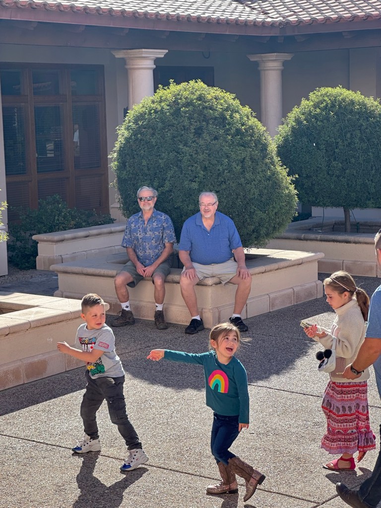
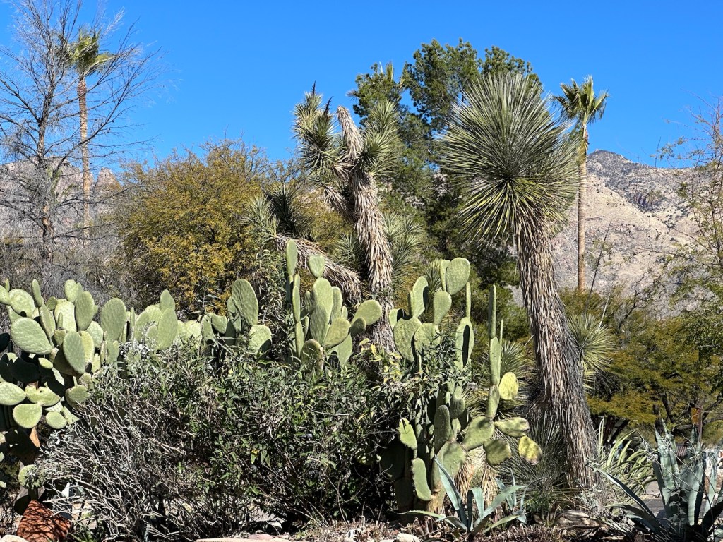
And the Tucson adventure continues. Temperatures this weekend were in the high 70s. Full sunshine was a welcome break from the gray and cloudy winter skies of Minnesota. My husband David and I are exploring the area with our favorite snowbirds — John and Vicki.
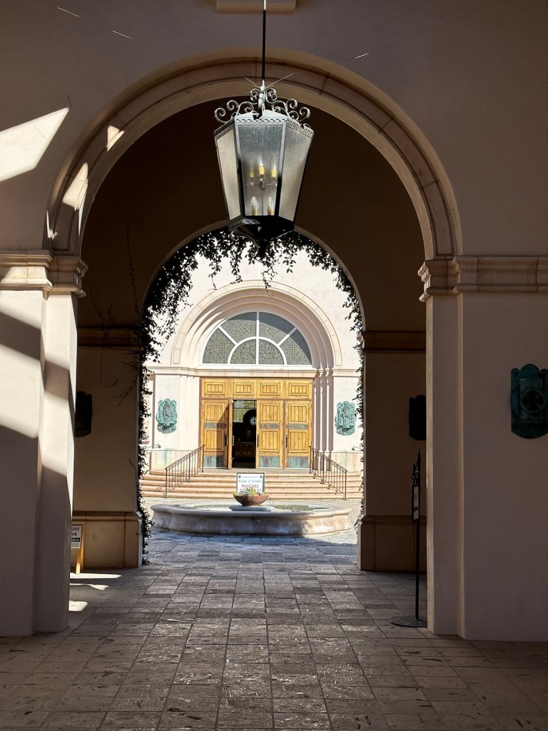
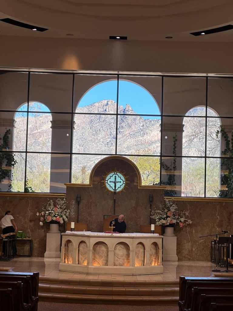
We’re on the serendipity path and one interesting stop was at a neighborhood church steeped in Spanish Missionary tradition. The neoclassical/Spanish colonial design of this church campus was inviting especially for the curious.
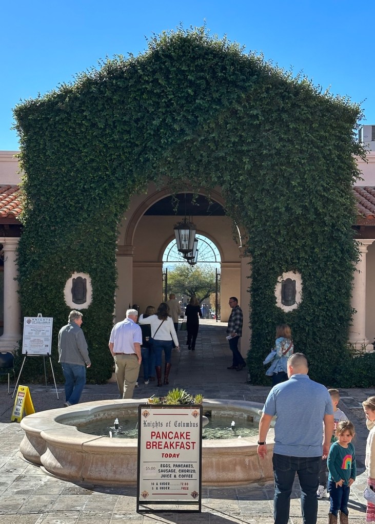
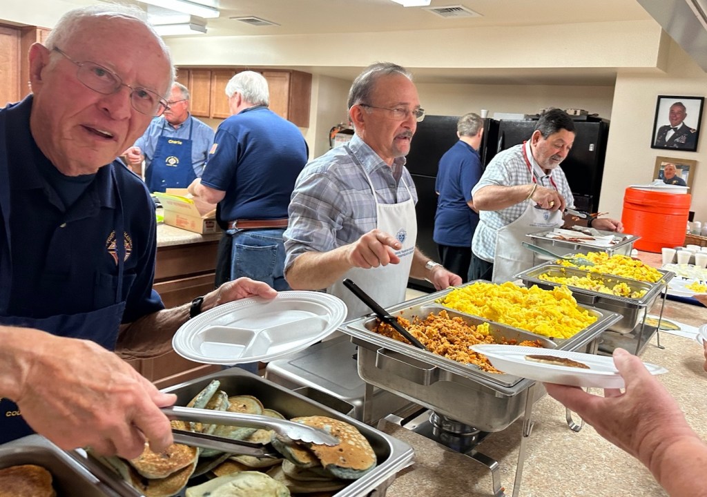
Lovely vine covered arches frame the main entrance. There’s a beautiful view of Finger Rock Mountain from the church’s nave.A sign from heaven — pancake breakfast $5
Vicki may know a bargain but I know church pancake breakfasts and this was an exceptional one … blueberry pancakes, scrambled eggs with chorizo, ham or cheese; pork sausage and bacon plus all the accoutrements — for $5. Obviously, with the price of eggs, this was not a fundraiser.
The church men knocked it out of the park especially with the chorizo eggs.An outdoor fountain featured an oasis of succulents. The pleasant courtyard is perfect for absorbing sun and planning the day.
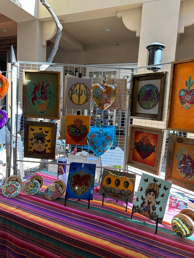
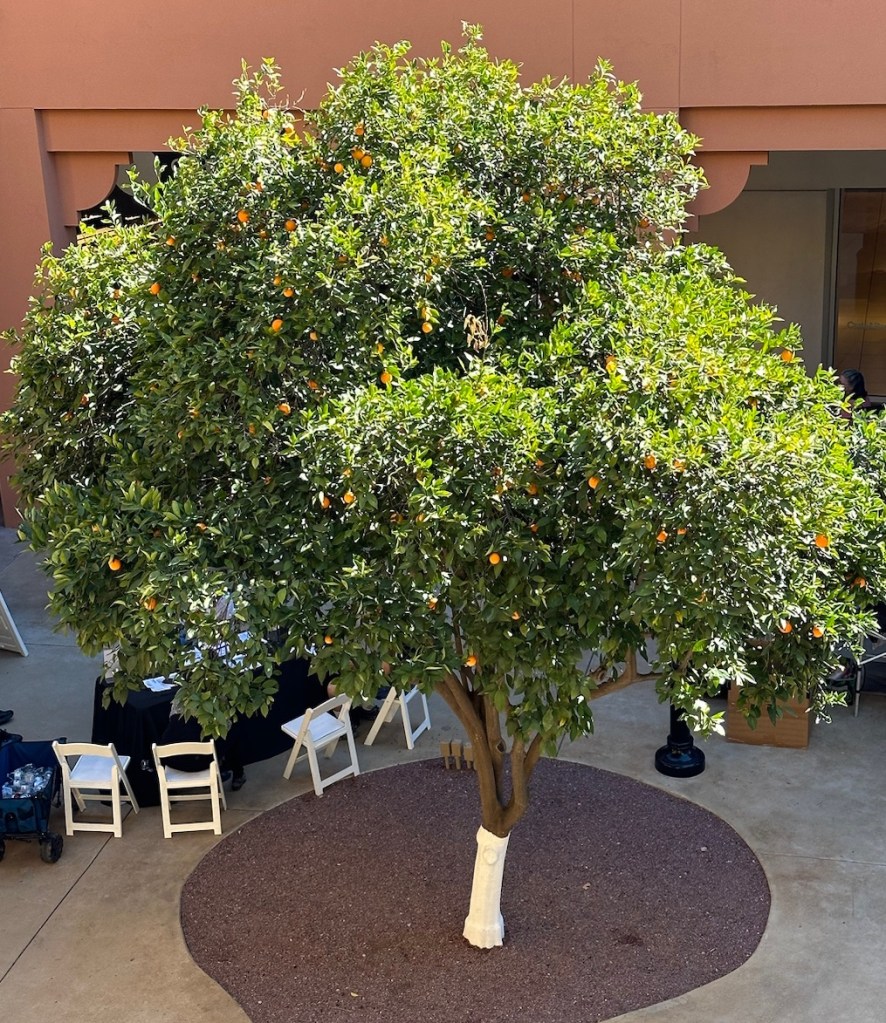
On our way to downtown Tucson, we made a stop at the La Encantada shopping mall for a Fine Arts Festival. This exhibit of local artists and craftsmen was held in the open-air atrium surrounded by beautiful lush greenery and gardens. There were a number of art shows throughout Tucson this weekend. Too many to choose from but this one was on the way.
La Encantada Fine Arts Exhibit featured the work of local artists.A blooming orange tree and lush gardens combined with the art exhibit for an open-air festival of natural and creative beauty.
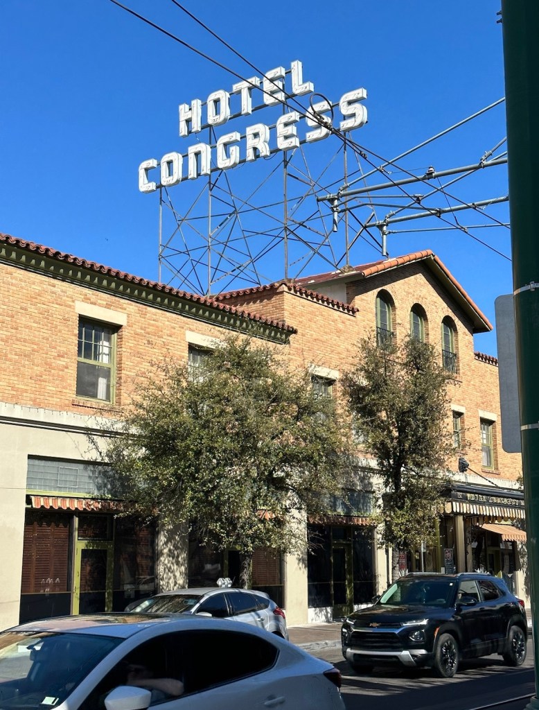
It was tempting to stop at some of the pop-up exhibits but we stayed focused on exploring downtown. We parked near the historic Congress Hotel which is in the heart of downtown Tucson.
Hotel Congress was built in 1918 and is known for being the site of the capture of gangster/bank robber John Dillinger in 1934. It is a cultural landmark that anchors the downtown area.
As we walked through the hotel it was easy to imagine yesteryear in this classically renovated and updatedbuilding. There is a story in every detail as well as in its history.
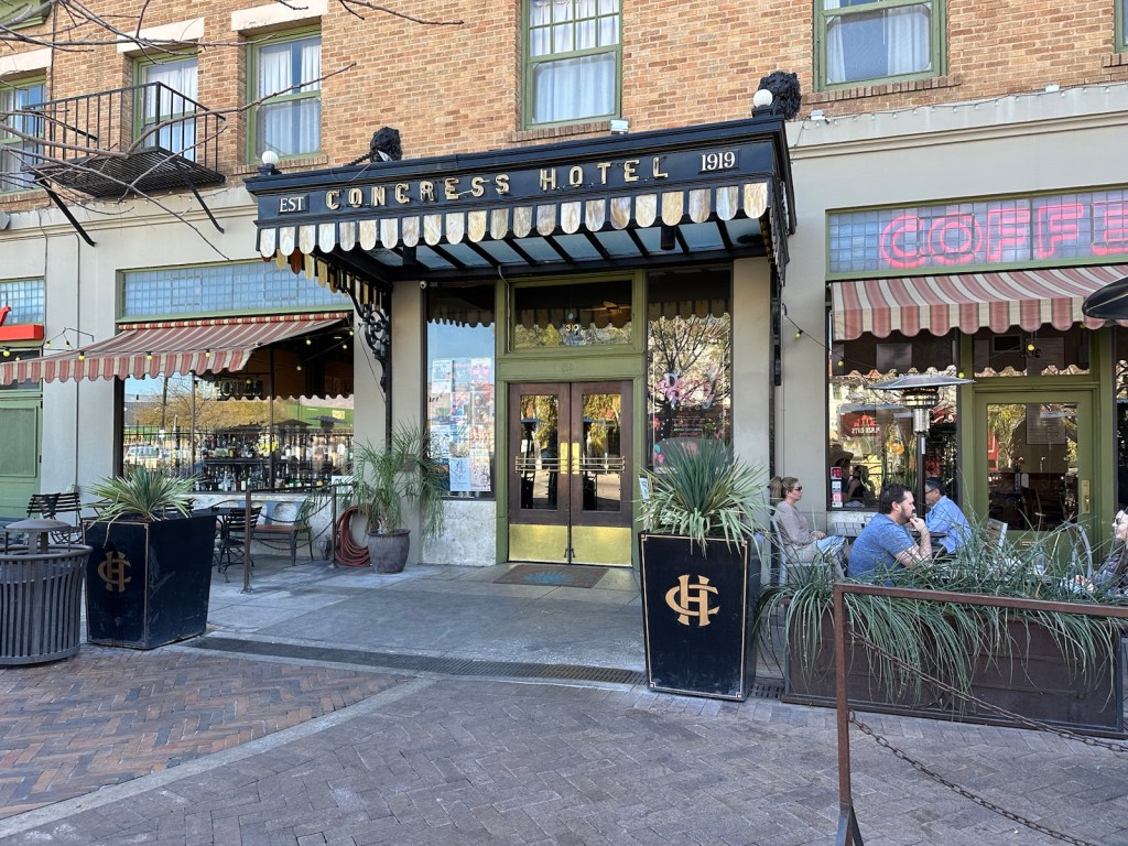
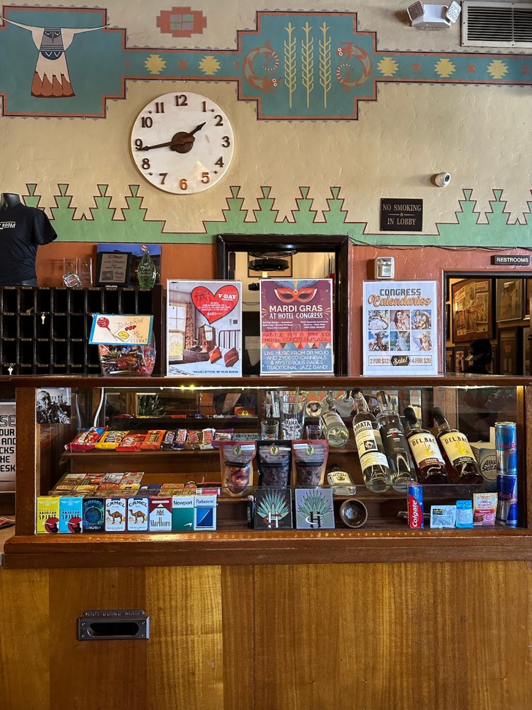
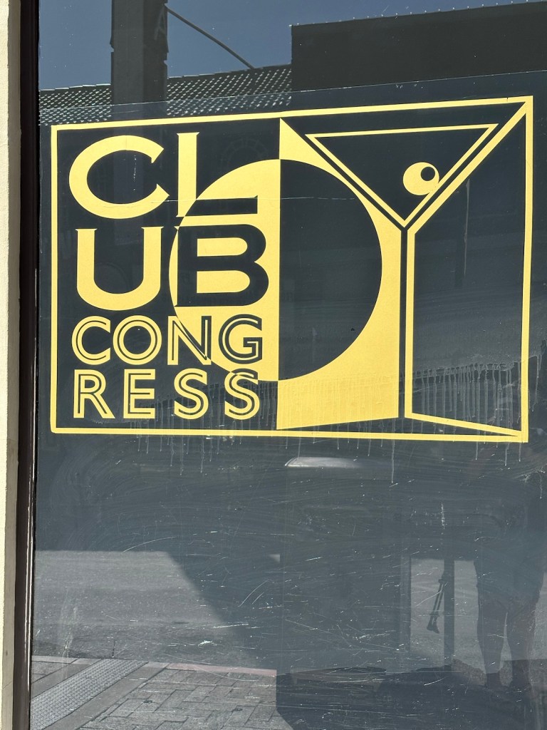
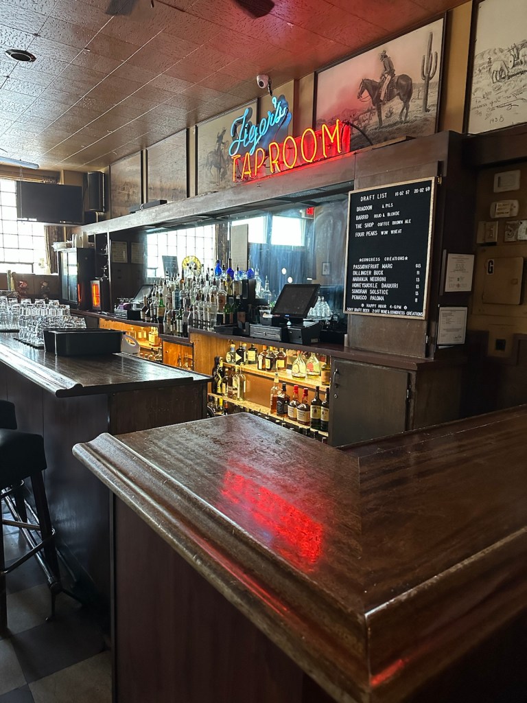
A charming entrance flanked with a sidewalk cafe greets visitors.The nostalgic front desk featured a display case of sundries. The switchboard has user directions for operators taped to it.Very hip artwork on the entrance to the cocktail lounge.Much of the original fixtures and charm still exist in the taproom.
Onto the streets! Downtown Tucson is filled with countless wall murals, paintings and works of art. There’s something around every corner.
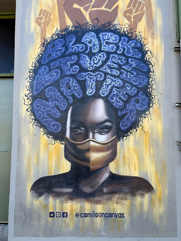
Black Lives Matter Afro: This wall mural is found outdoors on Hotel Congress. Camila Ibarra wanted to make a statement about the pandemic and the Black Lives Matter movement. She completed the mural in two days using her own painting supplies. Hotel Congress provided her with a wall space. She was inspired by a picture of a powerful-looking woman she saw on the internet, but she added her own interpretation.
“Black Lives Matter Afro” by Camila Ibarra
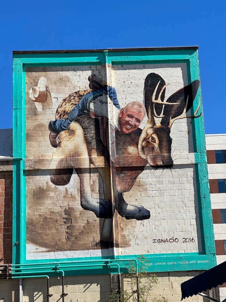
Jack and Bill: Just around the corner from the Congress Hotel is a mythical “jackalope” (a rabbit with antlers) and its rider, basketball legend and sportscaster Bill Walton. The artist, Tucsonan Ignacio Garcia, says the piece is meant to have a youthful quality and hopes it will impart joy to those who see it.
It imparted great joy for us — David, who is a distant relative of Bill Whalton, has followed his career since before his Boston Celtic days which lead to an MVP award and induction into the Hall of Fame. It was a nice surprise to stumble into this mural.
“Jack and Bill” by Ignacio Garcia
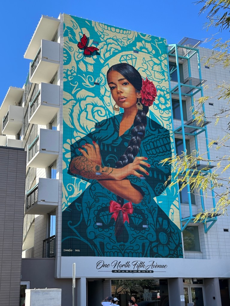
The Empowered Woman: Another downtown mural by Ignacio Garcia represents female empowerment and the increase in female leaders throughout Tucson. The mural represents strength, leadership, and the beauty of boldness.
“The Empowered Woman” by Ignacio Garcia.
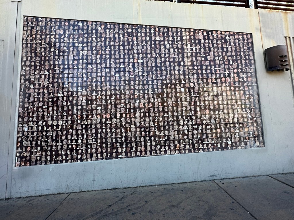
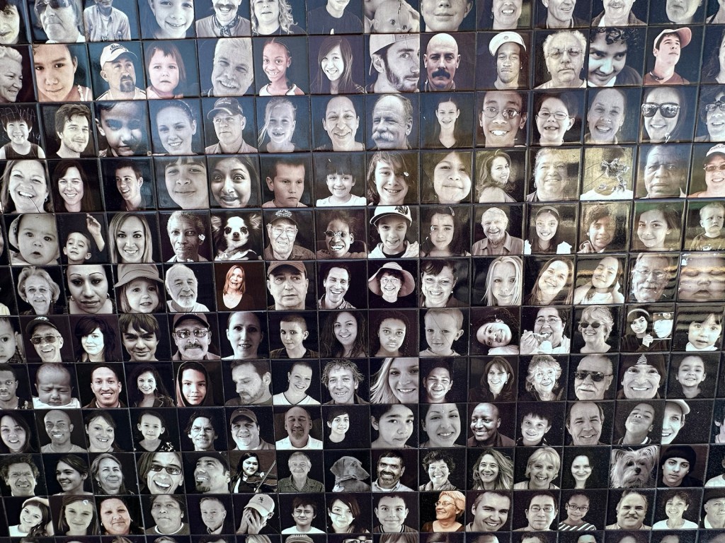
Tucson Portrait Project: As we walked through the Fourth Avenue underpass that leads to the historic downtown area, we noticed mosaic panels of black and white mugshot-type photo tiles.
Tucson Portrait Project by Gary Patch and Darren Clark
The 4 x 4-inch tiles feature 6,000 black-and-white photographs — a cross section of Tucsonans. Local designers spent six months snapping shots of people at various community events.
Becoming history … 6000 random mug shots taken at community events.
The portraits represent a cross section of the City of Tucson in 2010 and will become a historic landmark over the coming decades.
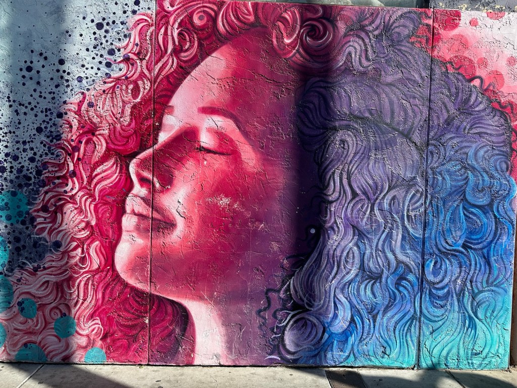
Tranquil Lady: This artwork puts you at ease — that was the intention behind Ignacio Garcia’s mural. The calming colors and woman’s relaxed facial expression are meant to evoke feelings of tranquility and breathing easy.
“Tranquil Lady” by Ignacio Garcia
The Fourth Avenue District: Affectionately known to locals as “Fourth”, this historic district with a hippie vibe offers an array of local artisans and boutiques with curated selections of vintage clothing, jewelry, furniture, artwork, antiques, handcrafted and imported wares, hard-to-find books and anything else you might want to go digging for.
This area has a flavor of its own with cafes, restaurants, thrift shops, bookstores, tattoo parlors and more.
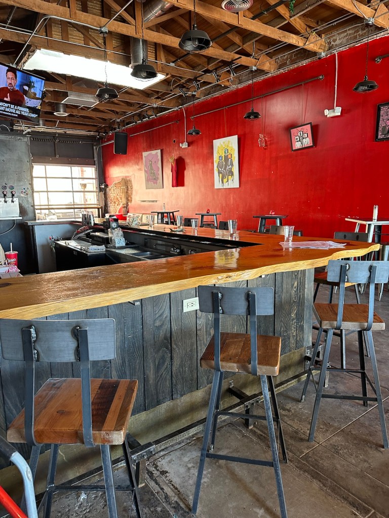
Corbett Brewing — a few blocks off Fourth Avenue is a little gem of a micro-brewery. Josh, the friendly brewmaster was behind the bar during our visit. We discovered that he lived in a little town in northern Minnesota called Pequot Lakes. He’s planning to expand with pizza ovens being installed in the adjoining space. Definitely worth a return visit.
Brewmaster Josh’s last brewery was in Pequot Lakes, Minnesota — it’s a small world.Corbett Brewing was the perfect rest stop on an 80 degree day.Brewery art included tiled Our Lady of Guadeloupe.
Moai Tiki Head: The stoic Easter Island-ish sculpture has become a fixture at the Polynesian-themed watering hole called, “The Hut”. Standing over 42-ft high, it is believed to be the largest Moai Tiki Head in North America.
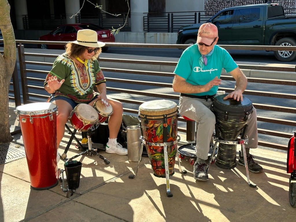
The Moai Tiki, salvaged from a golf course that closed, now watches over the Fourth Avenue activities.Not sure if this igloo looking camper qualifies as an “art car”. It would be perfect for Burning Man.Dillinger Brewing in the historic Coronado Hotel — a great place for people watching.Tony and his backpack dog Bonita stopped to chat with us. Bonita, who doesn’t like walking long distances, is this man’s best friend.Vibrant drumming on a pleasant afternoon by the Underpass.
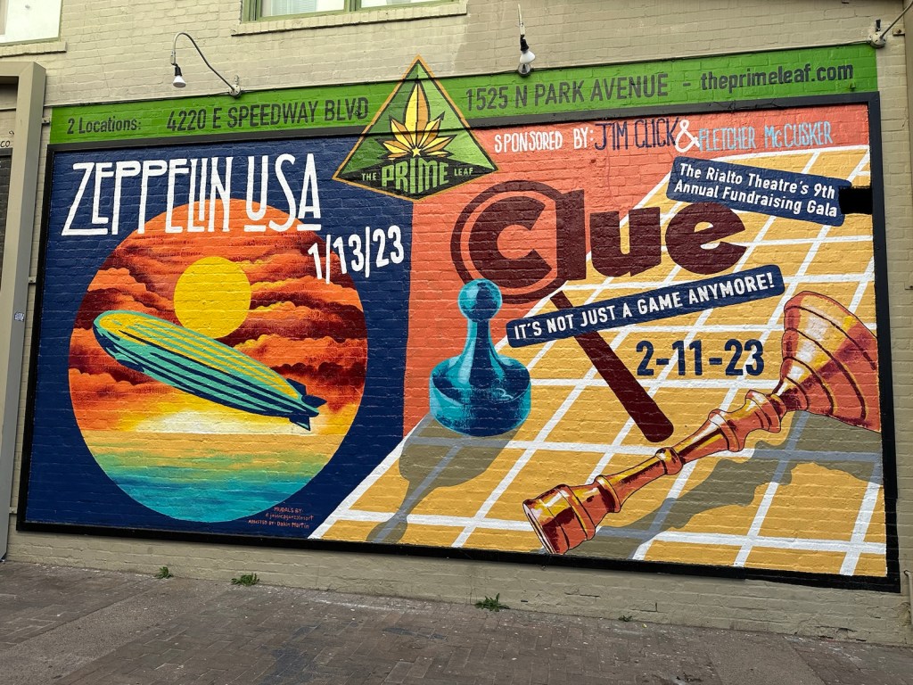
Zeppelin & Clue Mural: Featured on the Rialto Theater building, this artwork pays homage to two events — an American tribute to Led Zeppelin and the Rialto’s 9th annual fundraising gala which is themed after the Clue game.
Rialto Mural by Jessica Gonzales
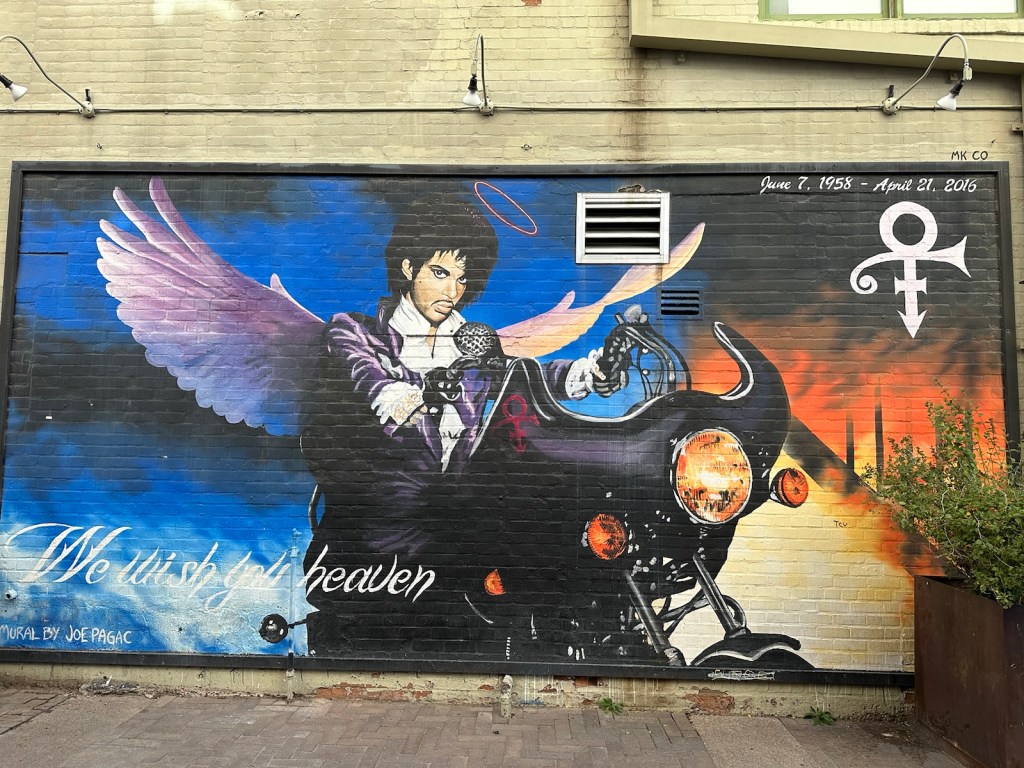
Prince Mural: Being from Minneapolis, this one hits home for me. Located on the side of the Rialto Theatre it honors Prince, who died in 2016.
“We Wish You Heaven” by Joe Pagac.
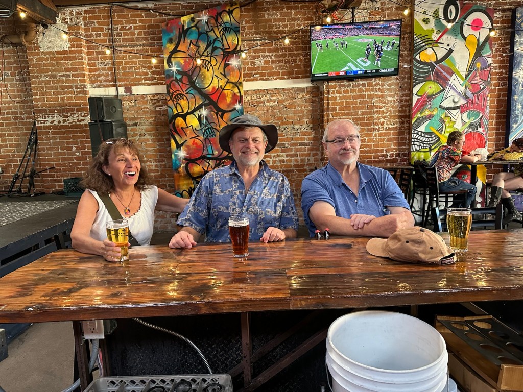
We looped back to our starting point which led us into the Thunder Canyon Brewery for more artwork and creativity.
Thunder Canyon Brewery — ‘a venue for artists who think like artists’. The word ‘artist’ is all encompassing. The brick walls displayed an assortment of painting by locals, the stage featured a variety of musicians and the Canyon also attracts video game enthusiasts.
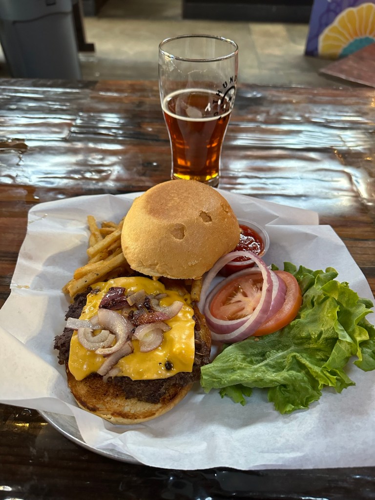
Plenty of ambiance here.Sunday Special — buy a pint and get a burger & fries for $3 more.
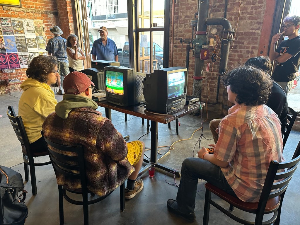
What I found most intriguing in this creative venue, was the number of young adults engaged in video games on really old devices. I saw several combination screen and VCR units that looked like what we used on road trips 20 years ago.
One observer told me that the original games were designed during the heyday of these old units and the quality and timing was far superior on the older units than games modified to be used on newer technology. Apparently, these techies meet here routinely to compete bringing their old technology devices with them.
Some video games work best on the old technology it was designed for.
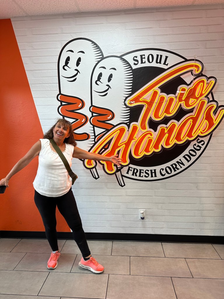
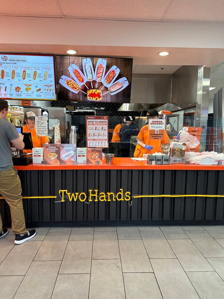
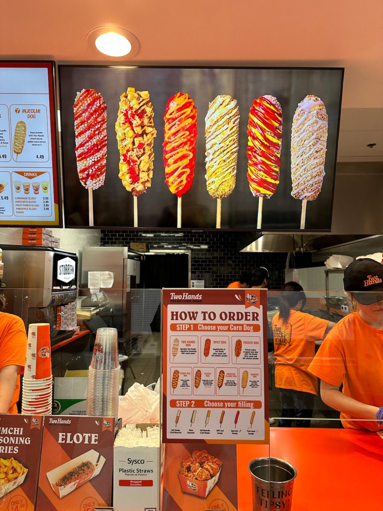
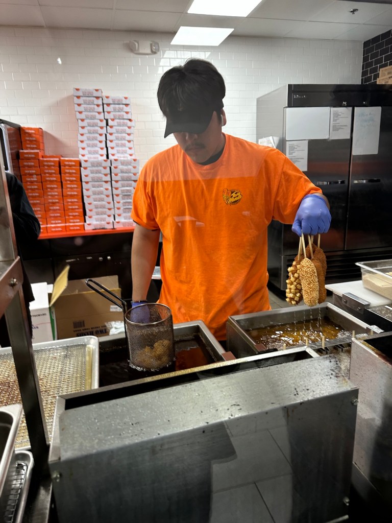
We headed out to the next adventure which was on our ‘must try’ list — the Korean hot dog.
Popular ‘Two Hands’ Korean Corn Dogs
Korean-Style Corn Dogs: these dogs usually have a rice flour batter as opposed to cornmeal batter used in the US. They can be filled with cheese, sausages or other proteins. And finally, Korean street corn dogs are often seen with creative toppings such as fried potatoes, dry ramen noodles or even a sugar coating that plays against the savory and salty filling.
Potato dog is coated with cubed potatoes, Spicy dog is rolled in Hot Cheetos and covered with spicy sauce and Two Hands dog has their signature seasoning covered with ranch dressing.
Dogs on display with ‘how-to order’ directions posted below.The deep-fryer guy is key to keeping the line moving … he’s dipping six at a time.
We checked this one off the bucket list. The final consensus was in favor of the Potato dog but not sure if it can compete with the Sonoran hot dog.
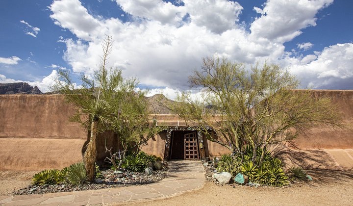
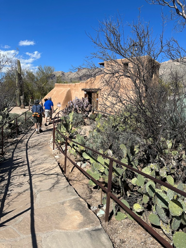
Our festival of artwork did not end in downtown Tucson. Just a short walk from our accommodations is a small gallery with an interesting history and an Arizona vibe.
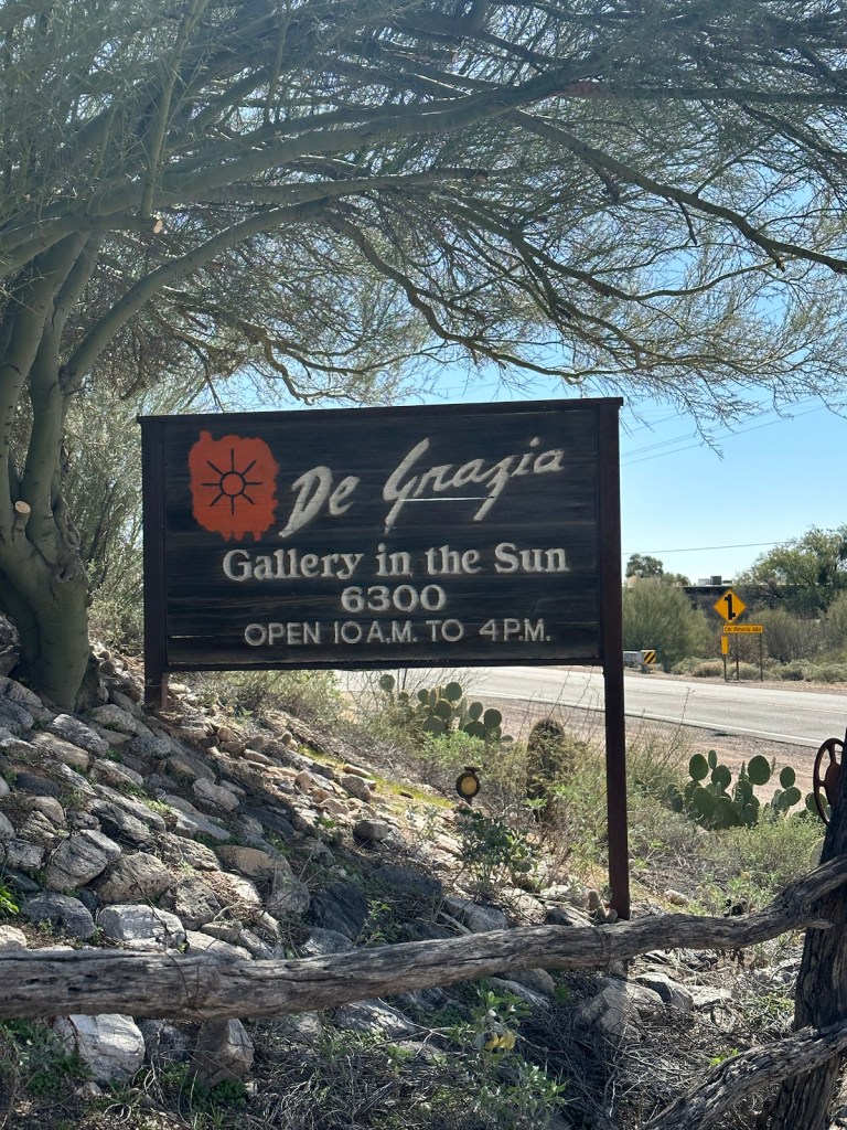
Hidden in the Catalina foothills is the DeGrazia Gallery in the Sun.
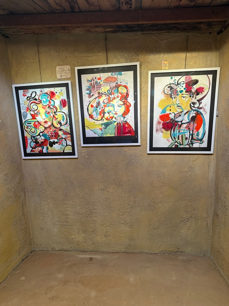
DeGrazia Gallery in the Sun started as a small construction project in the early 1950s and developed into a 10-acre National Historic District designed and built by acclaimed Arizona artist Ettore “Ted” DeGrazia.
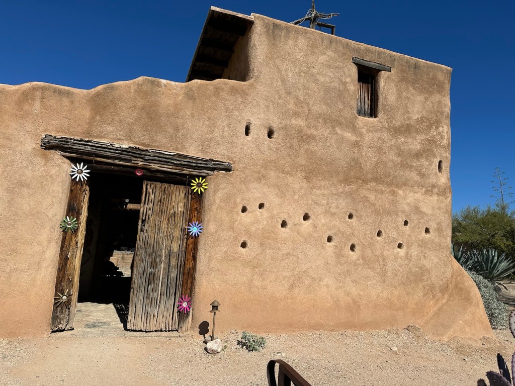
DeGrazia is best known for capturing the spirit of the Southwest and its people. (Photo from Smithsonian magazine.)The gift shop features work of local artists as well as DeGrazia’s work.A cactus bordered walkway leads to the Mission in the Sun. In 1952, DeGrazia built the Mission in the Sun in memory of Padre Kino, a Jesuit priest who founded many missions in Mexico and Arizona.
Mission in the Sun sits next to the gallery and was the first building constructed by DeGrazia on the gallery grounds. He built it in honor of Padre Kino and dedicated it to Our Lady of Guadalupe,
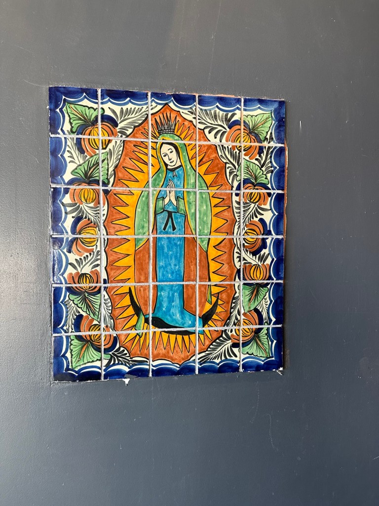
An altar with a depiction of Our Lady of Guadeloupe is surrounded by tributes, memorials and mementos left by visitors.The adobe chapel has a stone floor with simple benches surrounded by walls that showcase DeGrazia’s hand-painted frescoes.DeGrazia is known for his colorful images of Native American children of the Southwest and other Western scenes. A peaceful cactus garden with a walkway is perfect way to round out a contemplative experience to end the visit.
Our get-away to Tucson is winding down and it’s almost time to go back to reality. From warm weather, sunny skies, the foothills and cactus …
… to snow, snow and more snow. I’m looking forward to another adventure in Tucson next year.
There’s no place like home, almost.
Mural information and factual details taken from: Visit Tucson, Tucson Topia, Longview News-Journal, Library of Congress, Trip Advisor, Pima County Public Library, Smithsonian, Roadside America, Arizona Daily Star and Route 66 News.
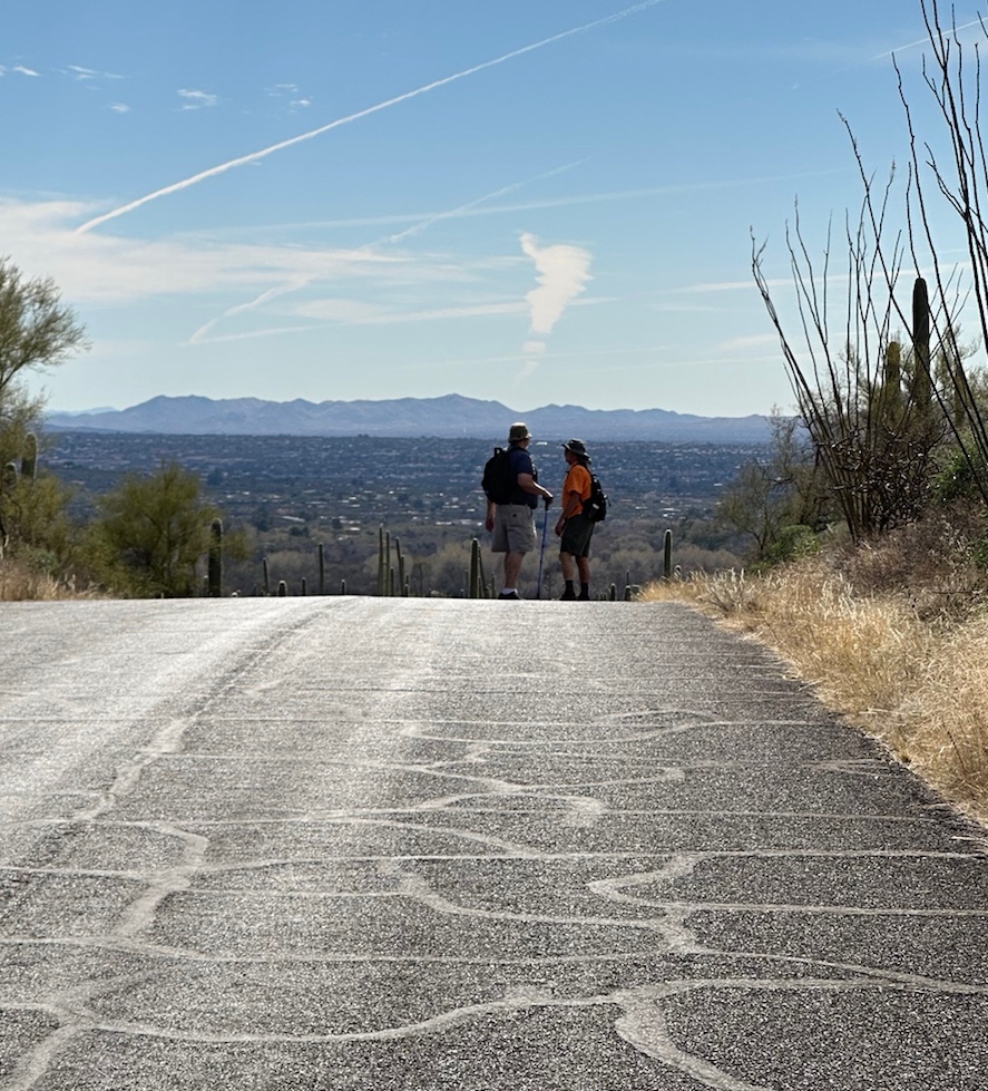
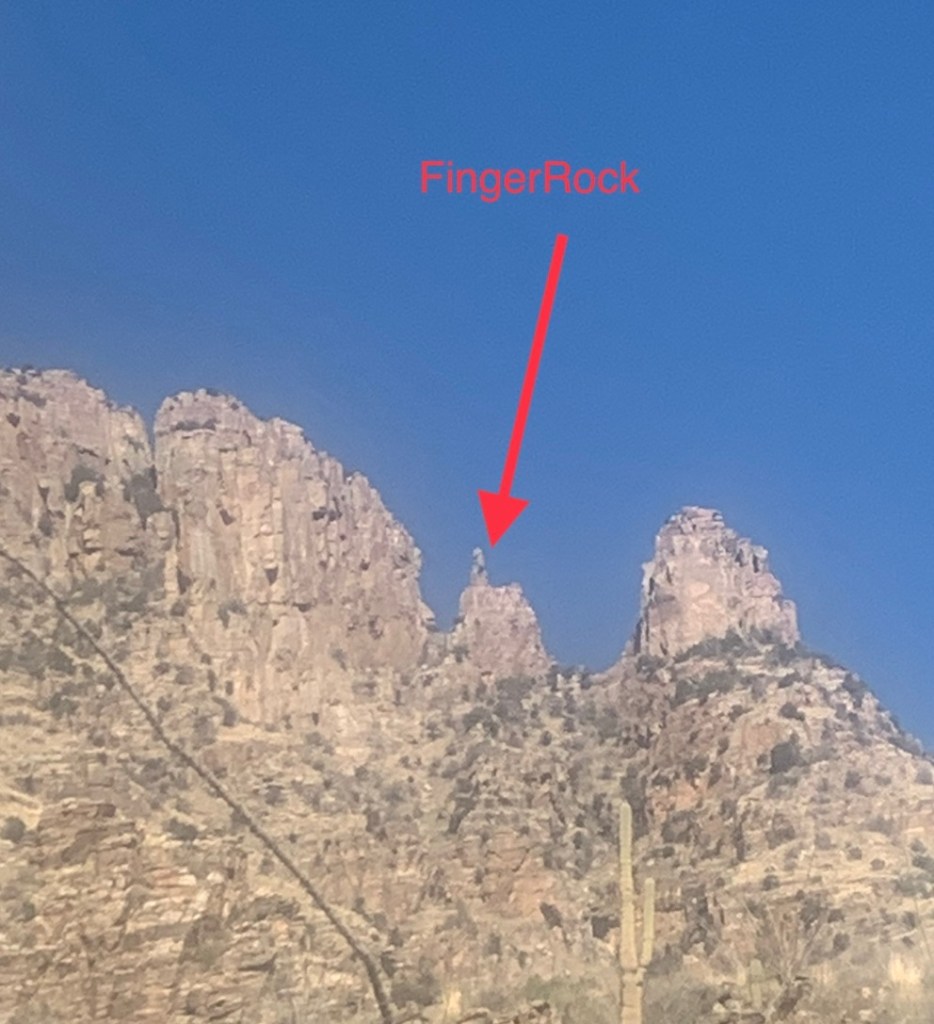
Bright blue sky today and lots of sunshine. Tough deciding what to do this weekend with so many options. After much coffee and tossing suggestions around the final picks are Sabino Canyon, FingerRock Mountain, Gem & Mineral Show and Sonoran hot dogs.
Vic and I coffee’d up on the patio while making plans.
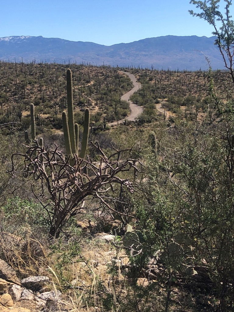
Sabino Canyon is scenic with gentle trails for walkers like me and more challenging opportunities for those who want a more of a work out.
This place has a very relaxing vibe … the warm sunshine, endless diversity of cactus, the rugged hillside and canyons with their dirt trails and a rambling creek. Very peaceful. Cars are allowed only in the parking lot and there is a daily shuttle that goes to various locations in the park which is part of the Coronado National Forest.
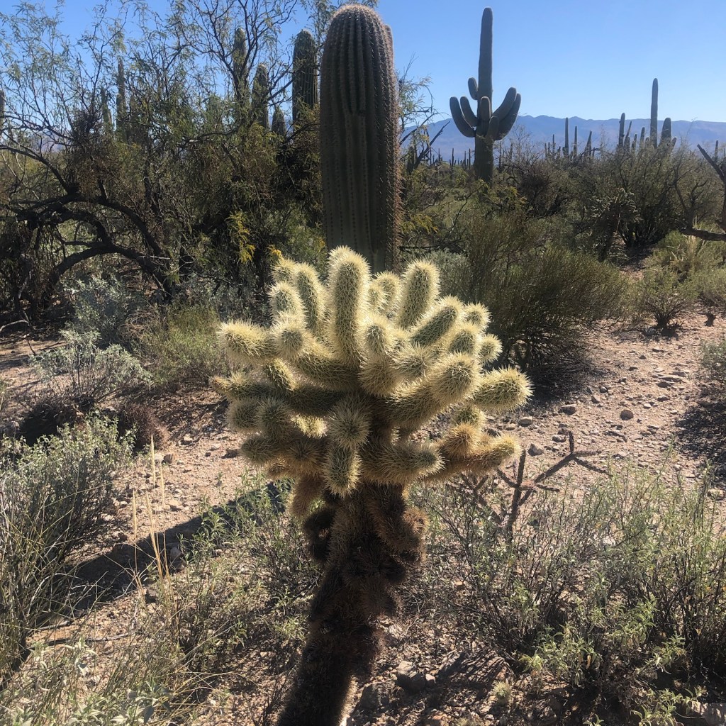
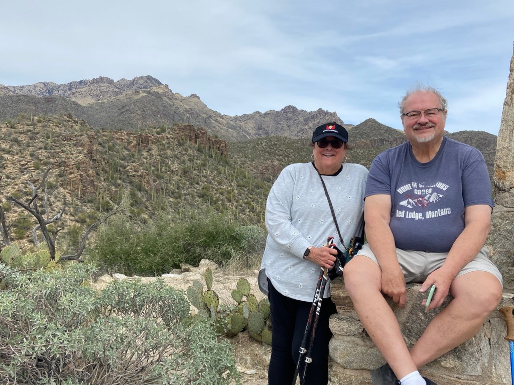
Sabino roads and trails are bordered with cactus and the view is framed with the Catalina foothills.Great views from the trails.A large variety of cacti can be discovered here.My brother John and me resting on a wall overlooking the dam.
Finger Rock Trail is an easily recognized landscape quirk resembling an index finger pointing to the sky above. David took on this challenging trail and took a few photos of the breathtaking views. The trail was breath taking… literally. Very steep with a lot of large rocks to climb up.
As the hike progresses, it gradually gets steeper and rockier and is challenging going up and coming down.
It’s a rocky climb with rewarding views.
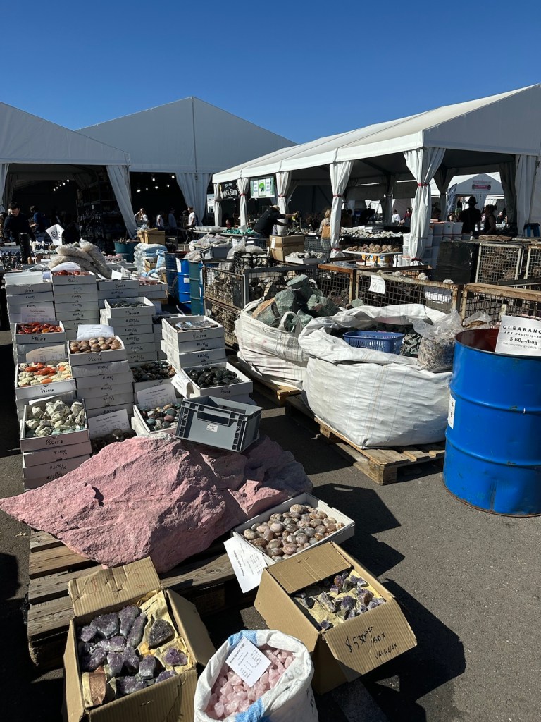
Tucson Gem and Mineral Show: While David climbed FingerRock and John golfed 18 holes, Vicki and I rocked the Gem & Mineral show. Going big, we went to the Kino Sports Complex which resembled a state fair with countless white tents on blacktop reflecting and absorbing the 80 degree heat. It smelled like a carnival with that deep-fried ‘whatever’ smell wafting through the air. We were surprised to find that parking and admission were free but it took us a good half-hour to walk from the car to the entrance.
The annual event is the largest annual gathering anywhere of gem, jade, rock, fossil, jewelry, and bead buyers and sellers from around the world. The gigantic Kino complex is not the only show in town, there are more than 50 different locations throughout the greater Tucson being held concurrently. The show runs for a couple weeks each year.
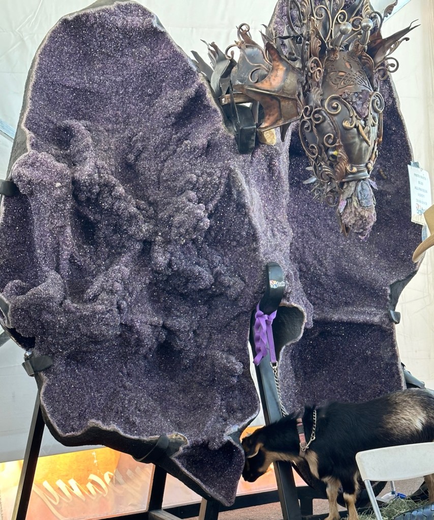
The size of the Kino complex is overwhelming. Even though we were only able to cover a small fraction of the show … we saw a lot.This amethyst geode was made into a dragon … look closely at the bottom right for the goat.
I haven’t figured out the connection of the goats and the amethyst. I’m sure it’s all good energy and it did attract a lot of attention.
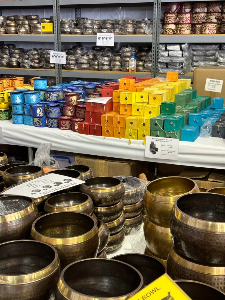
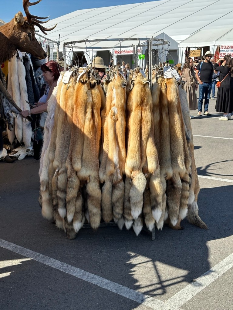
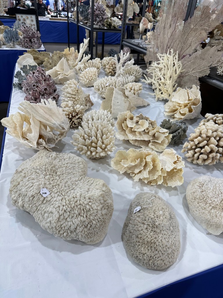
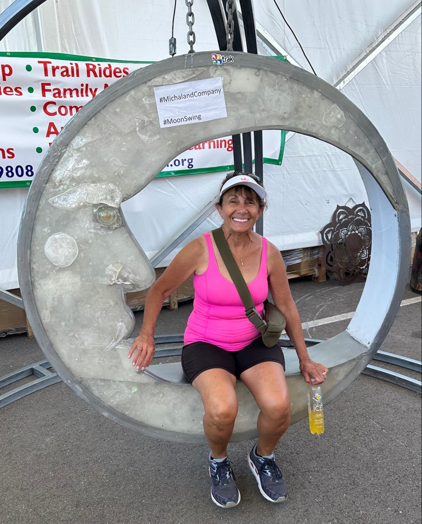
There were goats and a pony at this exhibit. Amethyst is one of my favorites and there were plenty of them to see here.A stone cutter working on site.This is the place to buy a gong — many different sizes available.Several Tibetan exhibits with singing bowls, prayer flags, clothing and jewelry.A tray of shark teeth …… Pelts and hides … … treasures from the sea …… stone birds …… lots of incense …… and a Moon swing. Lots of interesting things to look at but after a couple hours, we headed back to the car.
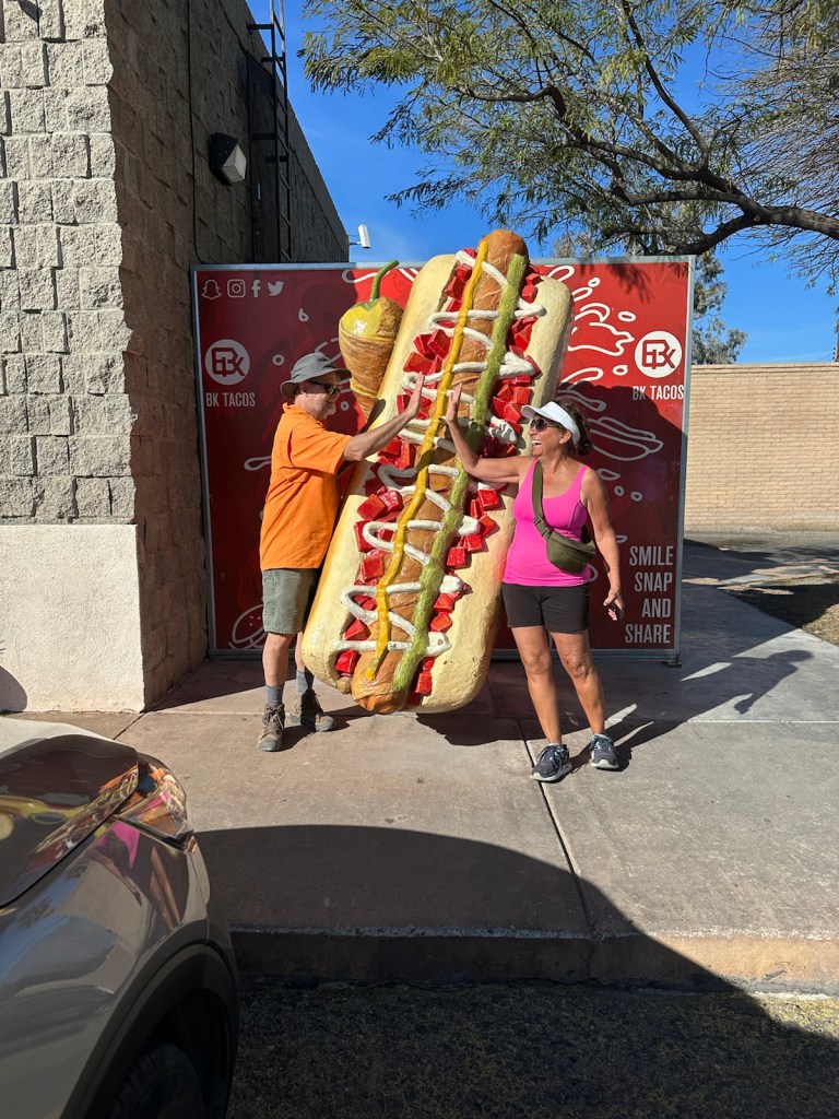
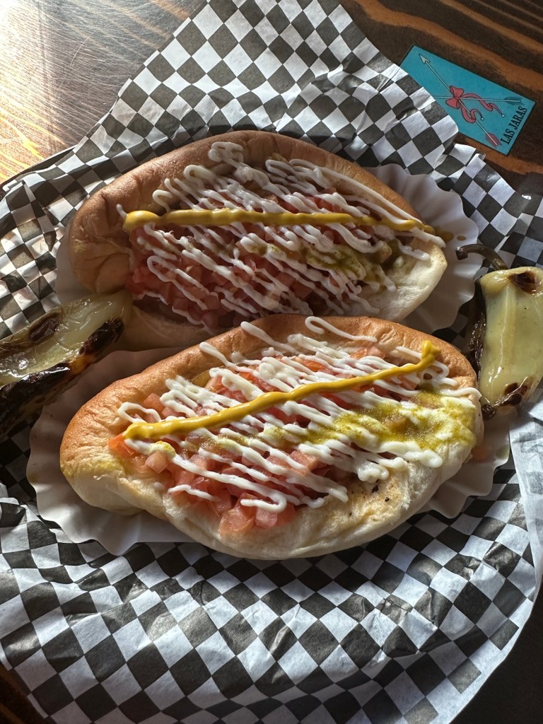
Sonoran Hot Dogs: We needed to try this local delicacy. It consists of a hot dog wrapped in bacon and grilled, served on a bolillo-style hot dog bun, and topped with pinto beans, onions, tomatoes, and a variety of additional condiments, often including mayonnaise, mustard, and jalapeño salsa. It’s an unremarkable set of ingredients that becomes a remarkable taste when it all comes together.
Many vendors sell Sonoran Hot Dogs (also called “dogueros”) from street carts which are randomly found. It took a little research, but we found a little Mexican restaurant with our sought after dogs.
You know you’ve found the real thing when they have a giant Sonoran hot dog in the parking lot. This is what we were waiting for and it did not disappoint.A nice cold michelada is the perfect accompaniment for Sonoran dogs.
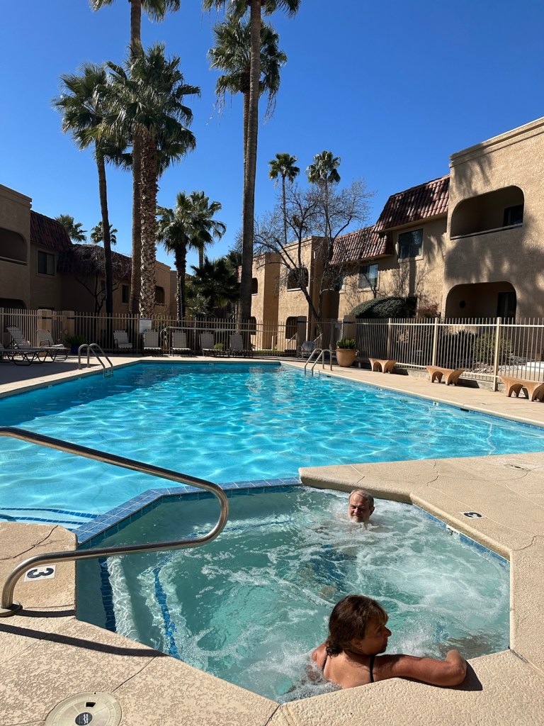
Time to wind down … a nice dip in the pool and hot tub to digest all we’ve experienced and figure out what’s left on the ‘must see’ list.
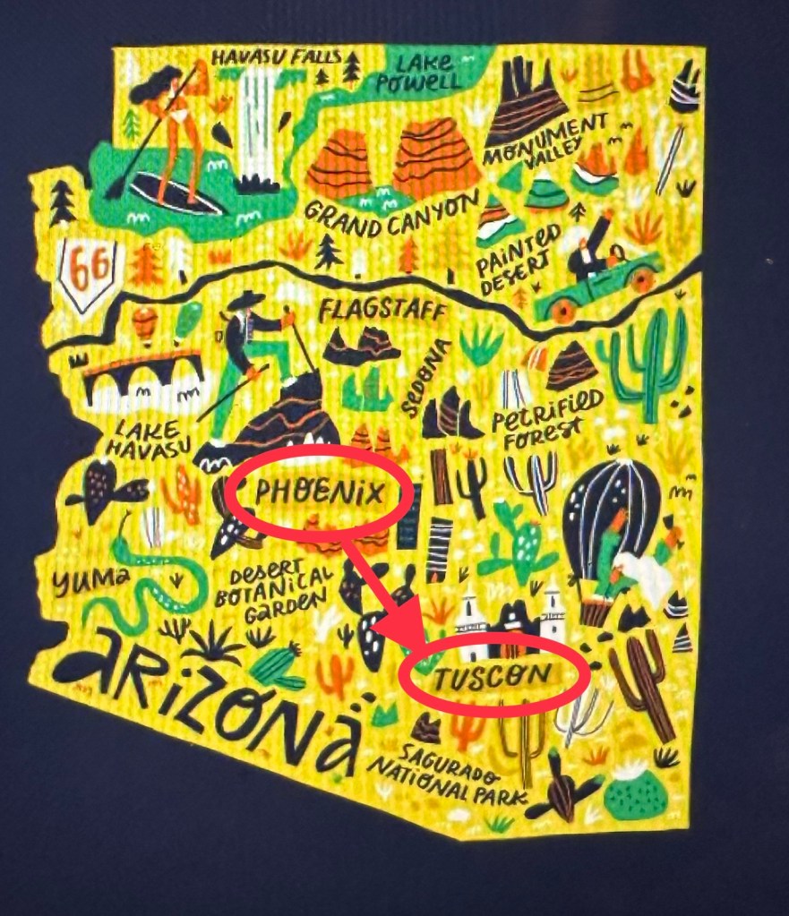
Minnesota winters merit a getaway to Arizona. On this trip, I’m heading for Tucson with my husband David for a long weekend. We’re flying into Phoenix and driving to Tucson.
Many areas of interest in Arizona, but this weekend we’re doing Tucson.
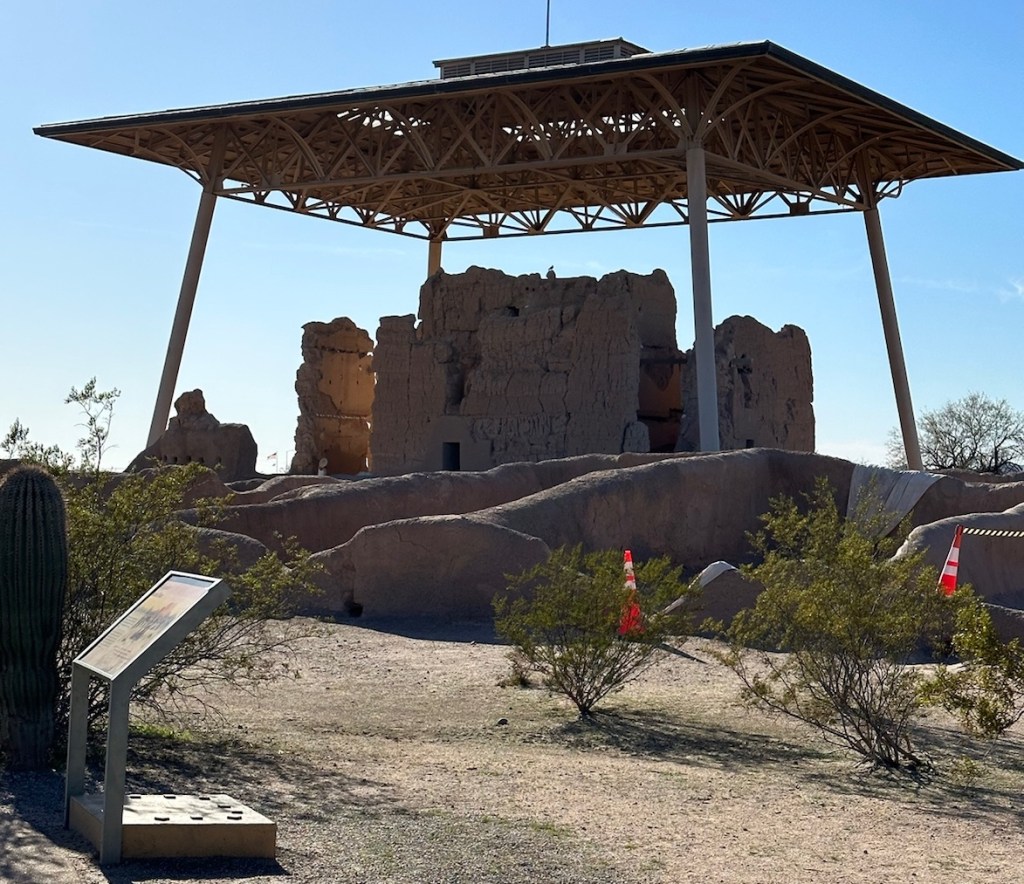
Our first stop is about 50 miles south of Phoenix near the Gila River Valley and the town of Coolidge. Here lies one of Arizona’s greatest mysteries — the Casa Grande Ruins National Monument. No one alive now knows what name the people who built the Casa Grande called themselves centuries ago.
Casa Grande Ruins
Archeologists today use the term Hohokam to label the culture that flourished here about 900 years ago. The people who lived here, left suddenly.
These Ancestral People tapped the Gila and Salt rivers with irrigation canals that diverted high water to the floodplains’ rich soil. They grew crops that withstood desert conditions — corn, beans, squash, tobacco, cotton and agave. They gathered wood, fruit, buds and seeds as well as wild plants to be used for medicine. They hunted rabbits, deer and sheep. The rivers provided fish. Saguaro fruits were eaten, dried or made into wine. Their pottery had a distinctive style of red-on-buff patterns.
Hohokam potters focused on geometric, basket-weave-like designs. (Image from desert.com Hohokam Ceramic Studies)
The Hohokam achieved remarkable success. For over 1,000 years, these people supported themselves with food they grew, hunted or gathered. The system provided for an estimated 80,000 people.
Sometime during the later half of the 14th century, the Hohokam entered a period of social disruption and community disintegration. There appear to be several causes including drought, flooding, and warfare.
A tour group dwarfed by the four-story “Great House”.
This one-square mile park was set aside in 1892 to preserve what remained of an Ancestral Sonoran Desert People’s community and irrigation system.
Archeologists don’t know for sure what the purpose of Casa Grande was. Perhaps the “Great House” was used as a gathering place for desert people. Were sacred rituals held here? Was it an astronomical observatory? It can still be observed that the sun and moon line up with certain holes in the wall. Did a leader who oversaw the irrigation canals work inside these rooms? Did an influential family or clan call the Casa Grande home? The only thing known for sure is that it will remain a mystery forever.
(Information taken from state museum.arizona.edu, arizonaruins.com and National Park Services ‘Casa Grande Ruins’)
Next Stop: Catalina Foothills
Catalina Foothills is a northern suburb of Tucson and situated in the southern foothills of the Santa Catalina Mountains.
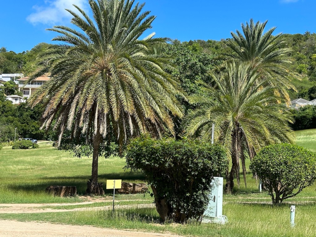
It’s easy to find a number of cacti varieties — everywhere.
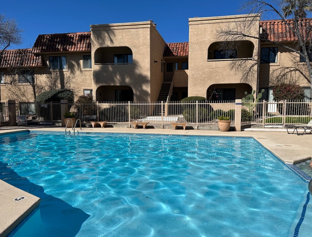
We have arrived at our accommodations in a nice little condo community. It’s a great location and very comfortable. I love the pool.
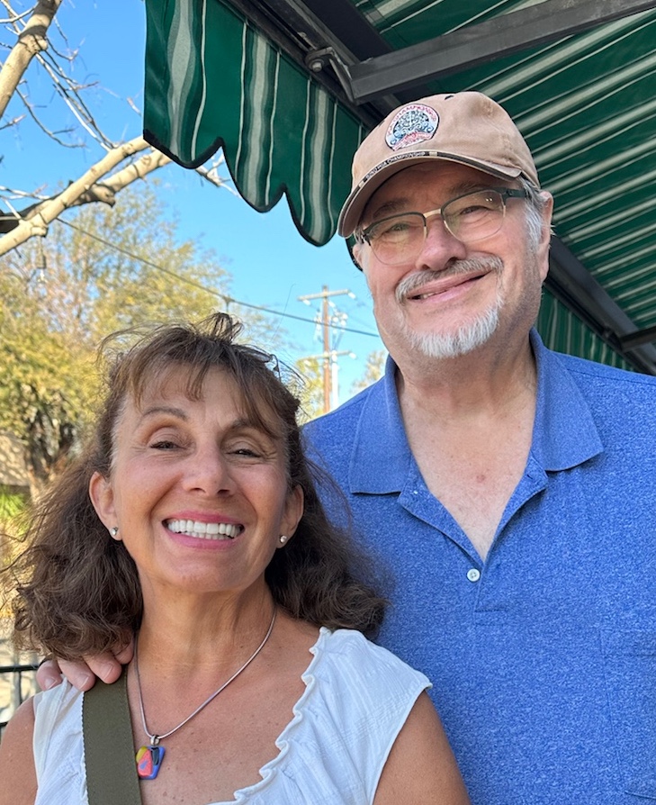
This happens to be the winter nest of our favorite Snowbirds … my brother John and wife Vicki. Their hospitality is unbeatable and they are great tour guides.
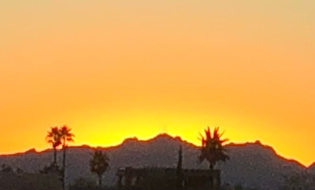
Vic and John led the way to a great weekend.A golden sunset in the Catalina Foothills ends the day.
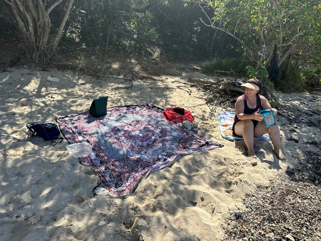
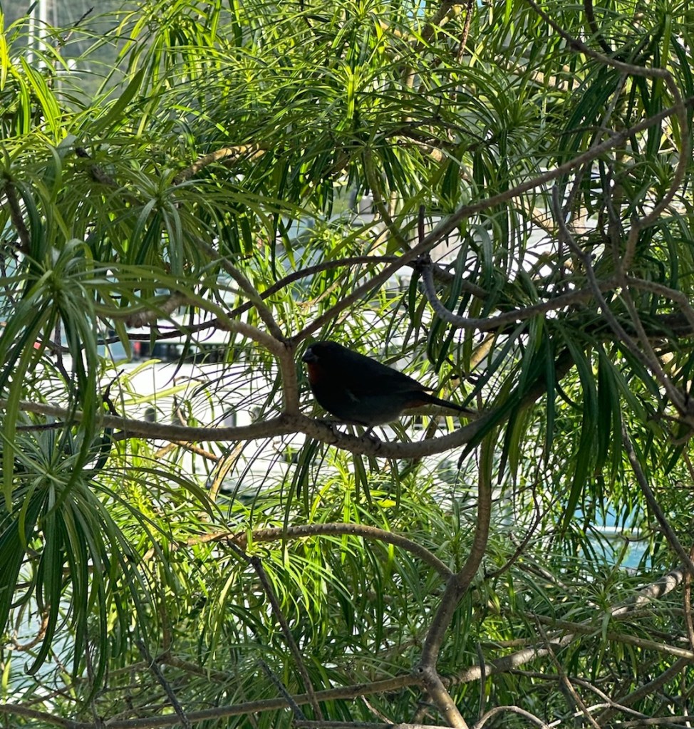
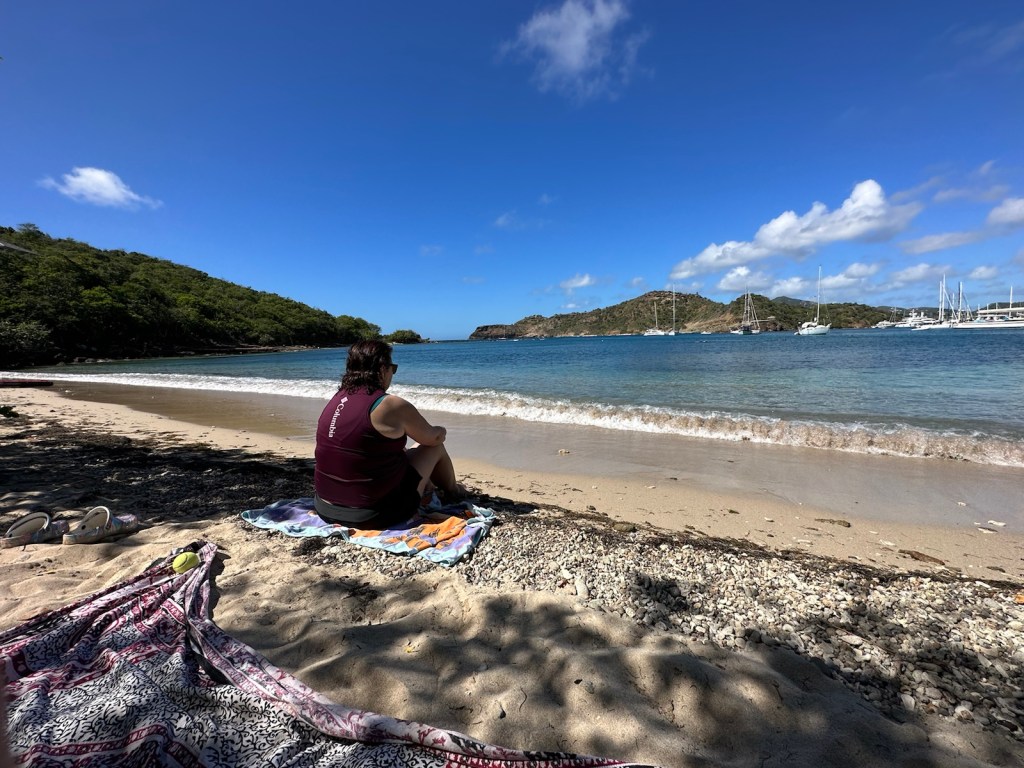
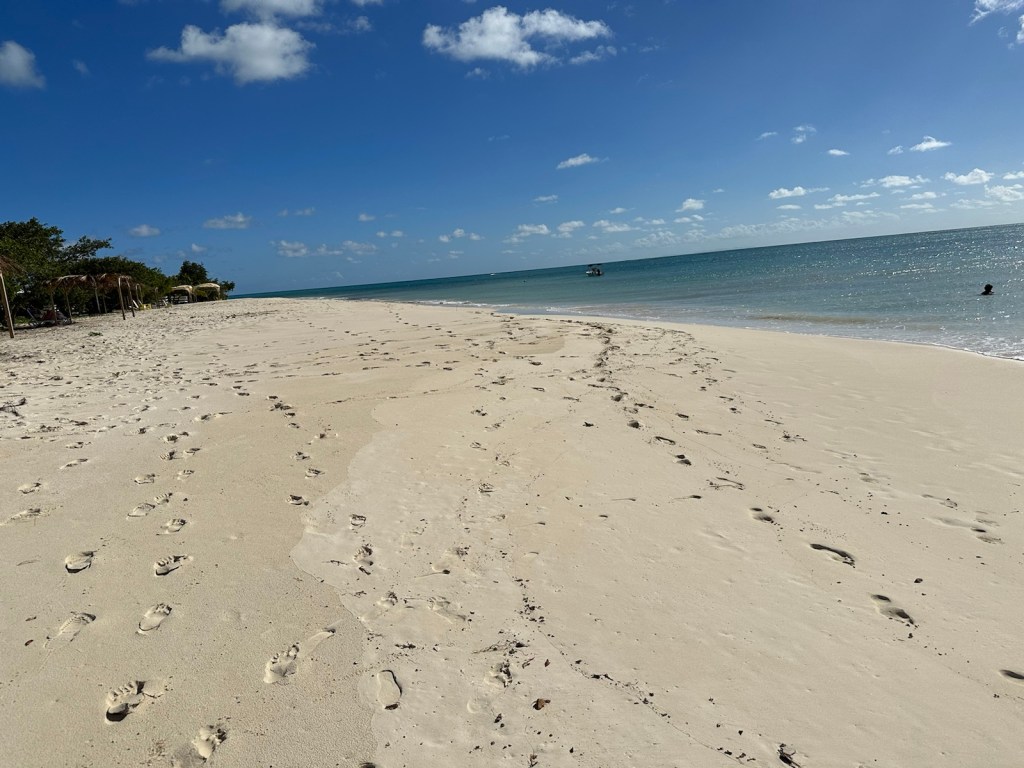
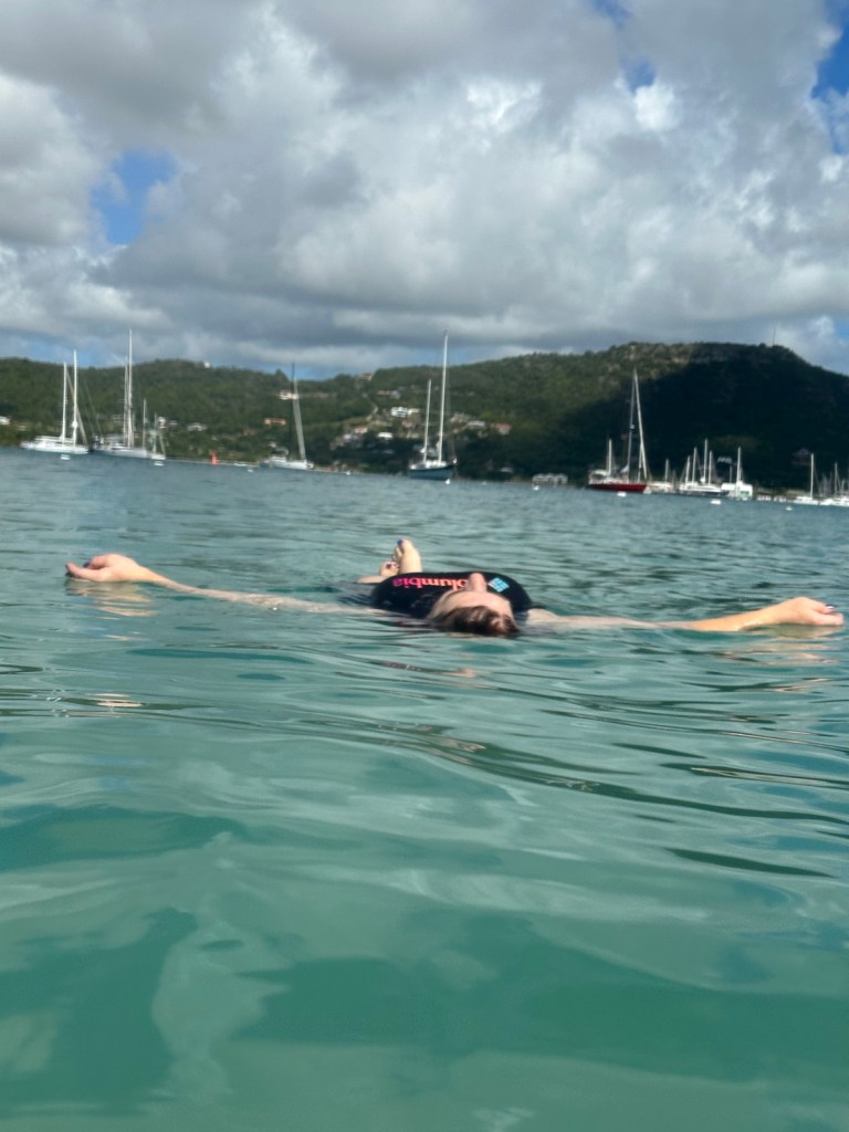
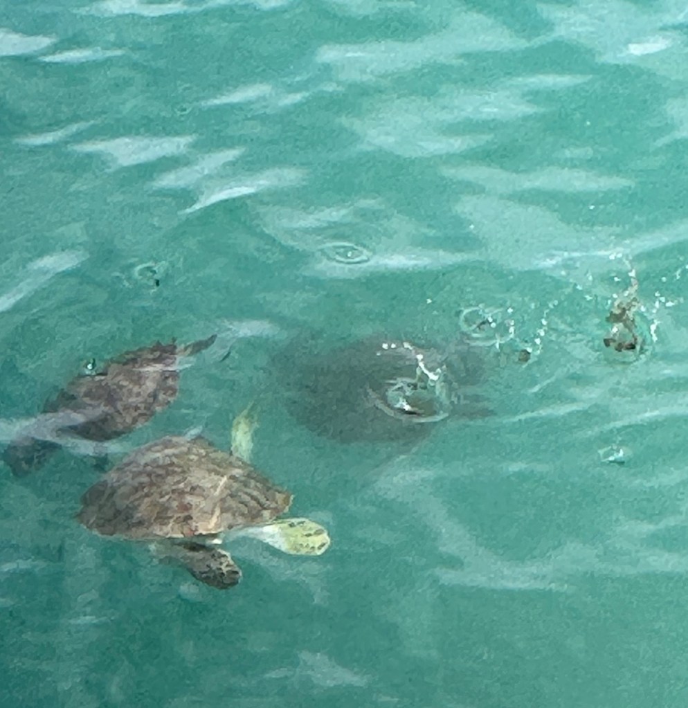
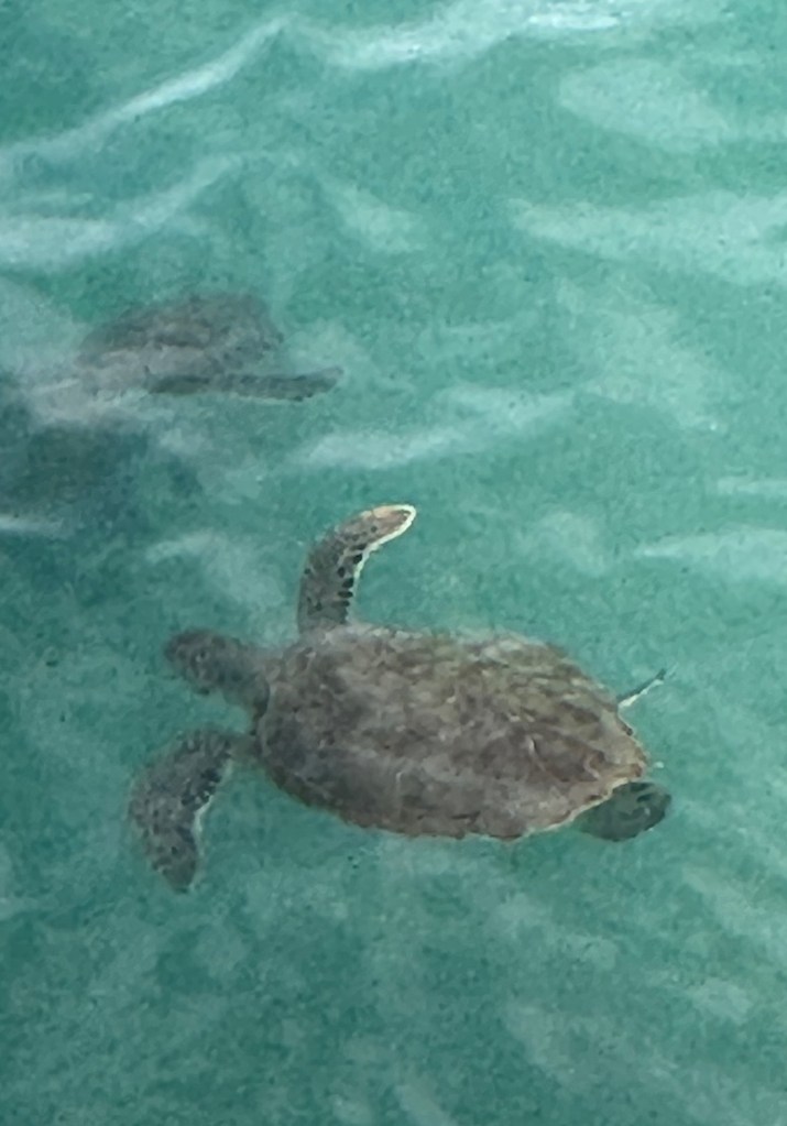
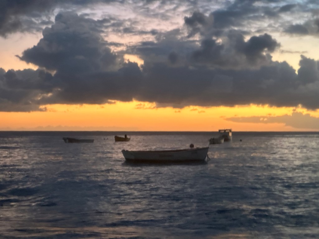
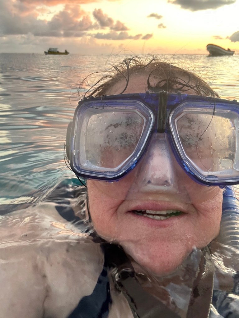
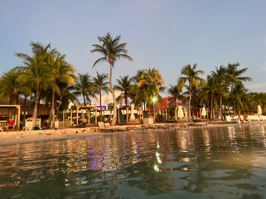
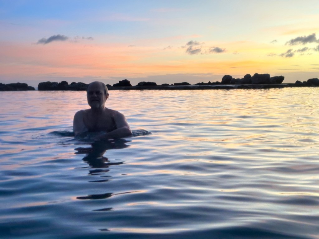
Our last full day! We went back to our new favorite snorkeling spot on Galleon Beach.
Chillin’ in the shade and enjoying a morning of snorkeling and beach time.
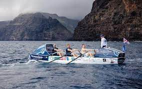
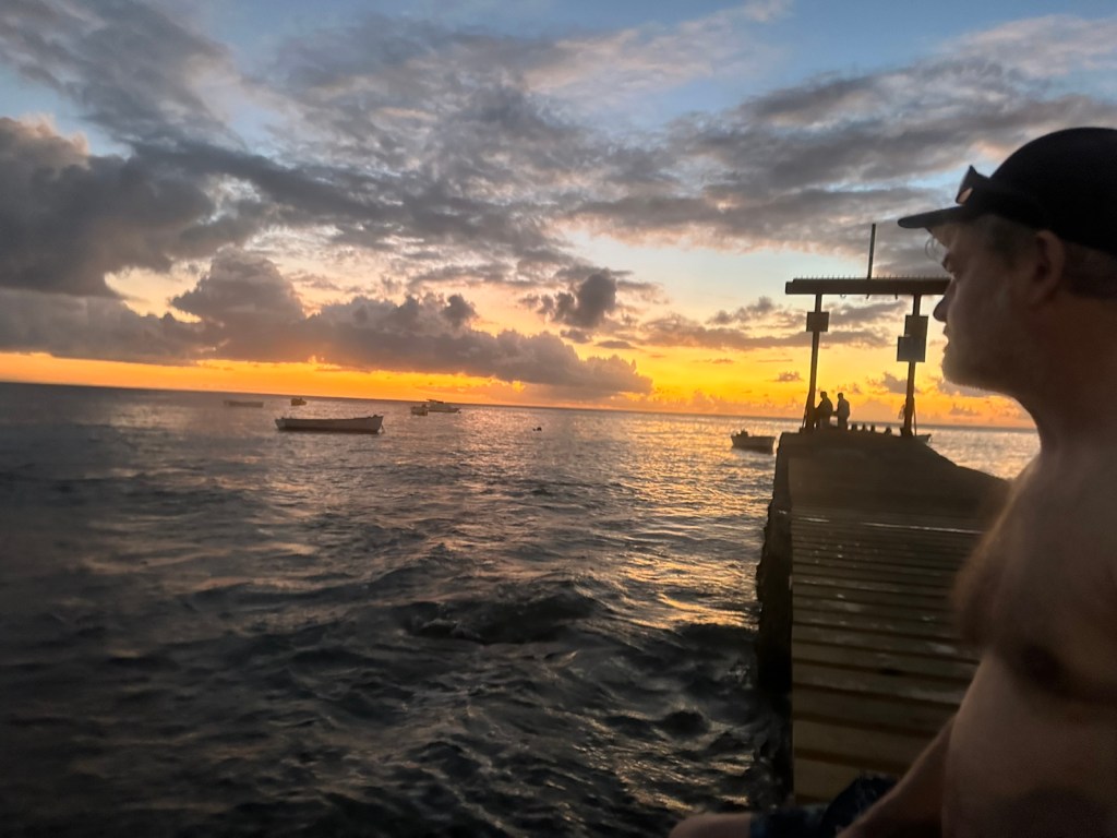
Mid-morning another Trans-Atlantic row boat entered the harbor. The two-man boat, Tikkurila, finished the 3000 mile trek in just over 51 days. The hoopla begins when they light the flares. The blue boat with the Antiguan flag circles around the rowboat several times and escorts it into Nelson’s Dockyard.
Tikkurila rowed into English Harbor this morning.Calm day with several snorkelers exploring the harbor.
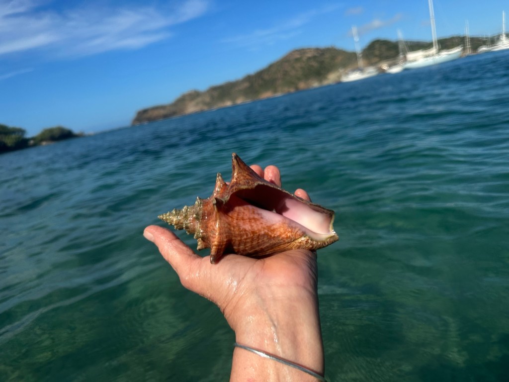
Today I found the most beautiful conch shell. It was perfect. A treasure for sure. I wanted to take it home but the conch was still living in it. Sadly but carefully I dove deep and found it a good home in the grass where it would be safe.
I found a beautiful conch shell when snorkeling. Catch and release … I dove deep and hid it in the grass.
Incidentally, at the airport there’s a conch display of shells removed from carry-on luggage. Conch shells are considered weapons and are compared to brass knuckles. They need to be in checked luggage.
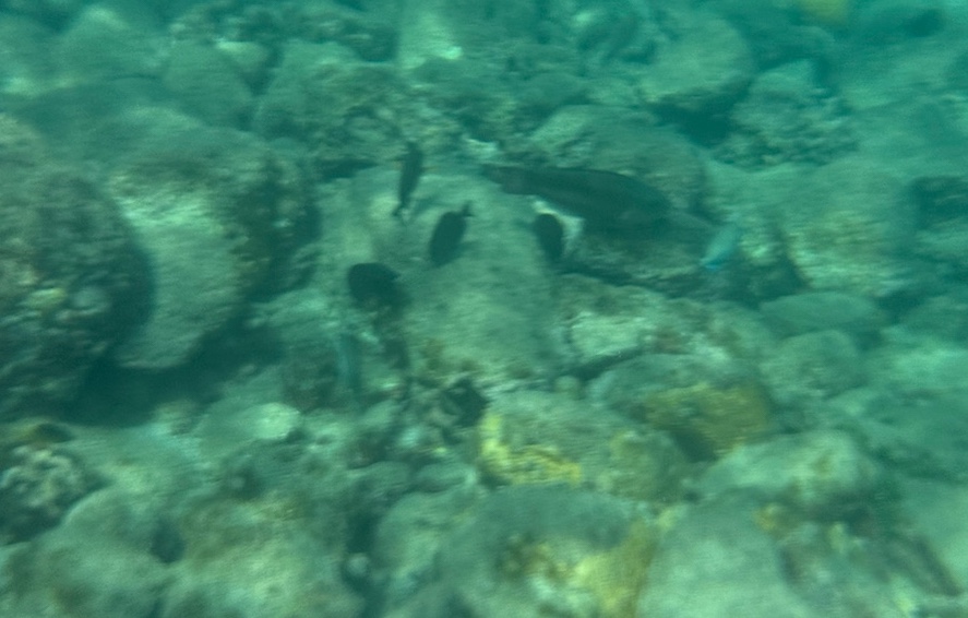
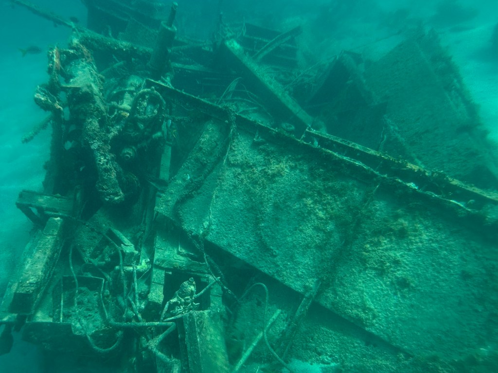
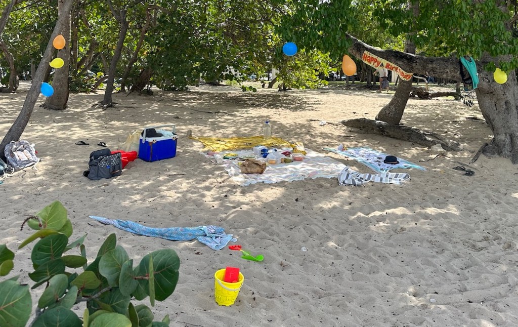
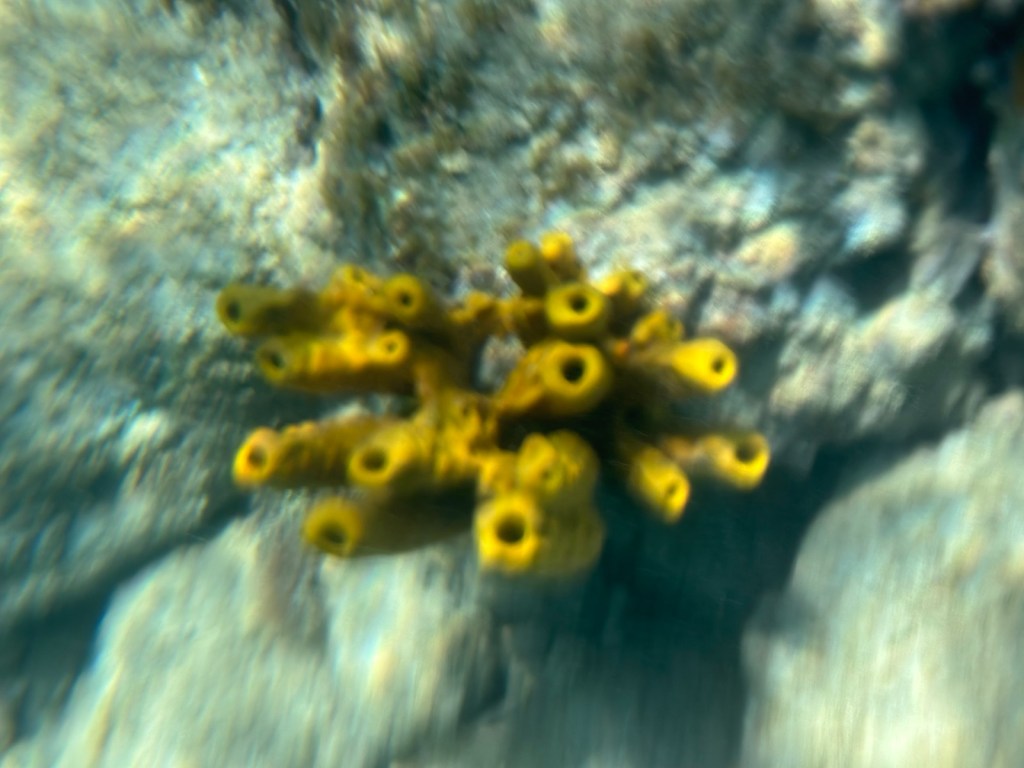
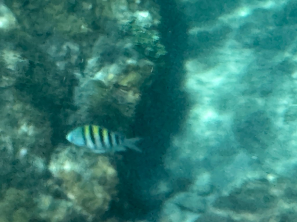
These small fish were either very dark blue or black. (I’m still working on my underwater photography skills.)This is a ship wreck. Several fish swimming around it. One last visit to our favorite near-by beach, Pidgeon Point. Nice shady spot decorated for a kiddie birthday party.
We wanted to check out one more beach on the top ten list — Half Moon Bay on the east coast of Antigua. Snorkeling is suppose to be good but it’s in the Atlantic which could have big waves and rough water. (West coast is the Caribbean). Its’ a beautiful drive.
By the time we arrived at Half Moon Bay is was raining.Waves, dried seaweed and rain. The beach was deserted.A view of Half Moon Bay (photo taken from halfmoonbayantigua.com)
We drove back to the ridge which is part of the Shirley Heights complex where there are several ruins.
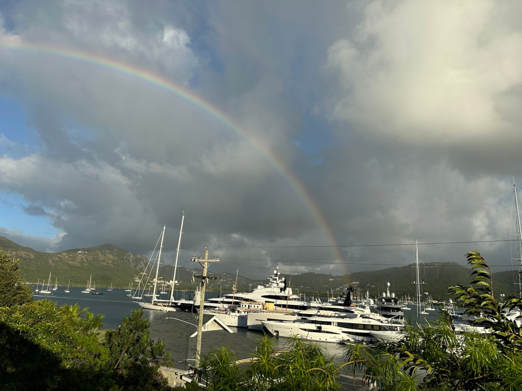
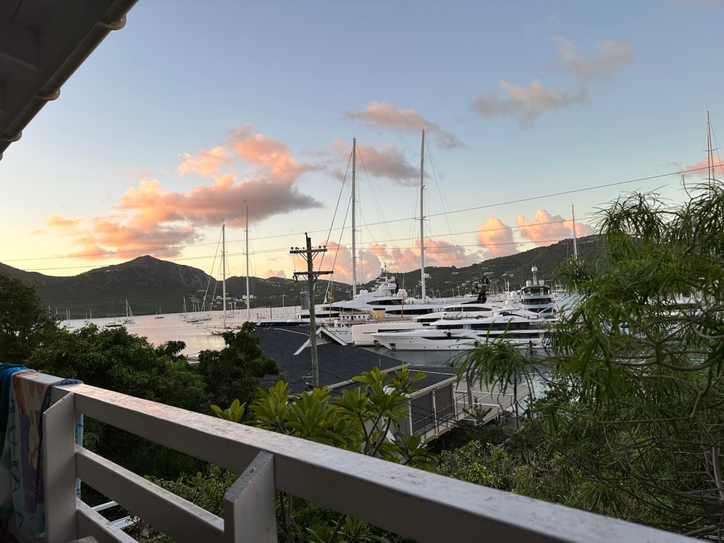
Rain at sea.Rainbow over the super yachts in Falmouth Harbor
Betty’s Hope
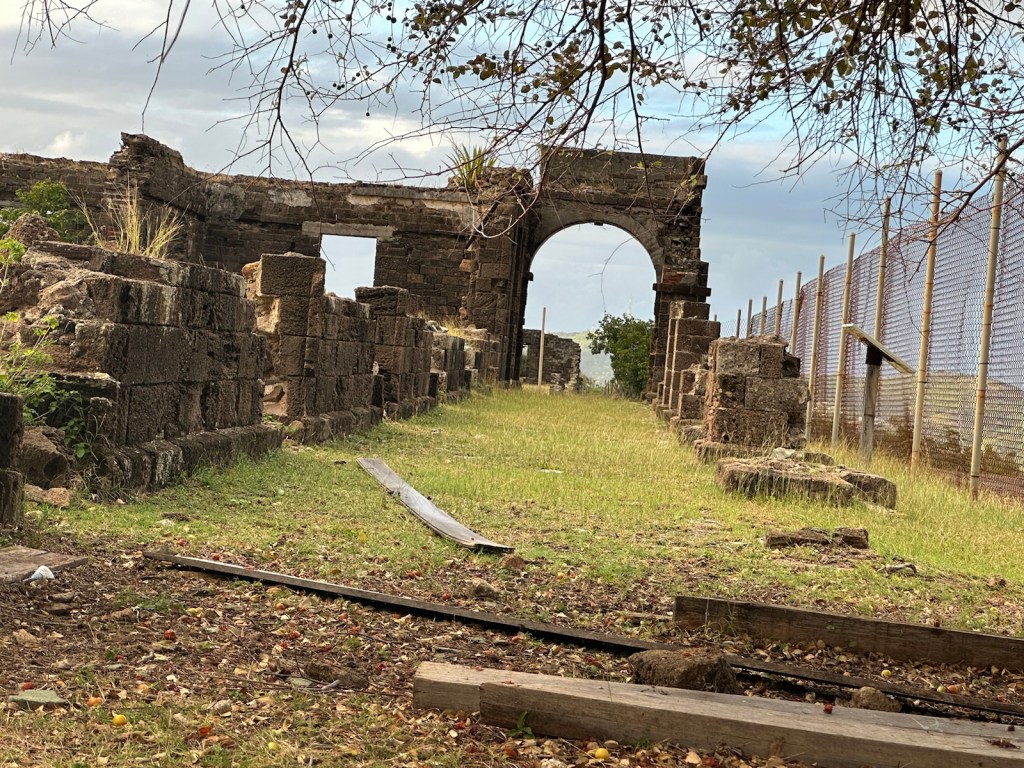
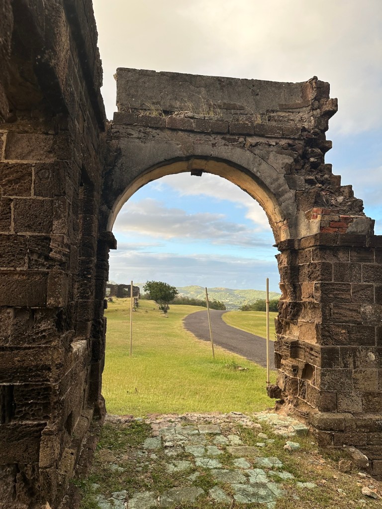
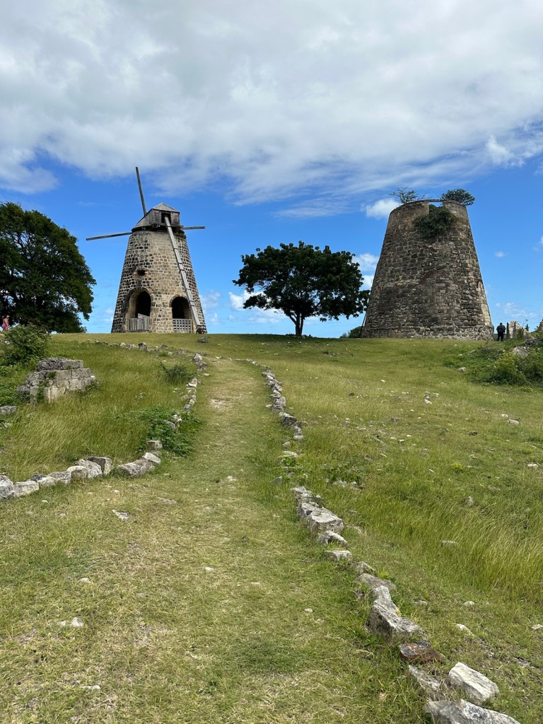
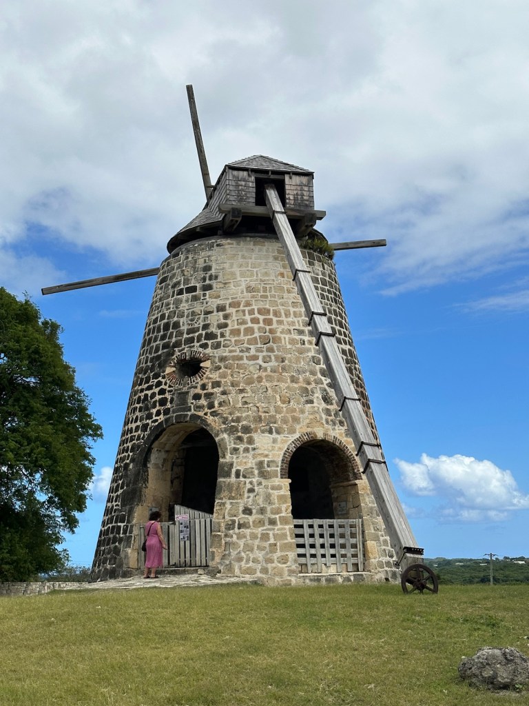
On our way to the airport we made a stop at a historic sugar cane plantation called Betty’s Hope. This is a sugar plantation site where one of the two sugar mill towers has been fully restored complete with sails. Betty’s Hope was one of the earliest sugar plantations.
The sugar mill tower on the left has been fully restored.
Windmills were central to the operation of a sugar estate. Betty’s Hope was large and required two mills to process all the cane. With a steady wind and working from sun up to late into the night, each mill could crush 60-70 cartloads of cane or about 2 acres per day.
It was the first large-scale sugar plantation to operate in Antigua and belonged to several generations of the Codrington family from 1674 until 1944. Christopher Codrington acquired the property in 1674 and named it Betty’s Hope, after his daughter.
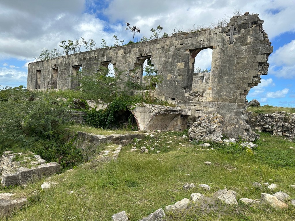
The Still House held pipes that carried condensed rum from the condensing coil into large tanks for mixing and diluting down to about 60% alcohol, and then into wooden barrels for storage and in some cases to age.
Remnants of the Still House where condensed rum was mixed, diluted, stored and aged.
Like other large plantations, Betty’s Hope was an agricultural as well as an industrial enterprise, and home to a large number of people. Supervised by a handful of European managers, hundreds of people of African origin lived out their lives on this and similar plantations, first as slaves, then as labourers after their emancipation in 1834.
Enduring the hardship of cultivating and processing the sugar under exhausting conditions, they developed great skill as craftsmen, boilers and distillers.
Small huts where the enslaved workers lived.
Throughout its 300 year history, Betty’s Hope played a prominent role in Antigua and Barbuda history and influenced the lives of many generations of Antiguans. (Information taken from visitantiguabarbuda.com)
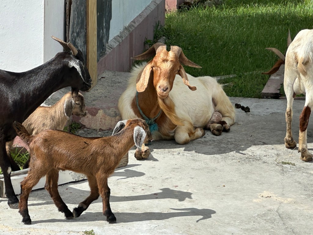
Random herds of goats pass through the property. Formerly a cistern, now filled with trees and greenery.
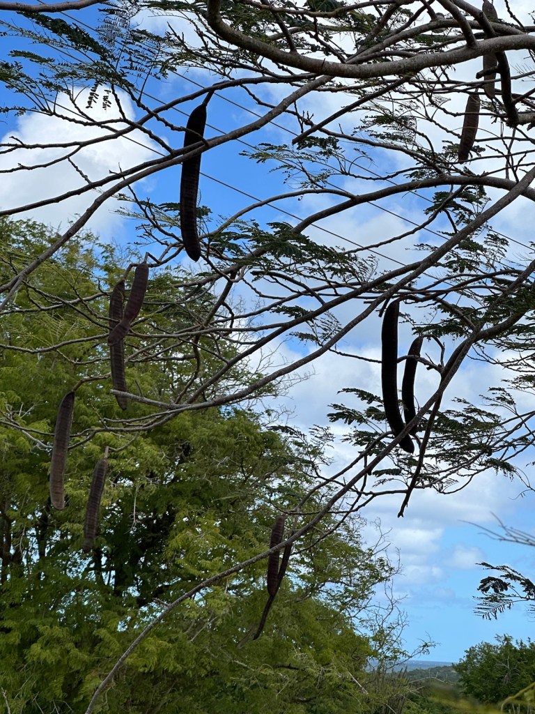
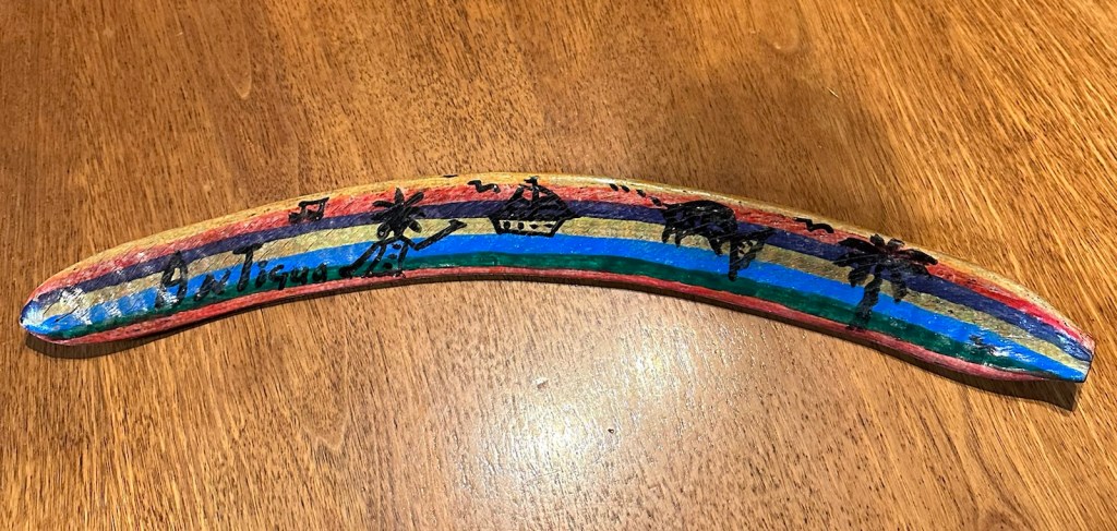
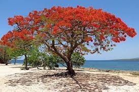
Walking through the property we came across a Flamboyant tree. In the spring, it’s covered with dazzling red blooms. In the Summer and fall, the large dark brown pods can’t be missed hanging from the leafless trees. The seeds rattle within and can be used as musical shake-shakes.
Flamboyant tree at Betty’s Hope.Long pods from the Flamboyant tree are used as a musical shake-shake. A decorated shake-shake made from a pod.Dazzling red Flamboyant trees bloom in the spring. (Photo from antiguanice.com)This big shady tree makes a peaceful resting place for the goats.
The adventures of Jane and Peggy in Antigua & Barbuda are coming to an end.
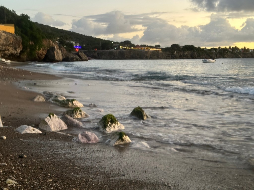
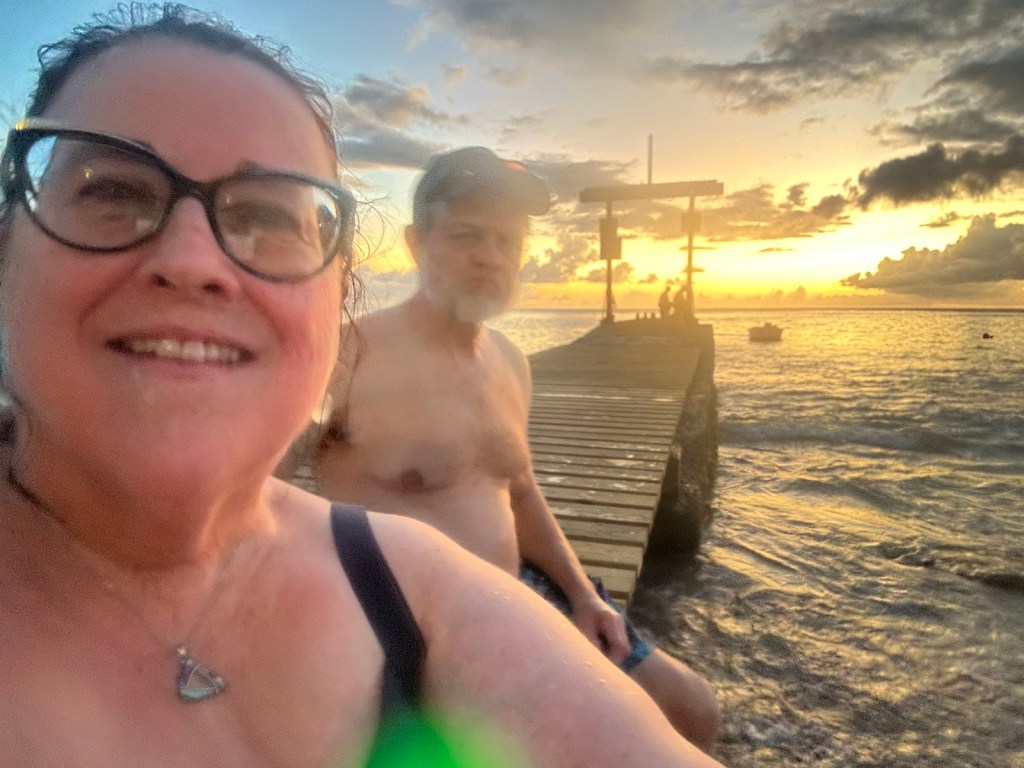
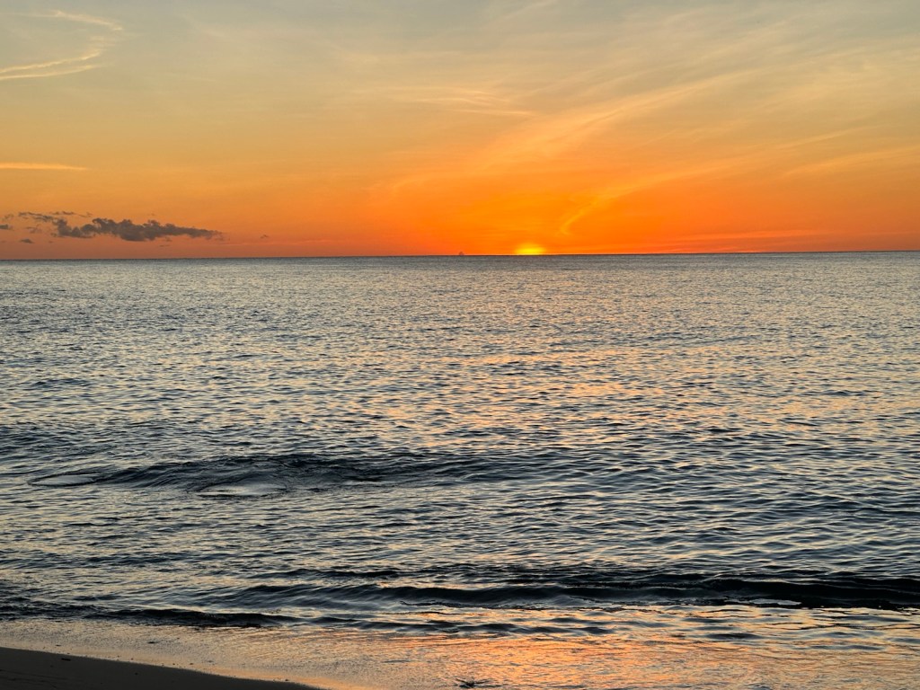
We were elated to return the rental car without a scratch.A farewell sunset on our way home.
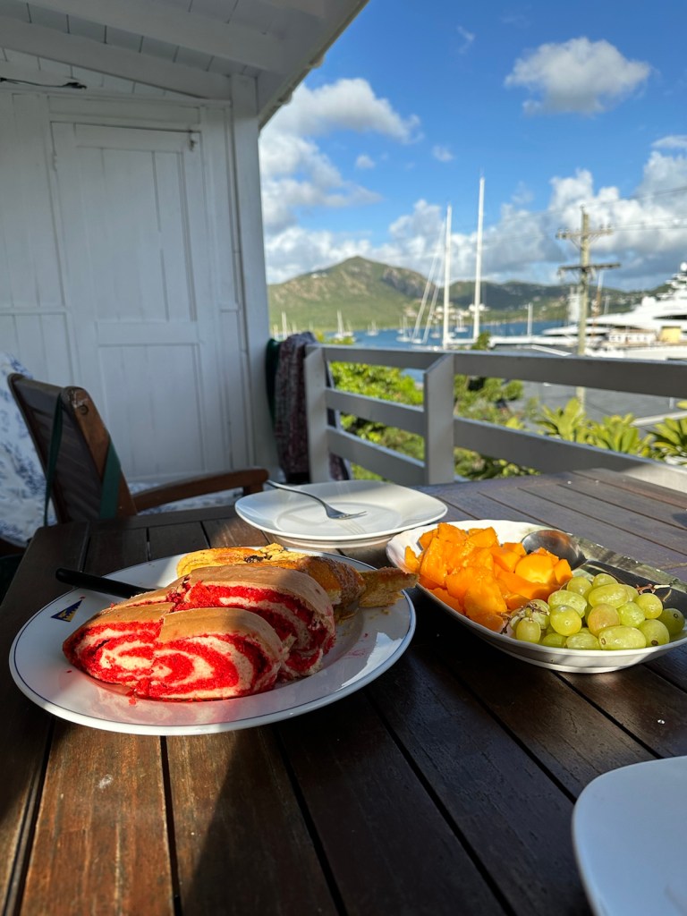
We had a nice variety of breakfast items bought at yesterday’s public market in Saint John.
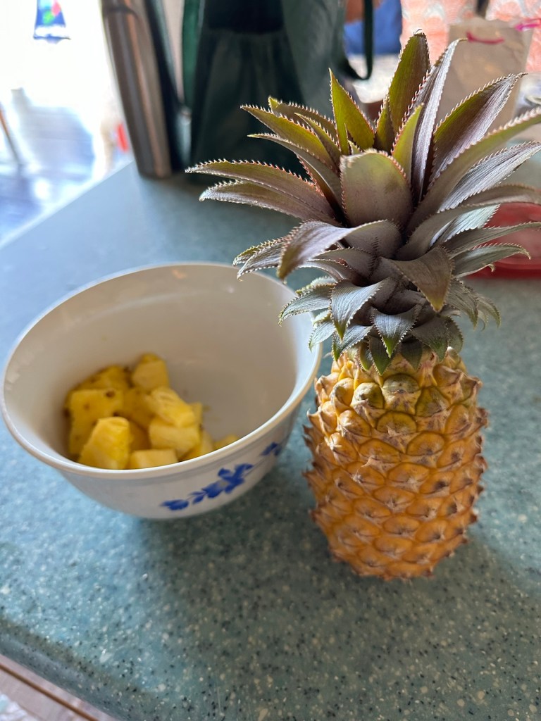
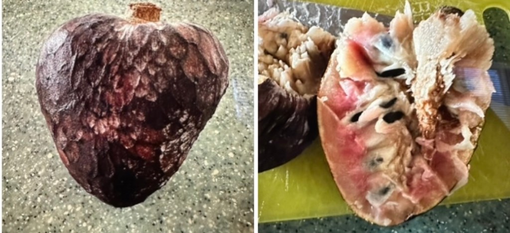
Coconut raspberry bread and fresh fruit grace our balcony table.We found the coveted black pineapple which is unique to Antigua.Not sure what this fruit is. I may have let it get a little too ripe. After removing the seeds and core, it had the texture and taste of sweet applesauce. Little gray bird in our balcony tree is waiting for bread crumbs.
We packed up snorkeling gear and headed to Galleon Beach in English Harbor. We’re going to try snorkeling where the security guard suggested.
We walked down the beach, past the big rusty anchor and over to the other side.At the end of the beach we followed a short trail through the trees. The trail led to a small semi-shaded beach.
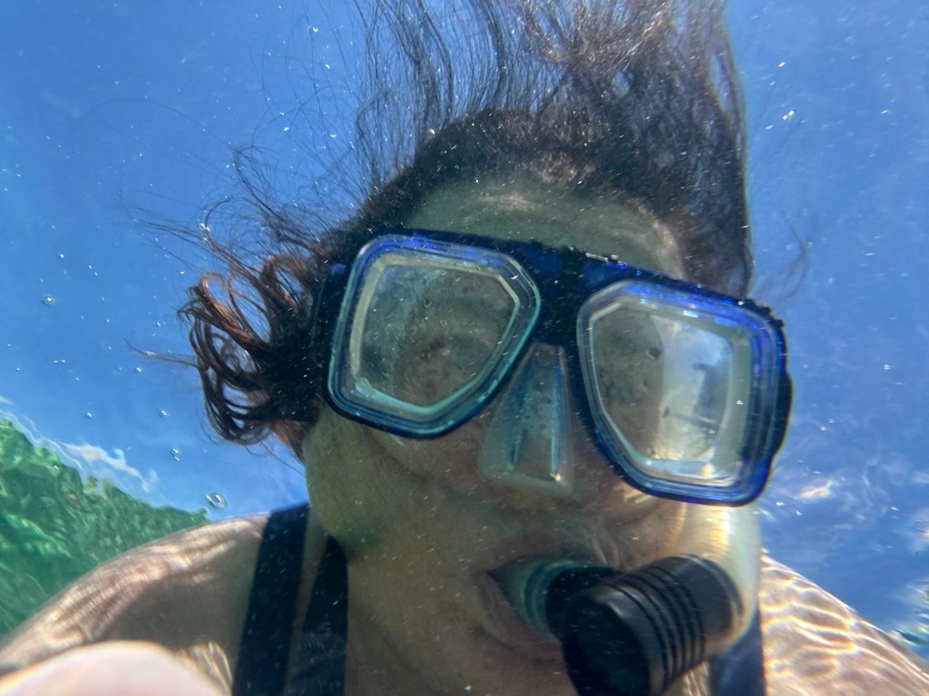
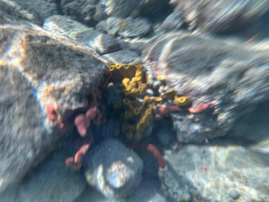
We were much closer to the reef and the snorkeling was pretty good here. This was my first attempt at underwater photography … just using my i-phone in a water proof case. There was a variety of colored fish but they’re hard to photograph — they move fast and I’m still fumbly with cell phone buttons under water in a case.
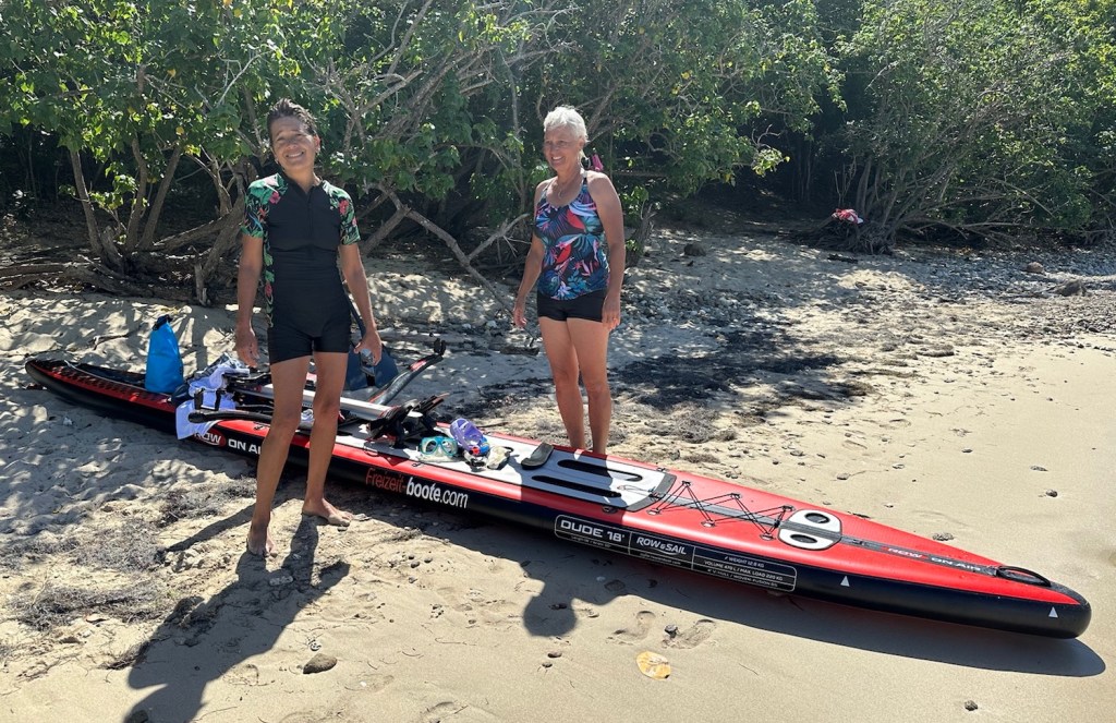
While snorkeling, a sport row boat with two women pulled up to our little beach. We chatted for awhile. It was the coach and nurse for the Swiss Trans-Atlantic rowing team. They were getting ready to welcome their team which would be finishing the 3,000 mile trek this afternoon.
The ladies were using an inflatable row boat. They said it folds up small and can be taken on an airplane.
The coach and nurse for the Swiss Trans-Atlantic rowing team getting ready to welcome and meet their team at the finish.
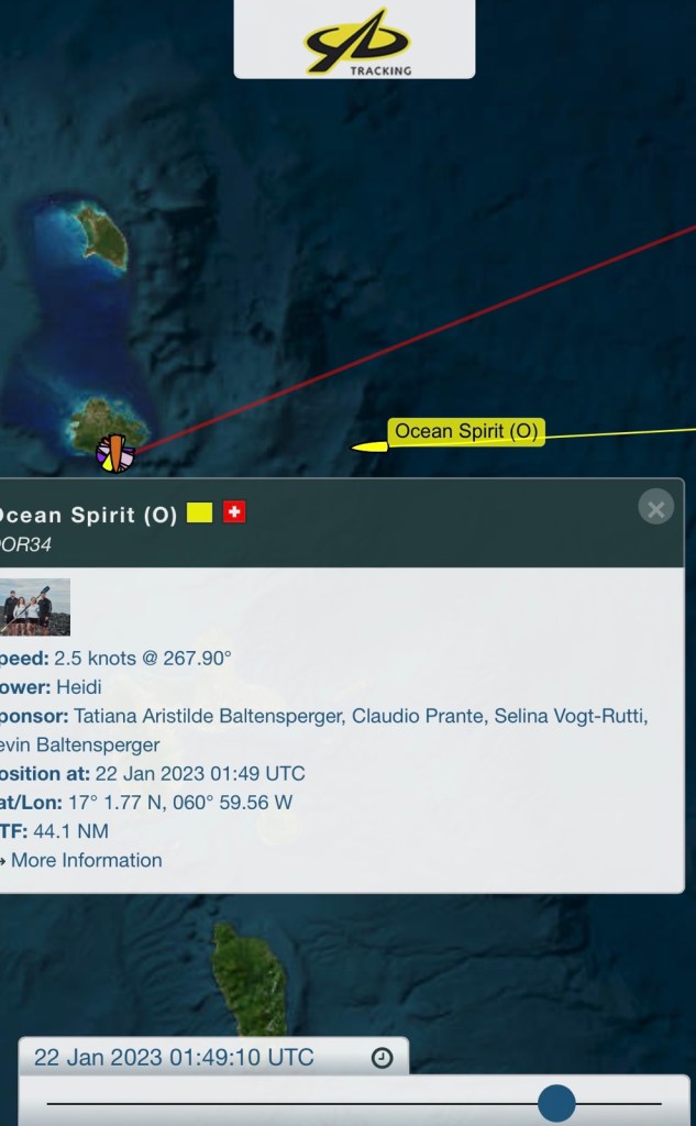
The app for following the Trans-Atlantic competition shows icons of all the boats and their locations. Click on your team’s boat icon and it provides their locations and other data. This lets the family and friends following each team, know when to show up in English Harbor for the grand finale.
The app shows the Swiss team, Ocean Spirit, approaching the finish.Time to move on … we shook out the sand and packed our gear.The trail back to the main beach area is full of flowers and greenery.Had to stop and look at little red star-shaped flowers.This tree and its strange fruit caught our attention.
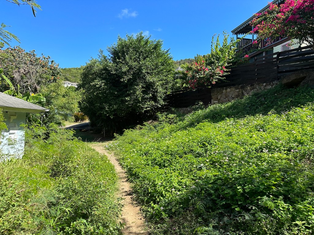
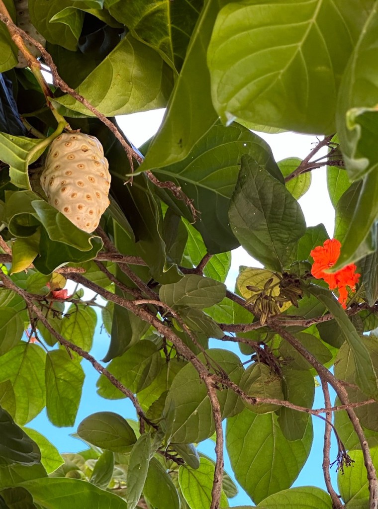
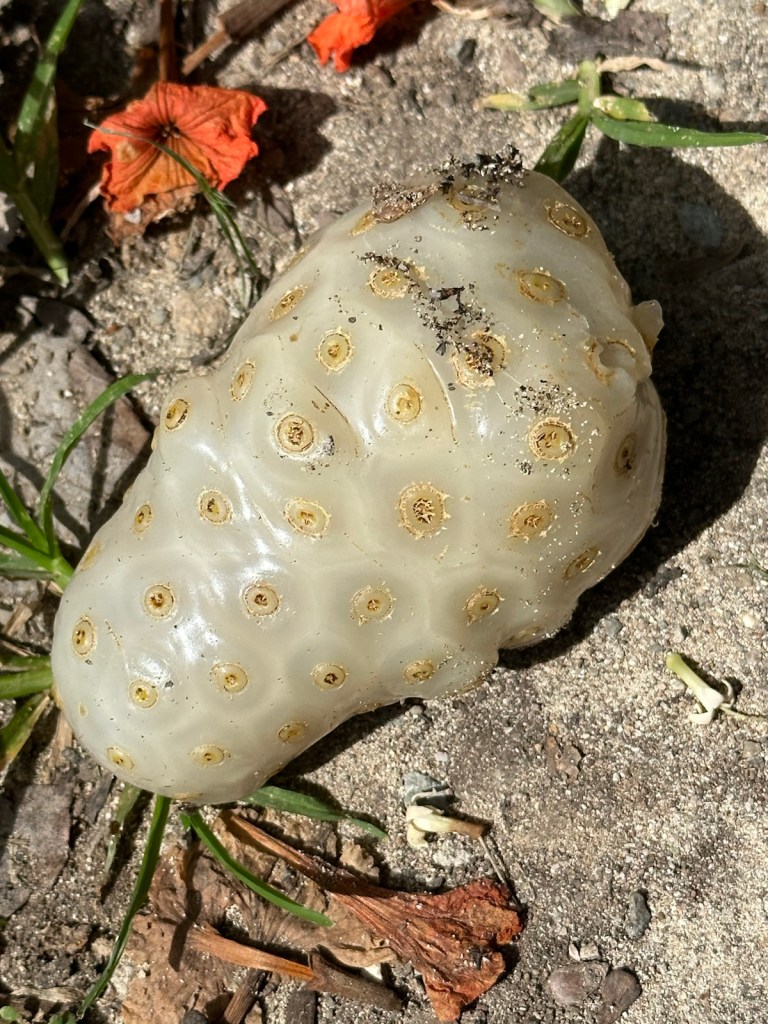
A tree on our path had big white soft squishy-gel like fruit. Peggy looked it up and discovered that one of its names is “vomit fruit”. Glad we didn’t smell or touch it. There are over 100 names for this fruit but the scientific name is Morinda Citrifolia more commonly known as Noni and it is a fruit-bearing tree from the coffee family.
Further research showed it is widespread and that the fresh fruit is consumed across the globe. Supplements made from Noni are estimated to bring in millions of dollars annually. Not bad for a fruit that tastes like rotten cheese. Unripe is most tolerable and tastes spicy and grassy with hints of horseradish and Parmesan.
Morinda Citrifolia is also known as Noni, Indian mulberry, beach mulberry, cheese fruit, dog dumpling and starvation fruit.
The main reason people opt to eat this fruit is for its purported health benefits. All parts of the plant are used to treat ailments as diverse as toothaches, cancer, attention deficit disorder, bruises and addiction. The majority of the health claims are unproven. (Information taken from atlasobscura.com).
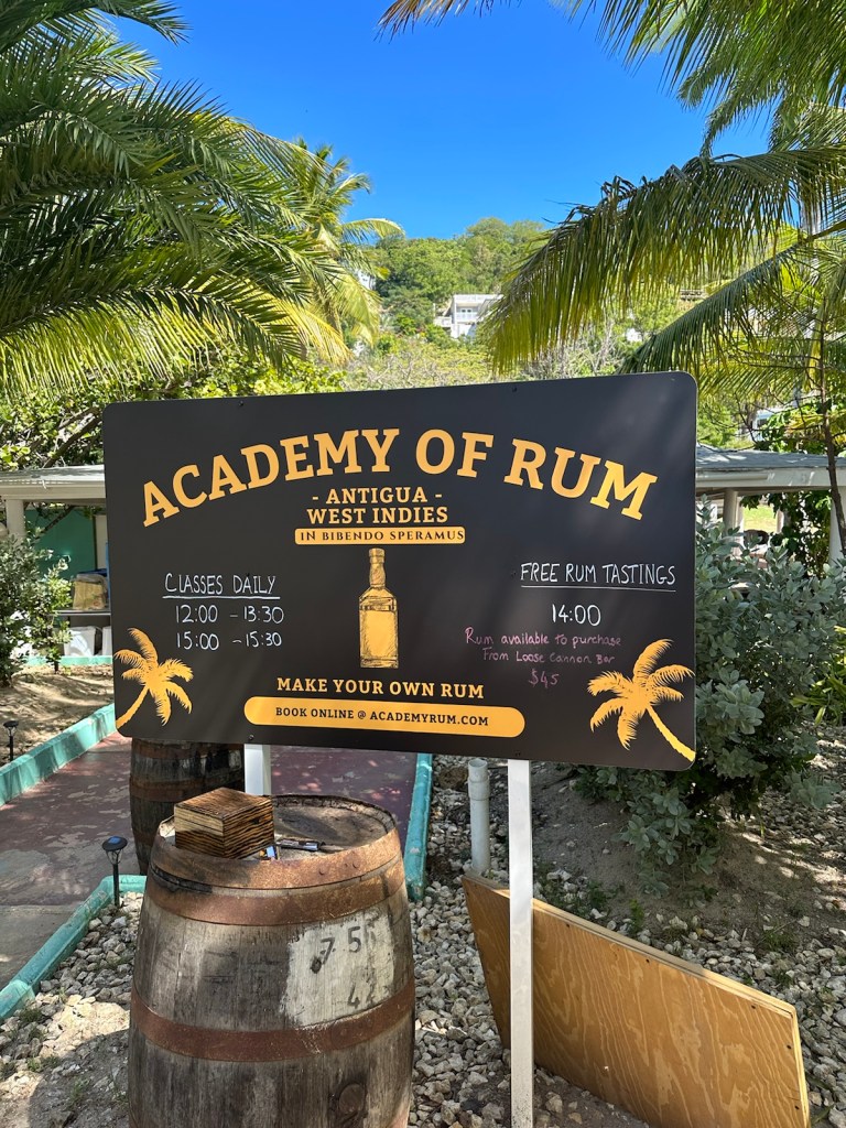
Our beach route is filled with interesting floral and greenery combinations.Lots of different types of palms.If you get tired of the beach, you can cross the road and attend the Academy of Rum … an opportunity to create your own rum flavor.
We made a stop at the apartment to de-sand before heading out to Shirley Heights, a much touted Sunday evening event with music and barbecue as well as a great view, especially at sunset.
Home Sweet HomeYou have to make friends with sand … it’s everywhere!
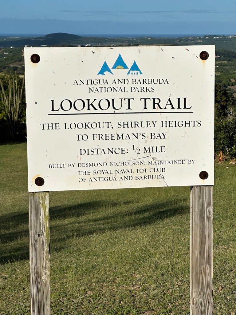
Shirley Heights
Shirley Heights is located high on a steep hilltop above Galleon beach where we were just snorkeling. It is a restored military lookout named after Sir Thomas Shirley, Governor of the Leeward Islands, who strengthened Antigua’s defenses in 1781.
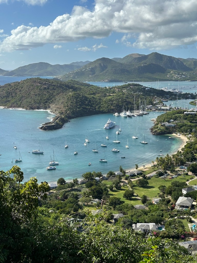
The iconic view from Shirley Heights includes English Harbor and Falmouth Harbor along with a few beaches and Nelson’s Dockyard.
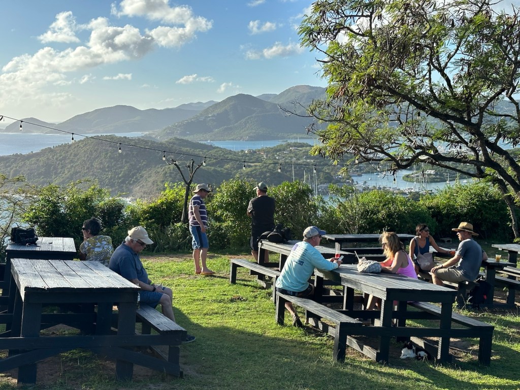
The view from Shirley Heights is spectacular.The hills are alive with strenuous trails to Shirley Heights. We opted to drive.
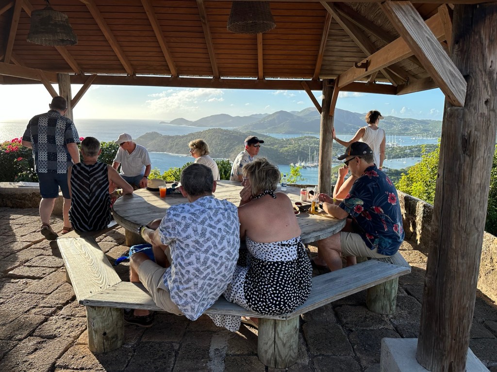
We arrived early around 3:00 pm. Parking was easy. No lines at the bar or food-ticket line. We could easily walk around and enjoy the views. The music starts at 4:00.
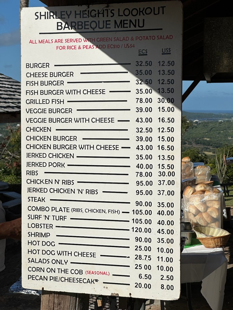
Sheltered picnic area with a view …… and large grass area with picnic tables and a great view. The smell of grilling charcoal wafted through the air.Several cooks worked the grills before the crowds arrive.An extensive menu of barbecue items is posted near the grills.
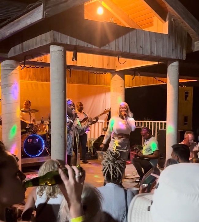
We enjoyed the sounds of the Halcyon Steel Orchestra. This musical ‘family’ has been together for over 50 years and has performed all over the globe. They have an impressive list of awards and have won countless competitions. Their big steel drum sound provides a Caribbean party vibe that gets everyone dancing.
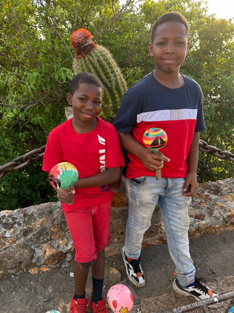
Halcyon Steel Orchestra, ‘When Steel Talks … Everybody Listens.’ Plenty of people selling percussion devices. I couldn’t resist and bought calabash shakers from my buddies Chevron and Kevon.
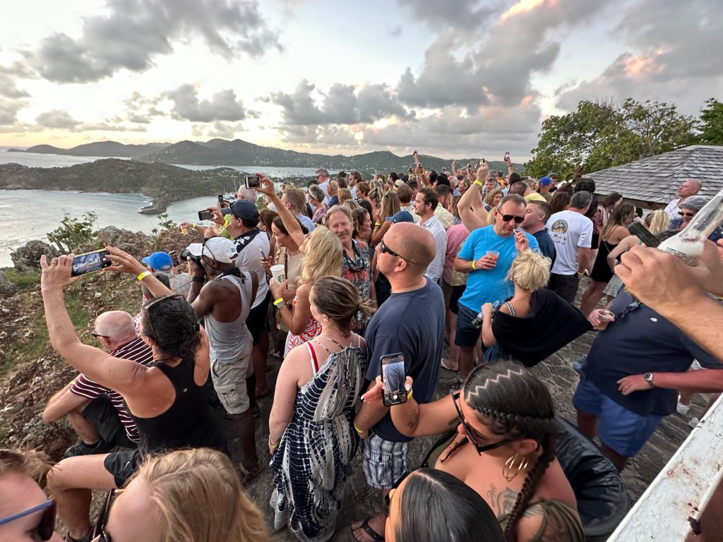
By 5:30, the place is packed shoulder-to-shoulder. Many gather at the point to watch and take photos of the sunset.
People crowd the corner of the Heights to view the sunset.
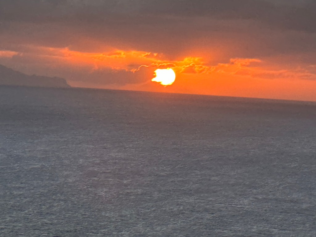
According to Visit Antigua and Barbuda tourism authority, if you watch closely for that split second as the sun sets behind the ocean, you may see at that moment a green jet of light that covers the horizon known as the Green Flash and is something that only the luckiest viewers and photographers have ever managed to capture on camera or in their memories.
The sun does not disappoint tonight.
Now it’s hard to maneuver around the crowd. Lines at the bars are ten deep with party-goers ordering trays of rum punch for their tables. There’s even longer lines for food tickets and the buffet where the portions are generous.
The Halcyon Steel Orchestra wrapped up about an hour after sunset. The next performers had a calypso sound … and the party goes on until the late hours.
Look out … steel drums coming through! Calypso-style music is up next.And the party goes on!
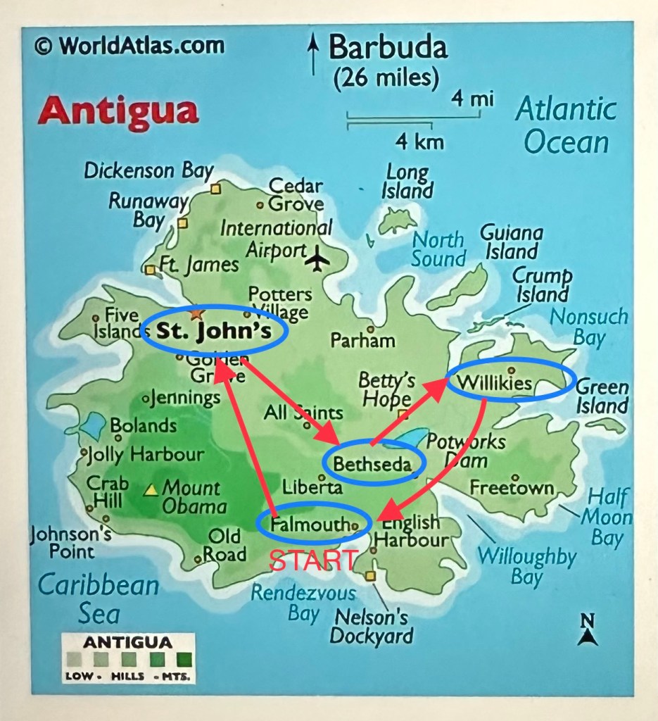
Today’s route does a little zig zag around the center of the island.
Todays travel route.
We started our route around 8:00 am. First stop is the Saturday public market at Saint Johns.
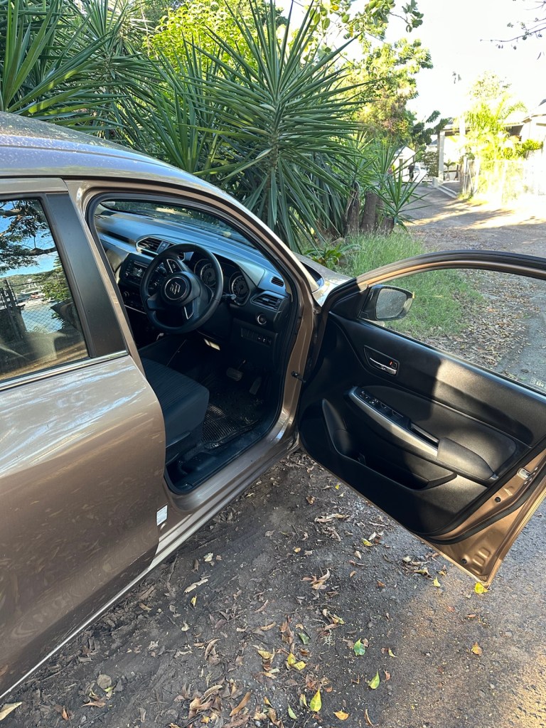
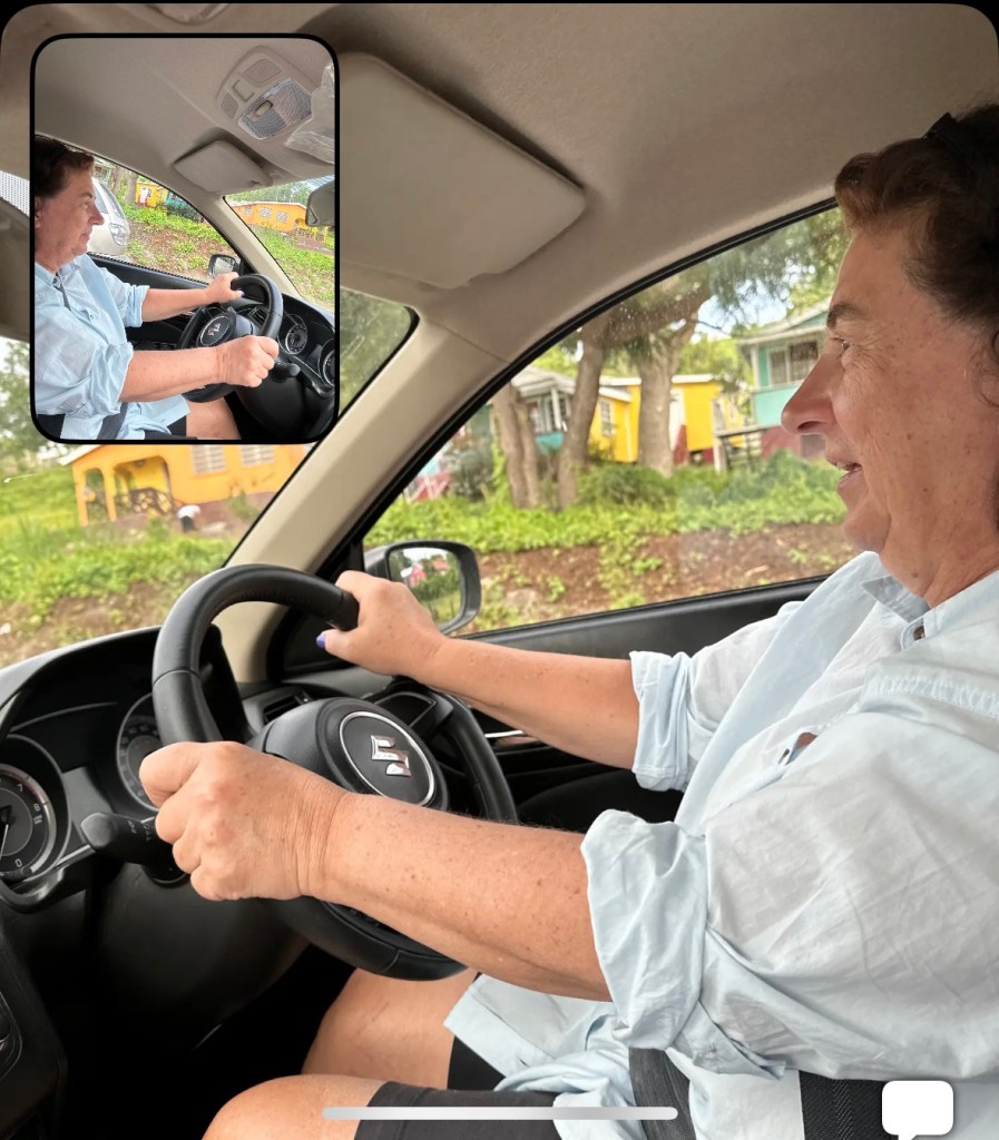
Back to our little car with the steering wheel on the right, driving on the left side of the road.
Today’s Driving Dilemma: Everything was going great until I came upon a row of parked cars. I followed a motorcycle around them and to my horror after passing about 10 cars, I discovered that they were not parked — the drivers were on the right side and they were all waiting for a traffic light. Embarrassing. We waved and smiled and went slowly. Some kind soul let us pass through the intersection. For the most part, Antiguan drivers are very courteous and will often stop, blink their lights and allow you to cut through their lane to accommodate a turn during backed-up traffic.
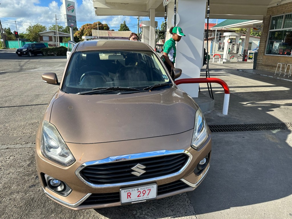
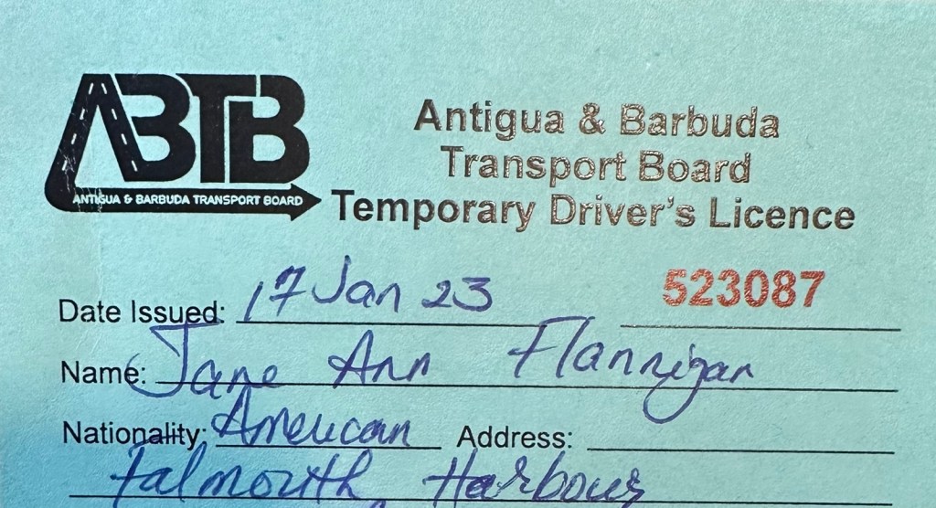
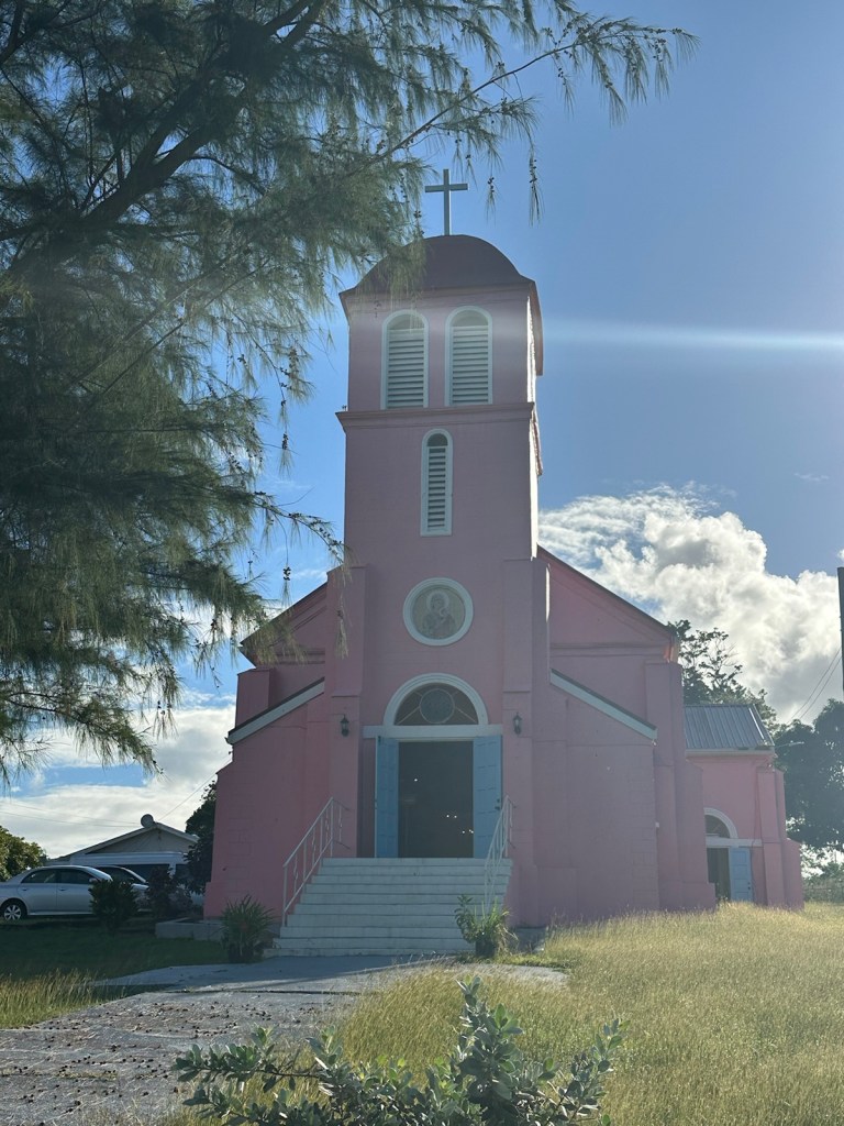
Gas is sold by the gallon, not liter. We paid $5.13 per gallon and spent less than $40 on gas for the entire week. We were required to purchase an Antiguan Temporary Driver’s License. In Antigua & Barbuda, those travelers wishing to drive must have a temporary Driver’s License. It is purchased from any car rental and costs about $20.We passed this very pink church a few times during the week … it’s very stunning against the blue sky. It is Our Lady of Perpetual Help, Roman Catholic Church.
Antigua and Barbuda is a predominately Christian nation. The Anglican Church accounts for about 17% of the population. Adventists and Pentecostals follow with about 12% each. The Methodists, Roman Catholic, Baptist, Moravian, Church of God and Weslyan Holiness churches account for about 10% of the population. Other religious groups claim around 12% of the population and include Rastafarians, Hindus, Bahia’is, Muslims and Jews. (Information taken from Antigua and Barbuda A Little Bit of Paradise.).
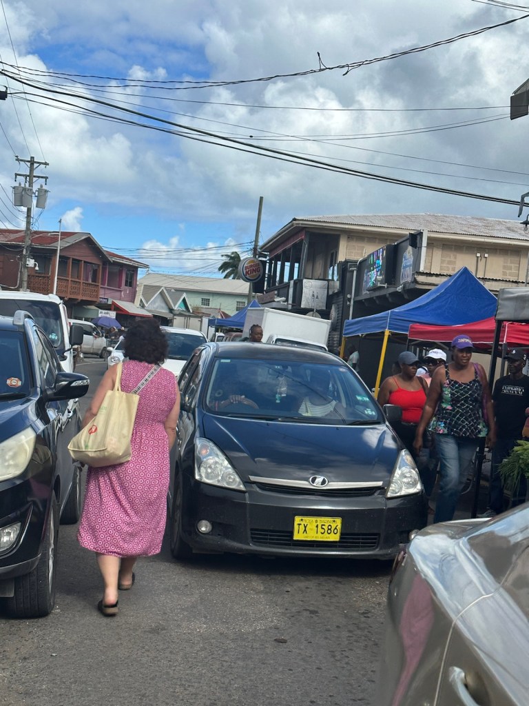
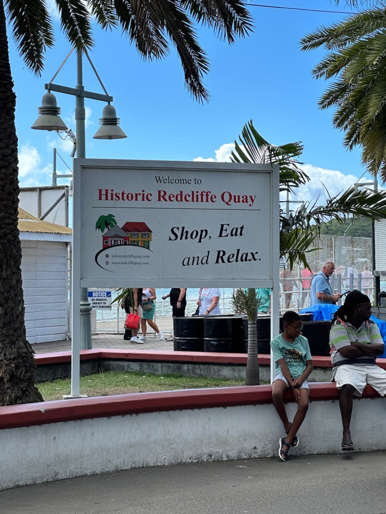
Driving in Saint Johns is a challenge. Many of the streets are one-way and the cruise ships bring in countless pedestrians. We were directed to park in a pay lot which was only open until 2:00 pm for whatever reason. The first thing we came across was a pedal-pub full of cruise ship tourists … yet another driving obstacle that made us glad we were parked.
Pedal Pub — probably a cruise ship excursion.
Saint Johns Market
A big old statue of V.C. Bird stands prominently downtown Saint Johns next to the public market. He was the first prime minister of Antigua and Barbuda and held that position from 1981 — 1994. In that time, he took the twin island nation from a British Colony to an independent nation.
Next to Bird’s statue is a black pineapple, a type of fruit that is said to be a delicacy and unique to the island.
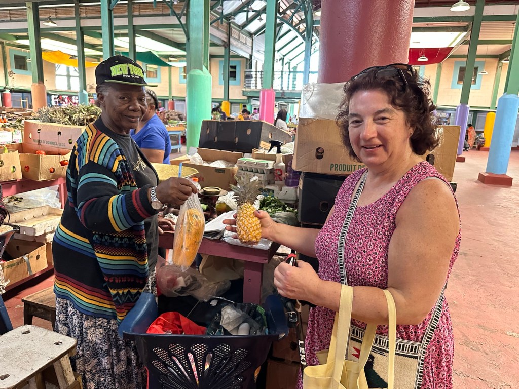
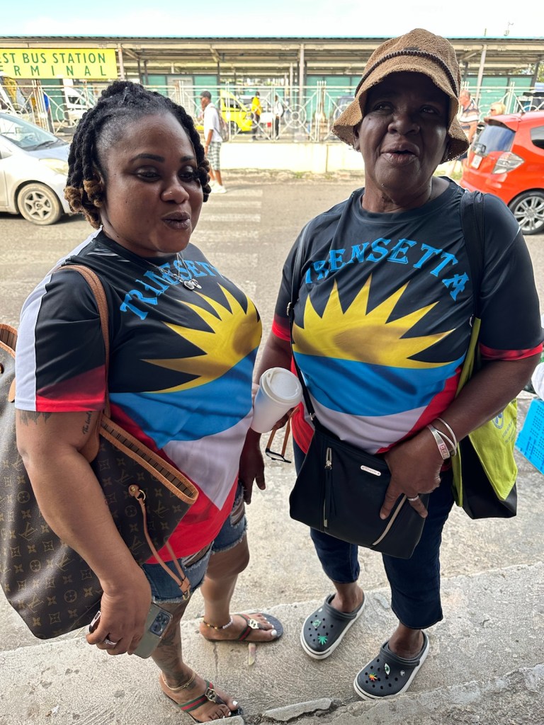
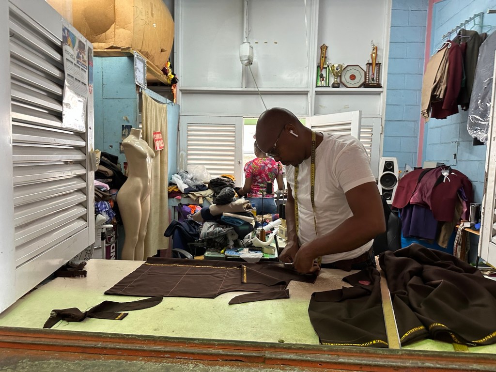
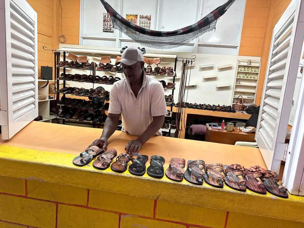
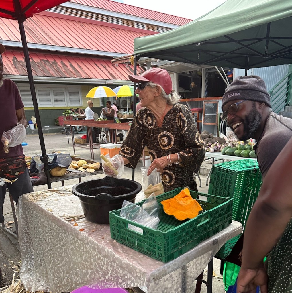
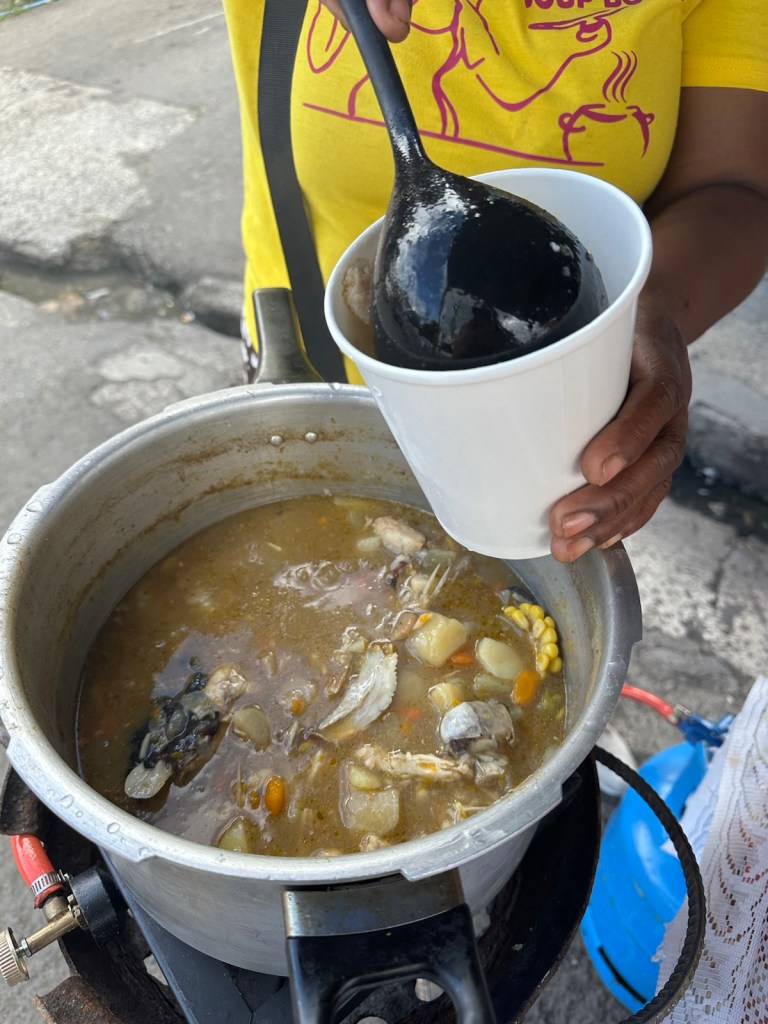
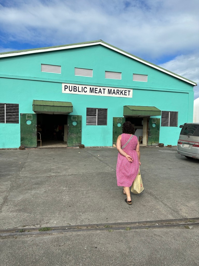
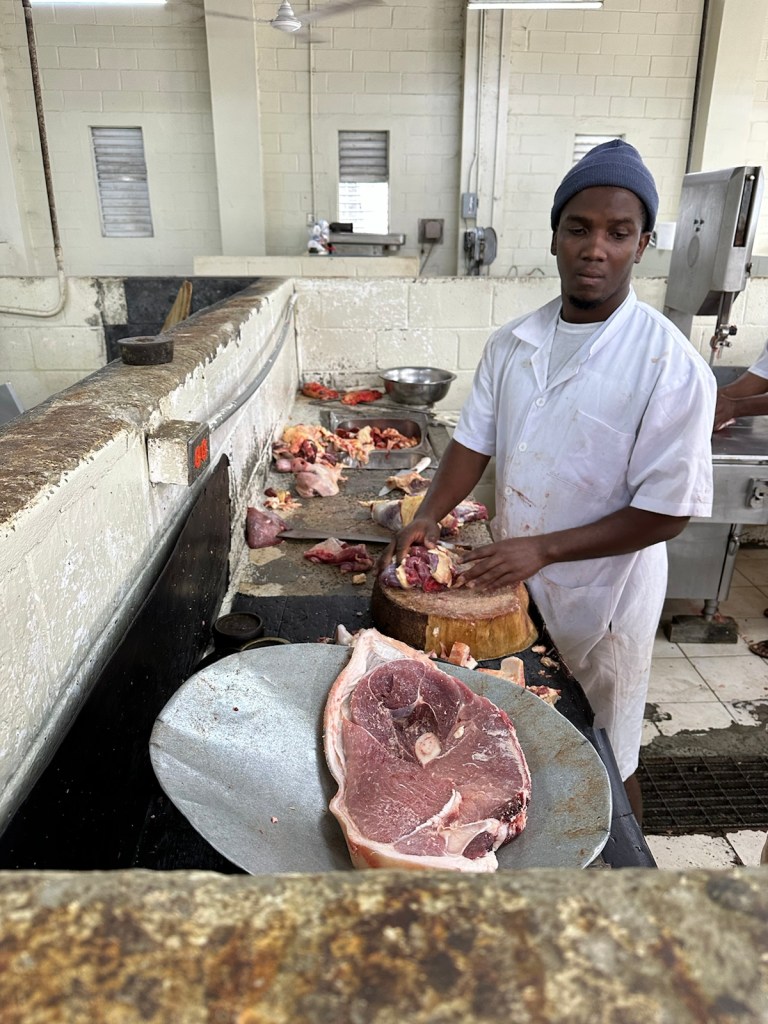
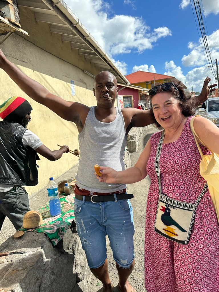
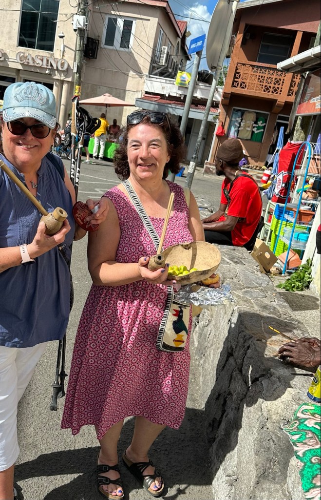
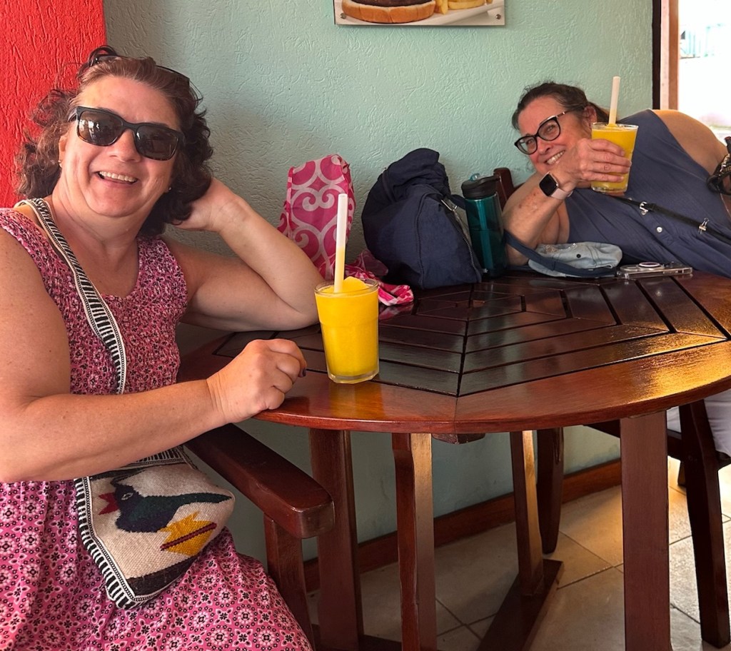
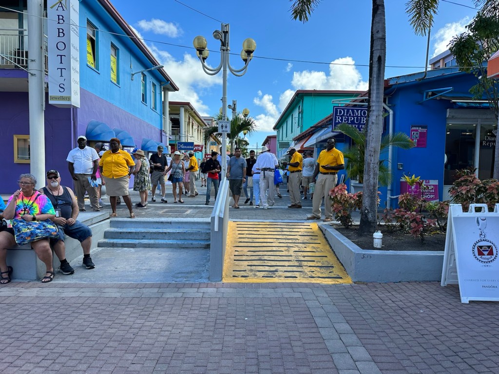
A bird poses on top of VC Bird’s statue at the triangular intersection of All Saints Road and two busy streets. The public market streets are crowded with vendors, pedestrians and cars.There are many street vendors selling everything from fruits and vegetable to socks and underwater.More vendors inside the public market building. We bought hot sauce here.Black pineapple is on the ‘must try’ list.Nesetta and her mother Lucy pose with their “Trensetta” (trend setter) shirts which is the name of Nesetta’s hair salon. The shirts resemble the design and colors of the Antiguan flag. In side the Handicraft building there are several tailor shops.This gentlemen said his wife makes all of the sandals he sells.Sugar Cane man had a hard time keeping up with the demand and had a line of customers waiting for him to chop up sugar cane into pieces. He took time to give each of us a piece and said they chew it like gum. So we got in line.Sugar Cane man’s assistant bagged the pieces and handled the customers.This vendor has seafood stew.The stew smelled wonderful and looked very enticing. The meat market is part of the public market.Very interesting to watch.These two dudes were selling pipes and bowls carved from coconuts.We posed with pipes and a carved bowl filled with dums.Steel drum music added to the Caribbean vibe of the market.We took a break and had a refreshing icy cold mango drink.This is the main shopping area by the cruise ship dock.Lots of little shops and good ‘people watching’ here. The individuals in gold shirts help cruise ship guests find taxi transportation.The mid-day heat is hard on everyone. Time to move on to our next stop.
Donkey Sanctuary
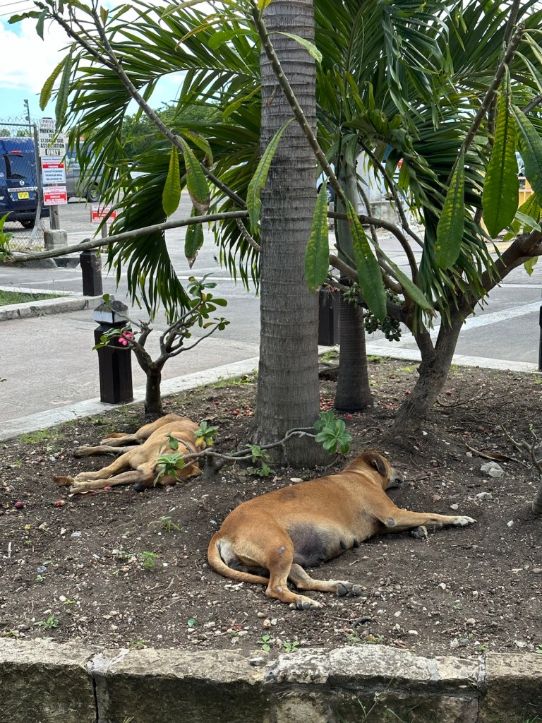
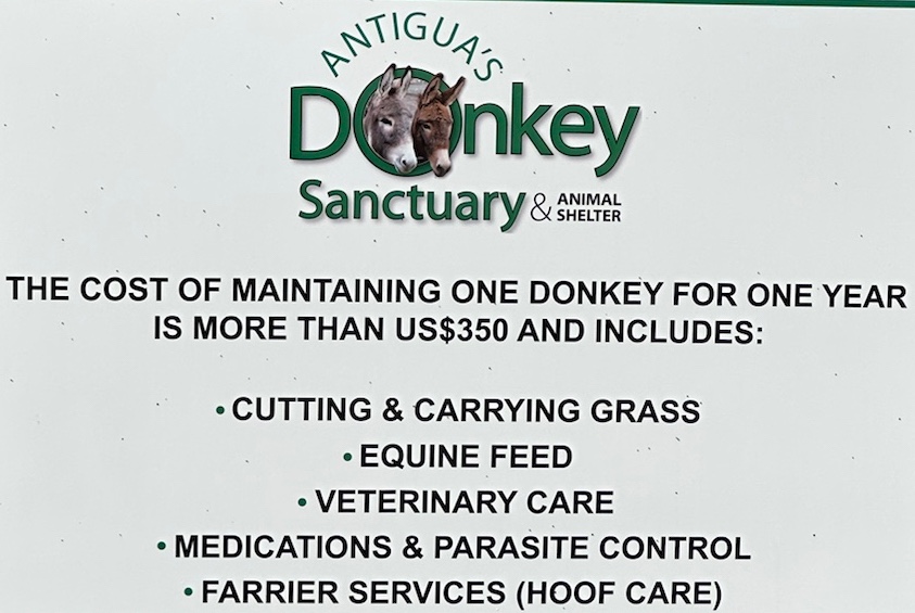
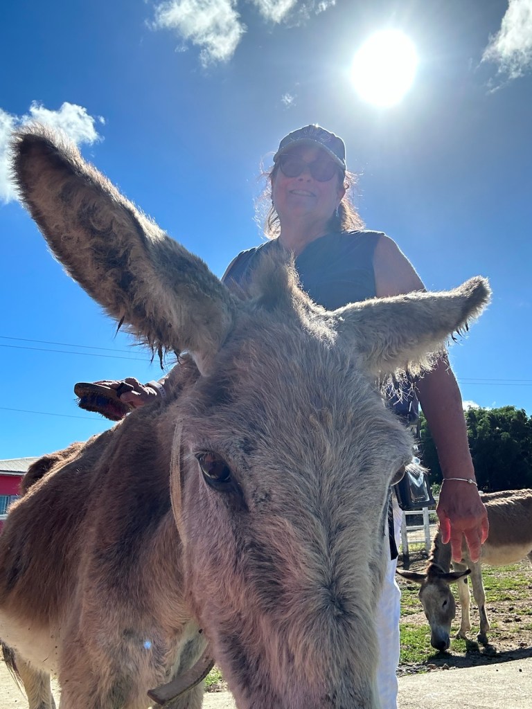
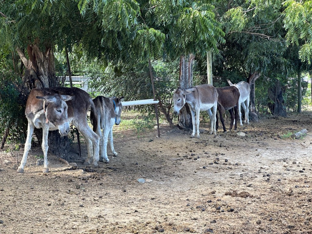
A dirt road full of potholes led us to the donkey sanctuary where it was hot and dusty. There are about 150 or so stray donkeys that have found a good home in this sanctuary operated by the Antigua & Barbuda Humane Society.
The decline of the sugar industry has contributed to the abandonment of donkeys and has done little to curtail their population. While some continued to be used on farms and to lug produce to and from market, they were largely left to fend for themselves after the doors closed on the last sugar factory in the 1970s. Most people have little use for donkeys these days.
The 43-acre site is home to 150 jacks, jennies and foals. It is estimated that up to 400 more are roaming wild, breeding at will. They cause a lot of trouble for farmers and crops, they also break irrigation lines, crash through people’s gardens and overturn garbage bins looking for food. The vagrant lifestyle is tough for the donkeys too.
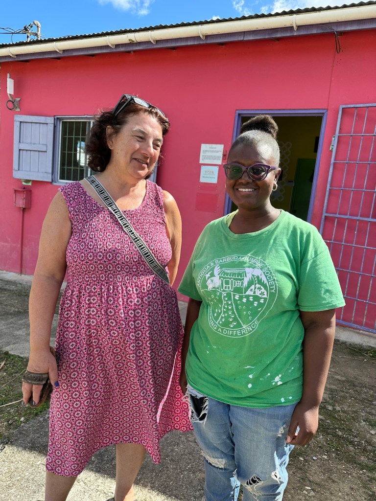
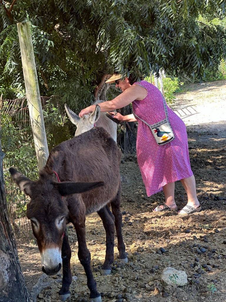
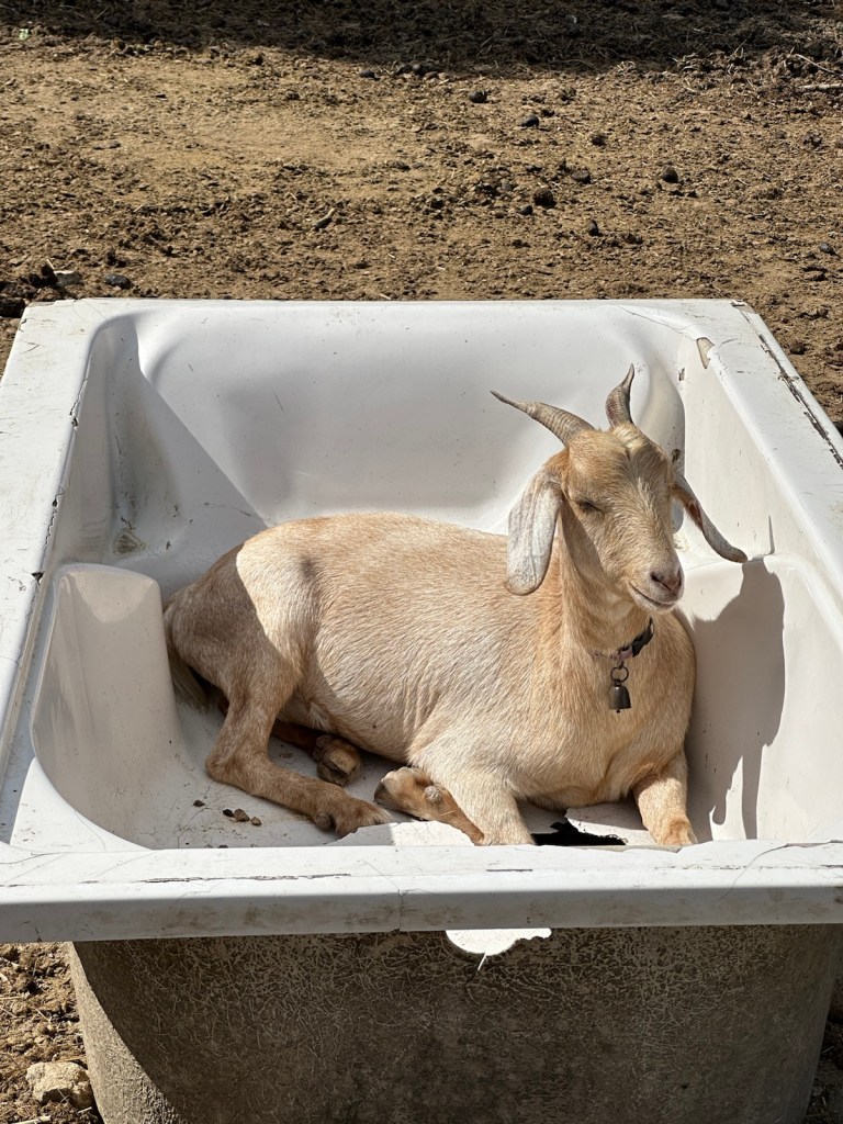
Takeeta welcomed us to the sanctuary and gave us each a brush. She sent us in with the elderly donkeys who were gentle and calm.Meet my friend Pumpkin. She loves being brushed. These poor old donkeys look like they’ve had a rough life. The darker donkey is Eeyore. They all wear a collar with their name on it.Goat in a bathtub? The goat is the best friend of Bruno, a donkey that had to be isolated because it has a hernia and needs care. Donkeys once held an important role in the growth of Antigua and the sugar cane industry. Now the Humane Society is caring for them and helping to control the population. (Information taken from antiguaanimals.com and Antigua humane society.com)
Devil’s Bridge
Our next destination is Devil’s Bridge near the town of Willikies. This National Park offers a stunning glimpse into Antigua’s natural formation.
Composed of limestone rock, the rugged terrain of Devil’s Bridge is the result of millions of years of ancient reef formation. A rough natural outcrop of limestone has been eroded by many years of Atlantic waves crashing into it and forming a bridge. I wouldn’t recommend walking over it but there are some who have.
A woman standing on Devil’s Bridge. Photo from luxeadventuretraveler.com
Back to Pidgeon Point Beach
We need to get back to Falmouth Harbour in time for a swim and sunset at Pidgeon Point beach. It’s Saturday evening and this is the first time we’ve seen a crowded beach. There were a lot of locals and kids enjoying the water and sunset.
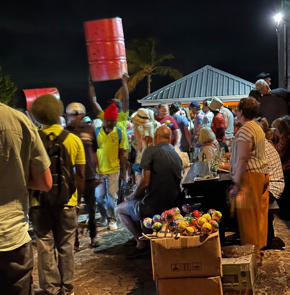
It was a spectacular sunset tonight.We walked down to Flatties for chicken. It has a nice Caribbean vibe and did not disappoint. On the way back to our apartment, we crossed paths with some ladies wearing costumes to promote Carnival as part of a music and dance event.
Antigua’s Carnival does not coincide with Mardi Gras. It was first celebrated in 1957 with the purpose of attracting tourists and to commemorate the emancipation from slavery.
It is a summer festival with artistic and cultural talent, music, steelbands and calypso. The streets come alive with parades, music bands and troupes with a multitude of masqueraders in colourful costumes. Held during the last week of July, and culminating on the first Monday and Tuesday of August, the event attracts locals and visitors alike. (Information taken from visitantiguaandbarbuda.com and iexplore.com).
Tomorrow we’re planning to snorkel and explore Shirley Heights.
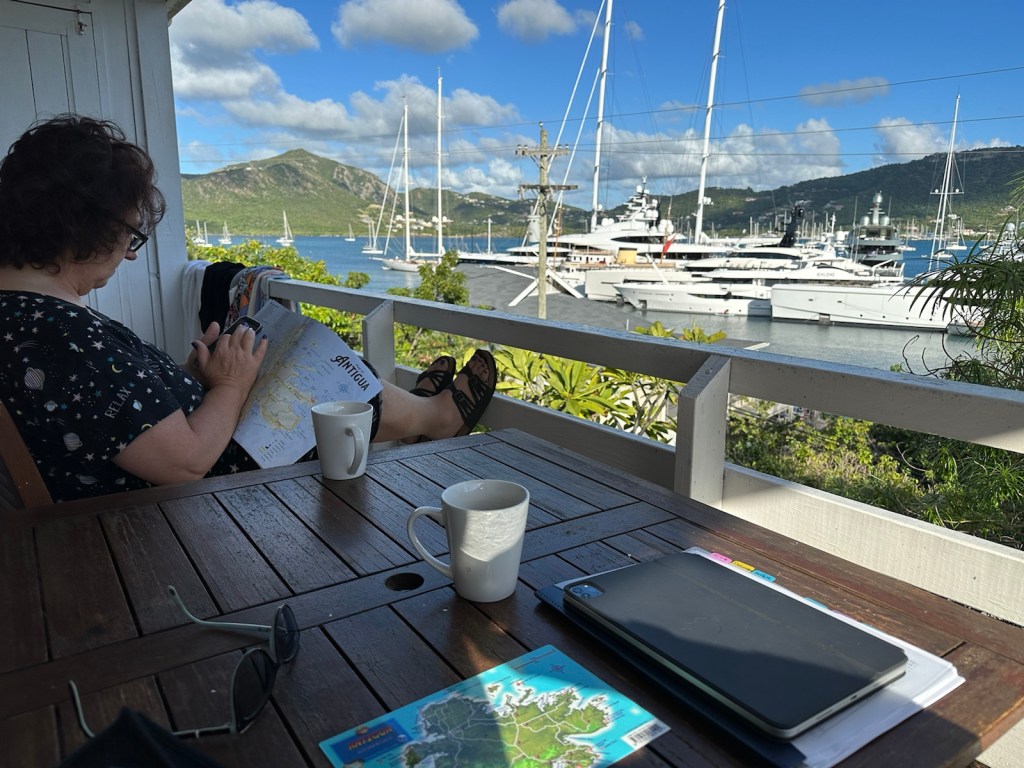
After the long day in Barbuda yesterday, we spent plenty of time relaxing on the balcony and drinking coffee this morning.
A warm sunny morning on the balcony. Our balcony has a tree full of birds next to it.We were wishing we had a bird book to help identify our guests.
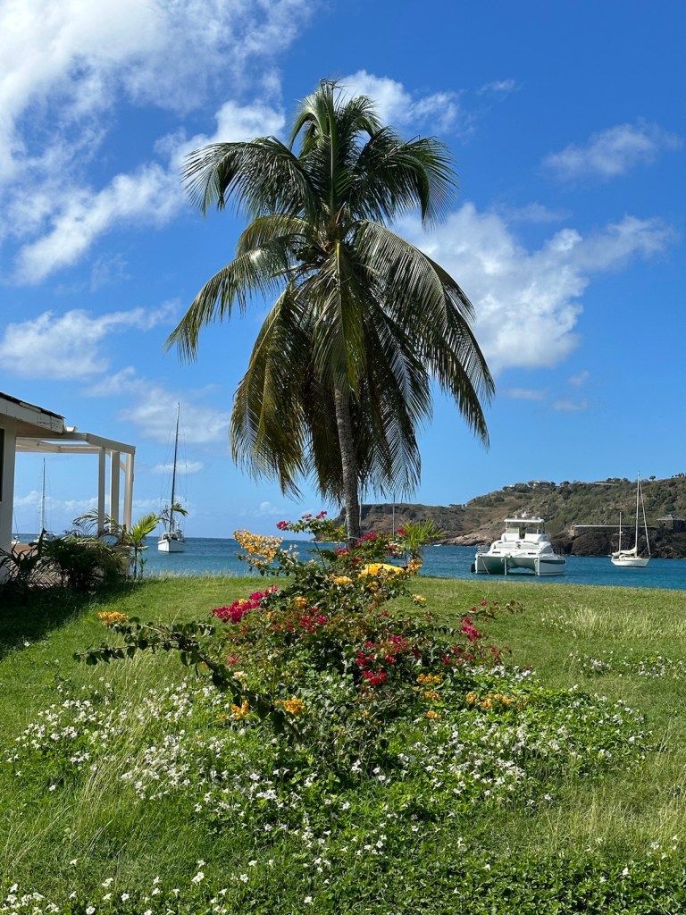
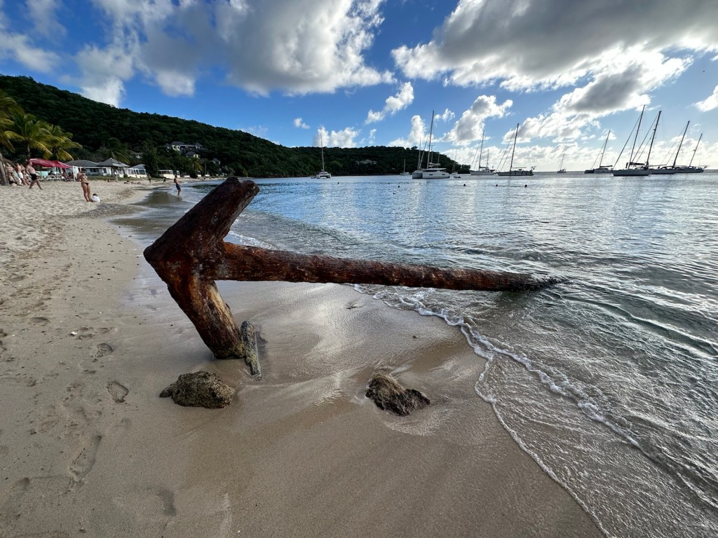
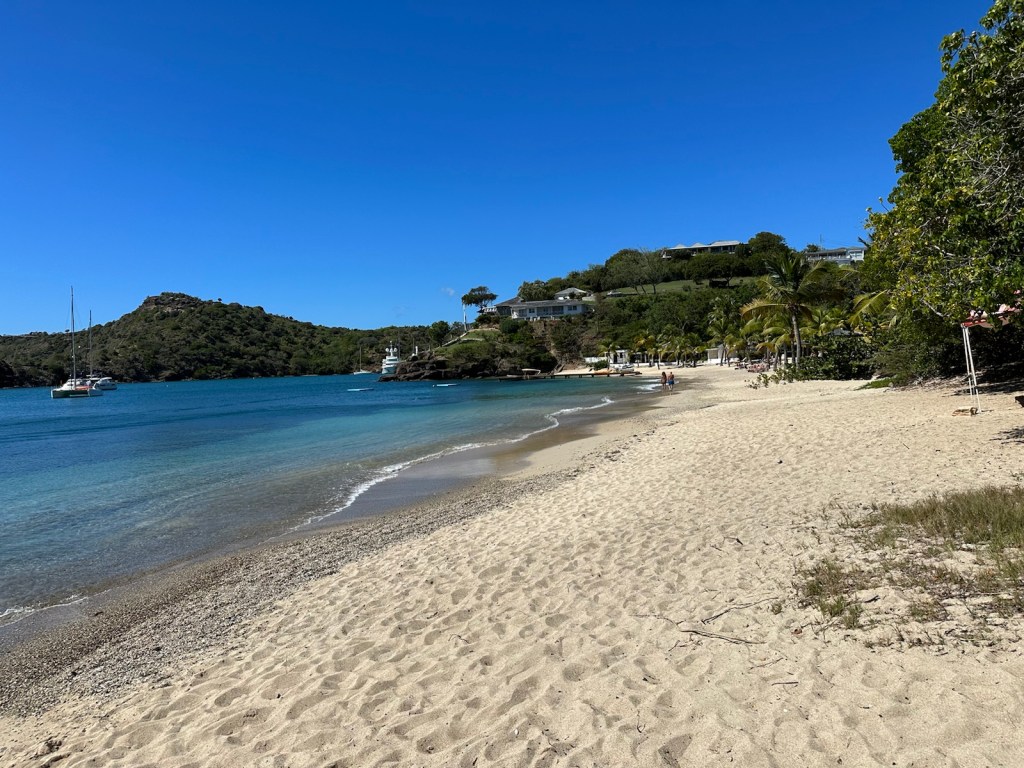
Beach time! Nearby Galleon Beach is calling us! Located on Antigua’s southern coast in English Harbor, Galleon Beach is relatively well protected from rough seas. It is named after the ships that used to moor here – evident by the huge rusting anchor that lies in the shallows in the middle of the beach.
Rusty anchor … a landmark on Galleon beach.
The soft sands of Galleon Beach slip into warm blue waters well-known locally for snorkeling. The security guard gave us a few tips on where to snorkel and also mentioned that turtles regularly come toward shore in the morning.
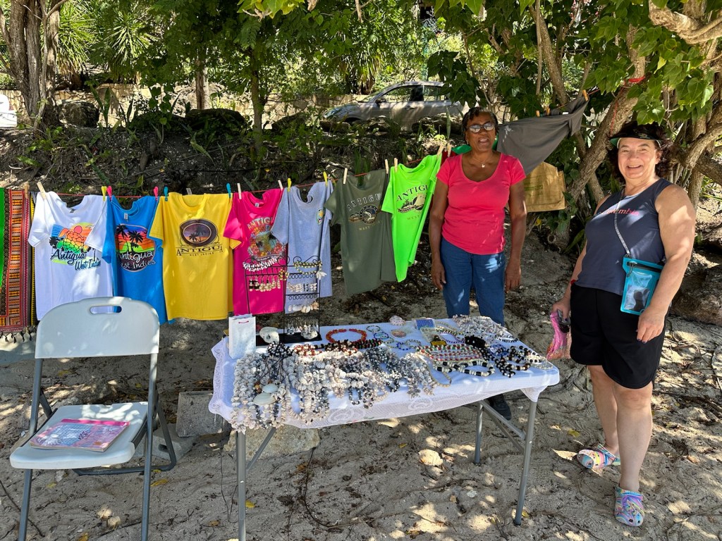
Before settling on the beach, we did a little beach shopping. A local entrepreneur offered an assortment of handmade necklaces and bracelets made from tamarind seeds and colorfully painted lavender pods in addition to t-shirts and scarves.
Beach shopping for unique necklaces and bracelets. Galleon is a peaceful and relaxing beach.
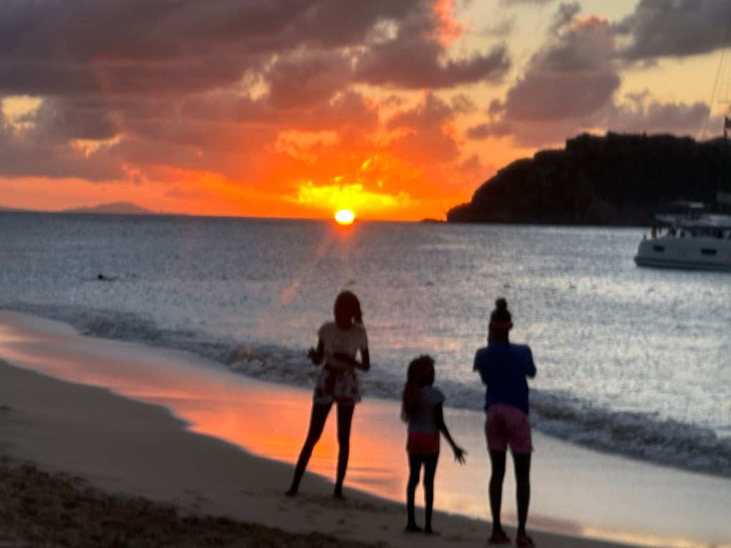
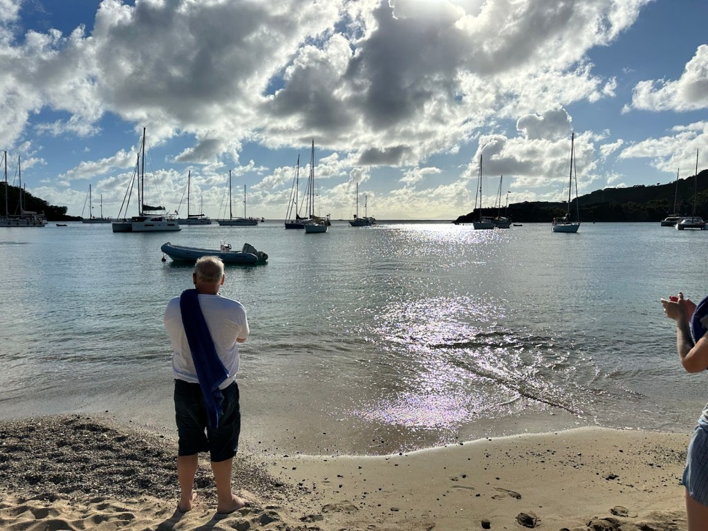
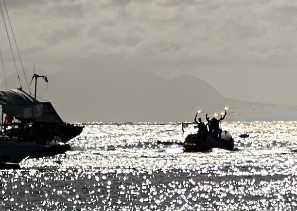
Late afternoon we heard what sounded like cannons. One of the rowboats from the Talisker Whisky Trans-Atlantic Rowboat Competition has finished and is heading for Nelson’s Dockyard. The yachts started blowing horns and everyone on the beach started hootin’ and hollering.
Watching the Trans-Atlantic rowboat enter English Harbor.The row team light flares and the cheering increases.
Participants in this competition, leave the Canary Islands (south of Spain, west of Africa) in early December. It takes between 30-95 days to reach Antigua which means they are spending their Christmas and New Years holidays at sea.
The row teams vary and have 1, 2, 3 or 4 participants. In their 3000 nautical mile trek across the Atlantic, they experience sleep deprivation, hallucinations and hunger. This test of body and mind is balanced by sighting incredible marine life, witnessing the breaking of a new day and sun sets that cannot be viewed from land.
This is what a 4-person team rowboat looks like.(Photo and Information taken from Atlantic endeavor.com and Talisker Whisky Atlantic Challenge.comApplause and cheers came from a line of people waiting for a water taxi and everyone else sitting on the beach.
We were motivated to move on to Nelson’s Dockyard which was on our list anyway but thought it might be fun to see the rowboat finishers.
Nelson’s Dockyard is just around the bend from Galleon Beach. (Photo from VisitAntiguaAndBarbuda.com)
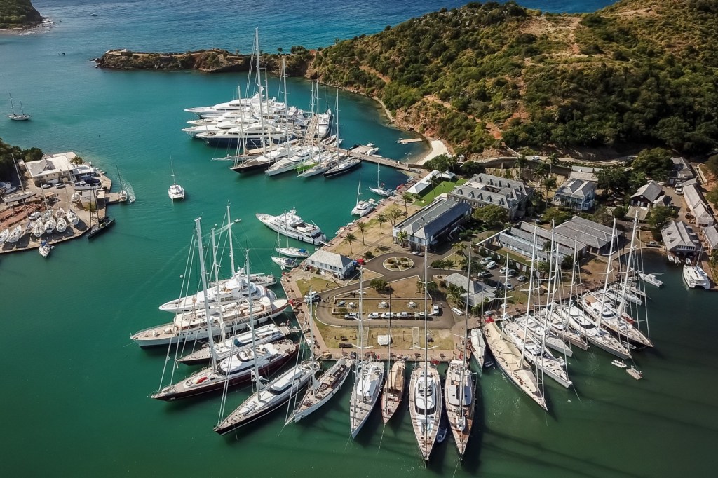
Nelson’s Dockyard is a cultural heritage site and marina which became a UNESCO World Heritage site in 2016. In the 1600’s it was established as a way to protect British ships from hurricanes and to monitor naval activity at the neighboring French island of Guadeloupe.
The Dockyard has been restored to its original state featuring 18th and 19th century buildings with modern amenities such as shops, hotels, and marina businesses. (Information from VisitAntiguaAndBarbuda.com)
It may have been faster for us to swim to Nelson’s Dockyard. By the time we got the car and drove there, all the Trans-Atlantic rowboat hoopla had moved on.
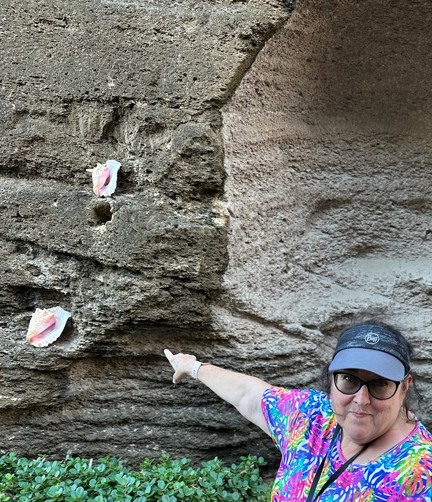
The walkway into Nelson’s Dockyard has a wall decorated with Conch shells — one of my favorites. Some of the historic buildings are now filled with souvenir shops.This old tree had a trunk that was about 6-7 ft in diameter.
After wandering around the dockyard, we returned to our apartment. The sunset is blocked by the hillside but still pretty to watch its hues color the clouds. We walked across the street to the Antigua Yacht Club’s restaurant for dinner and ended the evening there.
Pink clouds hovering over the hillside at Falmouth Harbor at sunset.
Crack of dawn and the roosters are crowing. We left our accommodations around 5:00 am and headed for Antigua’s main harbor in the town of Saint John. Our excursion to the island of Barbuda is going to fill the day.
Out the door at 5:00 am
We were nervous about finding a parking place on the streets in Saint John. A harbor security guard directed us to a very convenient parking space close to the dock.
We took a photo of the rental car and license plate just in case it was towed away. At least we’d know what we were looking for.
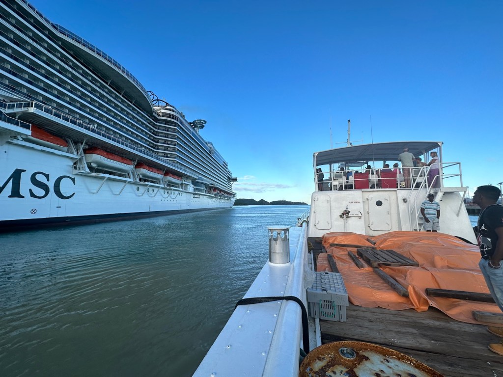
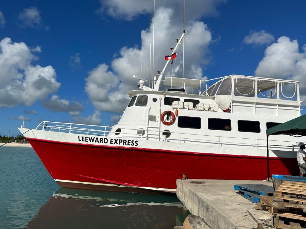
We were directed to be at the dock around 6:30 am. Our ferry departure was delayed by an hour because a cruise ship was docking.
Our little ferry boat was dwarfed by the cruise ship.Our ride to Barbuda … the Leeward Express.
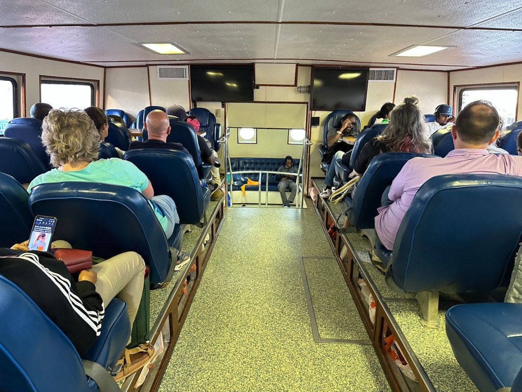
The air-conditioned inside cabin of the ferry boat had very comfortable seating.
A local man came through the main cabin selling fruit while we were waiting to depart. We opted to sit outside in the sun on the cargo deck.Sitting on the cargo deck felt a little like being a stow away.An orange tarp covered the suitcases and other cargo. This dude made himself comfy on a wooden pallet that was holding the tarp down.A touch of sea sickness? Nothing fancy at Barbuda’s small boat harbor.
Barbuda is flat! Unlike Antigua with its scenic mountains and rolling hills, this island is low-lying limestone. It’s easy to see how hurricane Irma ravaged the island in 2019. It was a category 5 storm that destroyed about 95% of the island’s structures. Most of the population was evacuated to Antigua.
The harbor had some industrial equipment and a few fishing boats.
There is a third island that belongs to Antigua & Barbuda called Redonda. It is uninhabited but home to a number of sea birds. The island became an important source of guano before artificial fertilizers were mass-produced.
Redonda is a third island that belongs to Antigua & Barbuda. (Photo from Birds Caribbean).
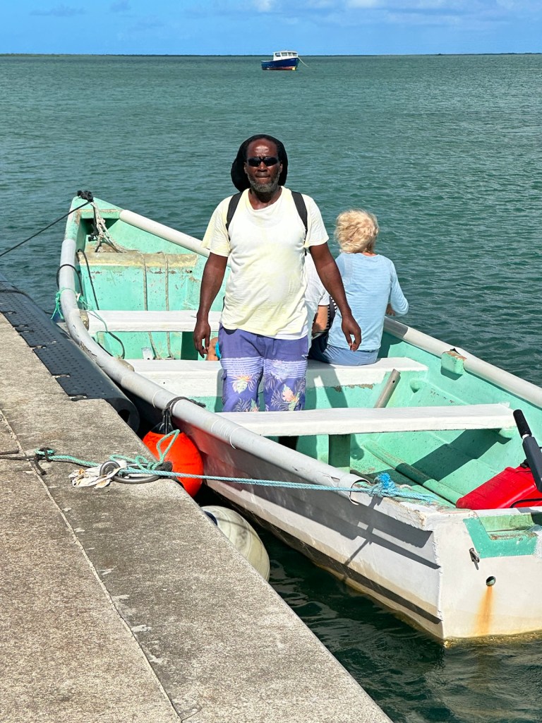
After the ferry docked, we connected with Henry our guide and our tour group was loaded into vans to start our excursion.
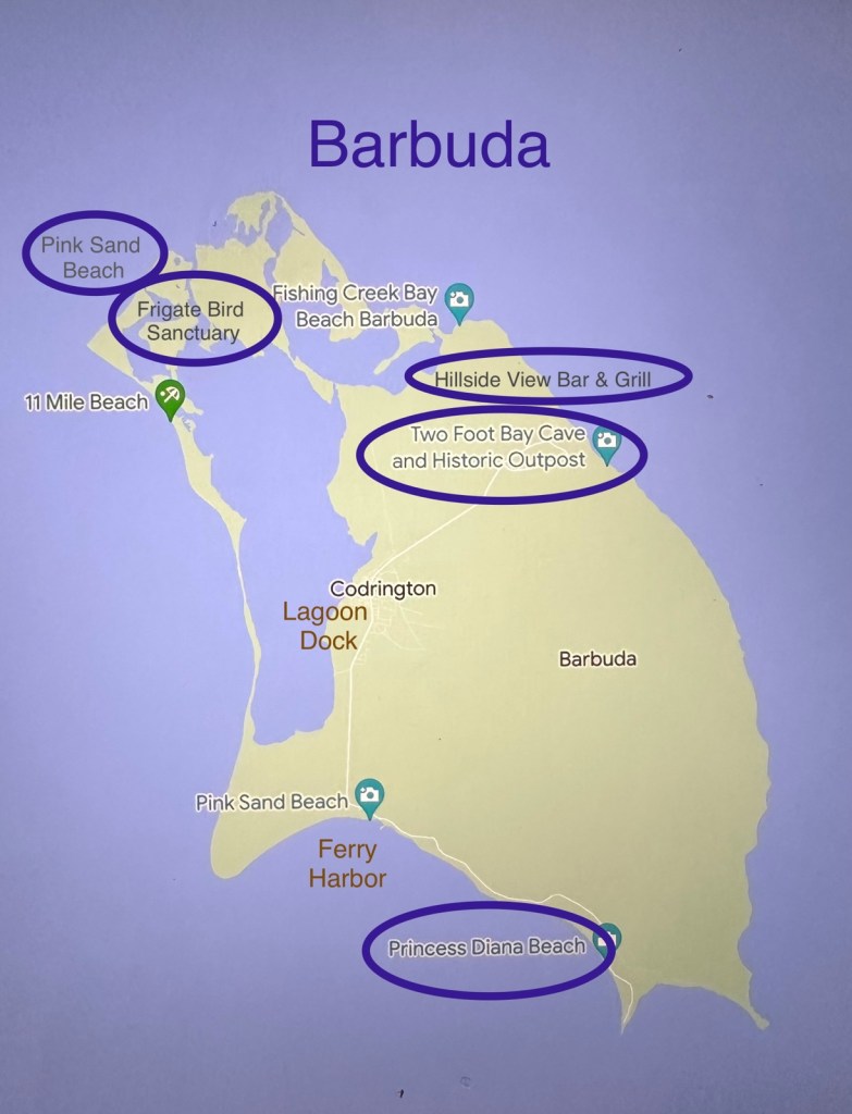
The bad girls hang out in the back of the bus.Barbuda Excursion Stops
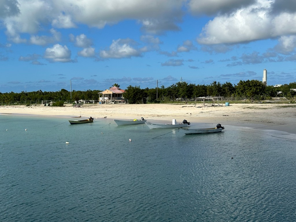
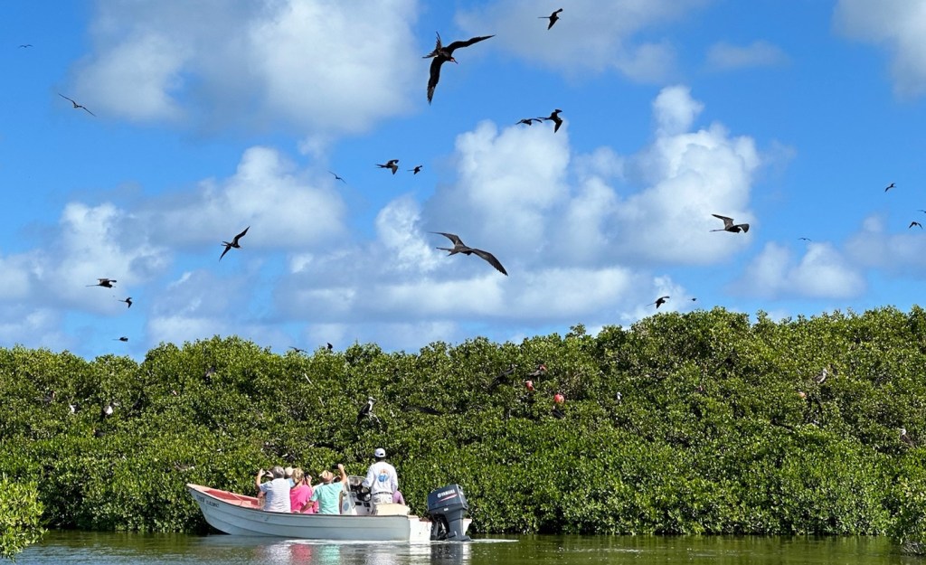
It was a short drive to a dock in Codrington lagoon, a tranquil 11 mile stretch of water where small boats were waiting to transport our group.
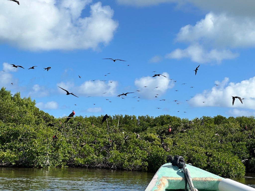
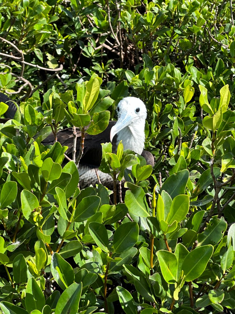
Boats took our group across the Codrington Lagoon to the bird sanctuary and pink sand beach.This National Park bird sanctuary is home to 30,000 Frigates.
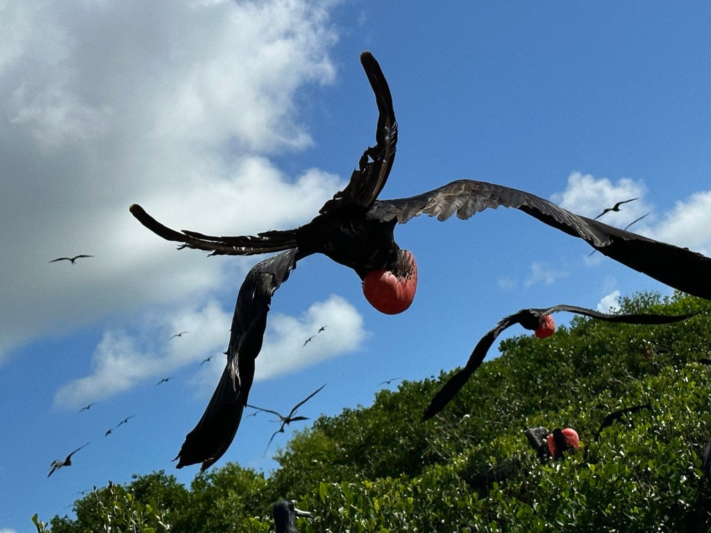
Frigates have a 7-ft wing span and have predominantly black plumage, long, forked tails and long hooked bills. They are seabirds but their feathers are not waterproof. They can stay aloft for up to two months without touching down on land or water. They can’t swim and if they do encounter water, they would become waterlogged and eventually drown.
The name Frigate comes from the French mariners’ name for a frigate or fast warship.
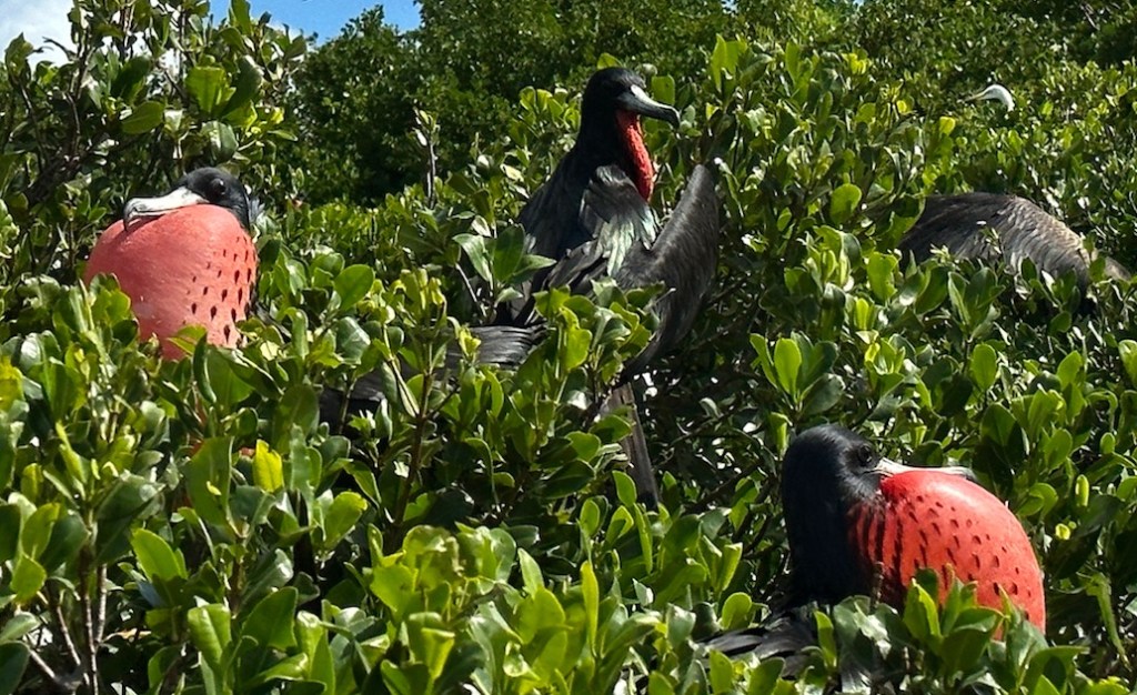
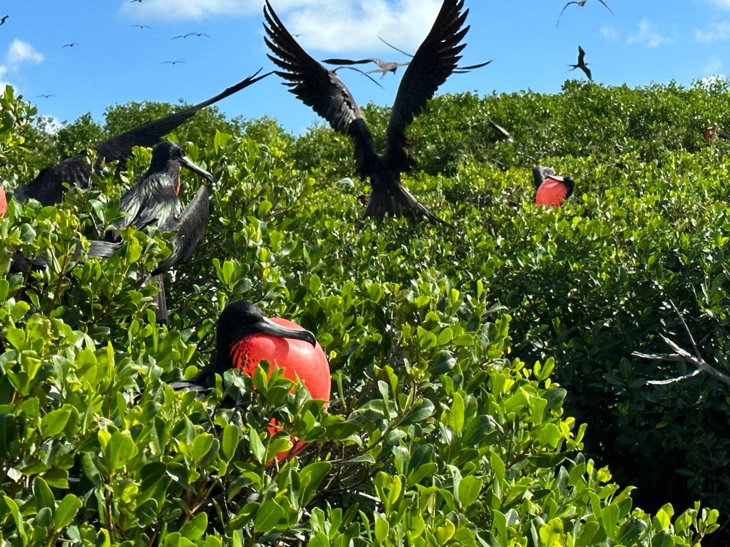
Scientists have evidence that Frigates sleep while flying in short 10-second bursts for about 45 minutes each day.The male frigates puff up their red chest in hopes of attracting a mate.
Only one chick per pair of frigate birds is hatched and stays in the nest for 8-10 months. Because of this they breed once every other year.
Mother and child frigates. The females have a white chest, a dark head and are larger than the males. Juveniles have a white head.Young birds have varying amounts of white on the head, chest, and belly and also have a pale tan streak on the upper wing.
The bird sanctuary is amazing. (Information about Frigates taken from Rough Guide to Antigua & Barbuda, National Geographic.org and Audubon.org).
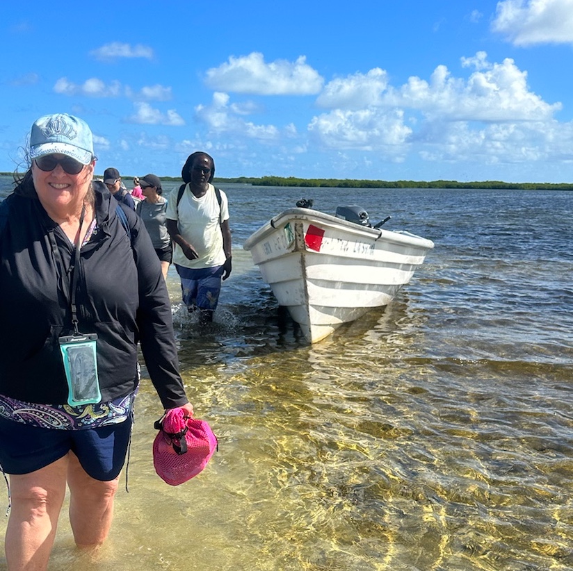
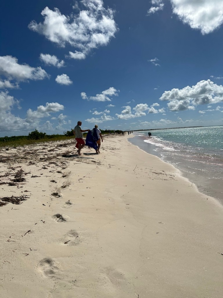
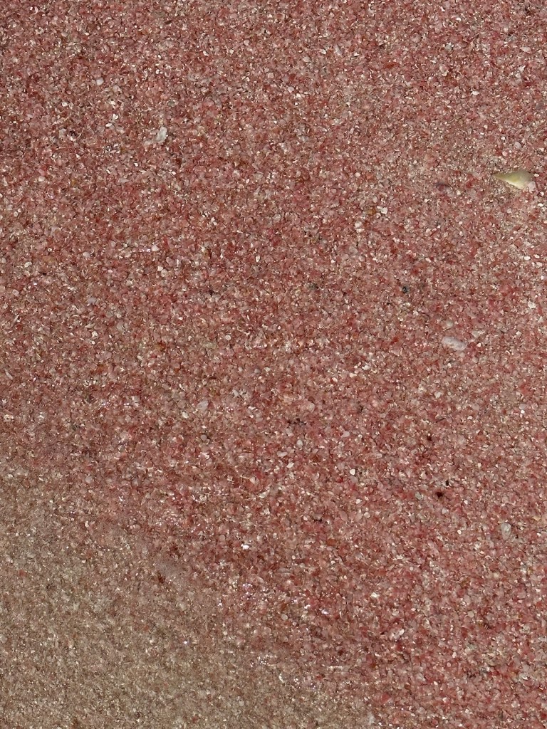
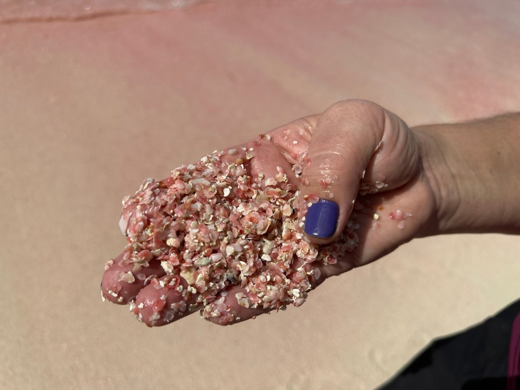
The boats took us a short distance across the lagoon to the pink sand beach. Our guide told us to go barefoot since we were going to jump out of the boat and walk through water.We walked over a small dune and down the shoreline.Barbuda’s pink sand beaches are known to be the pinkest of all the Caribbean beaches due to the high levels of coral reefs along the coast. The pink sand beach has a beautiful palatte of colors ranging from sand brown to sky blue. The beach stretches for eight miles but it is not always visible. The pink hue is visible when shells have been deposited by surging waves.A closer look reveals crushed shells.Back to the boats and on to the caves.
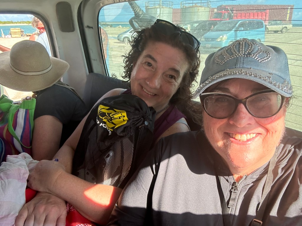
After docking, we boarded the vans again. It was a long ride across the island. Two women sitting next to me were talking in another language that I didn’t recognize. When I asked where they were from, one responded in English, ‘what do you mean where are we from’. Then I asked what language they were speaking. She went on to explain that they were originally from Poland but now live outside of Toronto, Canada.
Maggie and Dora, traveling with their husbands, were originally from Poland but now live near Toronto. They were a delightful addition to the tour.
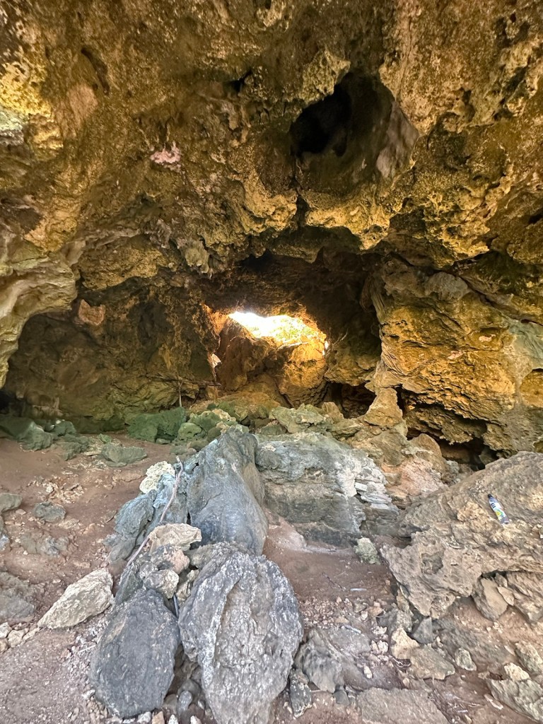
Barbuda has many caves and sink holes primarily because it is composed of limestone. The caves at Two Foot Bay run along the sea cliffs.
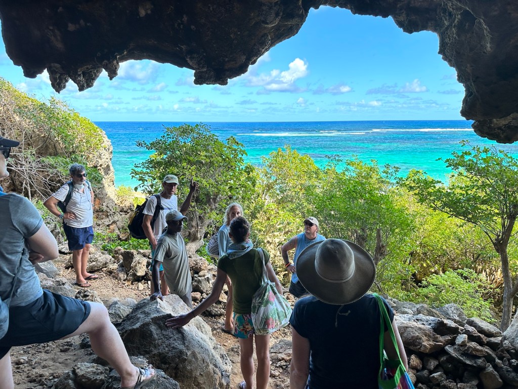
It was a about a half-mile hike to the caves at Two Foot Bay.The terrain is full of fossils.The farther we hiked, the more interesting the terrain became.The trail went uphill and became a bit rugged.This is the view from the entrance of the cave.A large hole at the top of the cave revealed daylight.
Our guide Kendrick was born in Barbuda and lived there most of his life. When Hurricane Irma came he didn’t evacuate, he stayed in the cave. I’m not exactly clear on the details of his story but the water level in the cave became a problem. Somehow he survived.
Tour guide Kendrick is a native of Barbuda.
Kendrick was a great guide pointing out some of the natural wonders on our route.
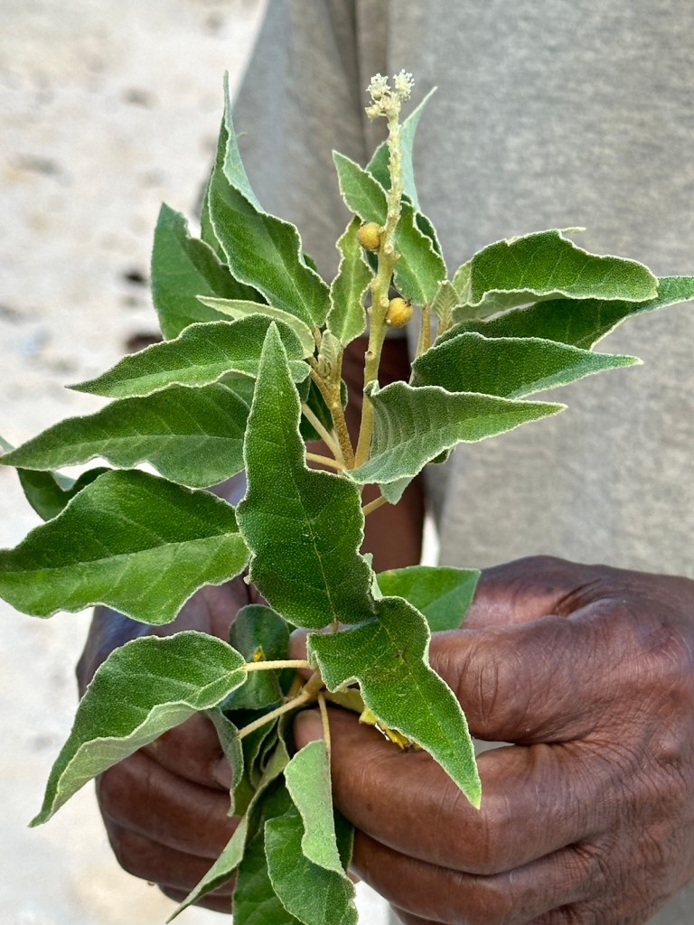
This is a medicinal plant that stops bleeding.This is a brain coral fossil.
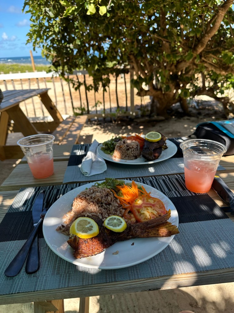
Lunch was served at the Hillside View Bar & Grill in the National Park near the caves.
The catch of the day was red snapper.This is the ‘kitchen’ where the grilling takes place and food is prepared and plated.
After lunch, we boarded the vans and it was a long ride to the “Princess Diana Beach” so named because Princess Diana often vacationed in Barbuda and enjoyed the seclusion of this beach. The beach was re-named after her in 2011 to coincide with what would have been her 50th birthday.
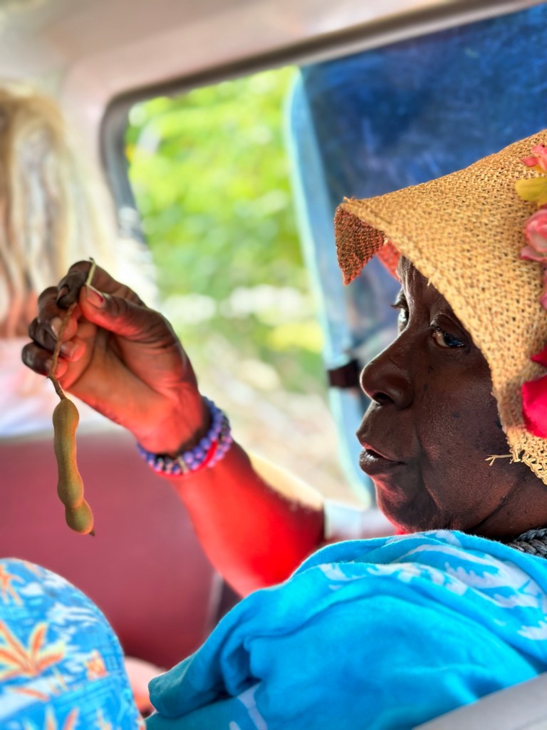
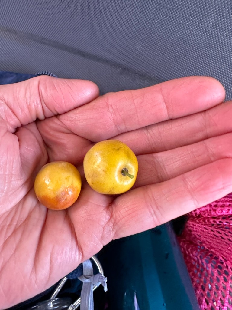
Gosha, a native of Antigua, holds a tamarind pod, plucked from a tree by our guide Henry. It’s a plump pod-like fruit with a sweet tangy flavor often used in Indian cuisine.Our guide Henry would stop the van and pick fruit for us to sample. They called this fruit “dums” but it has many other names and a variety of flavors and textures. These tasted similar to a crab apple.We passed goats on the way as well as a few wild donkeys.Princess Diana beach is a stretch of sugary white sand with clear blue water. Our time at the beach was shortened due to the morning’s departure delay.Ritu and Anil originally from Bombay, sat with us on the return ferry boat ride. They now live near Toronto and travel extensively. Peggy enjoyed chatting with them about her travels in India.The ferry boat returned to Saint John’s harbor around 5:00 pm.Driving Adventure of the Day — lost in the dark
Driving Adventure of the Day: Our drive from Saint Johns across the island to our apartment in Falmouth Harbor was in the dark … one more obstacle in addition to driving on the left, potholes, chickens, dogs, pedestrians and other hazards. We were using cell phone GPS to guide us and at some point it went out of range and we missed a turn. After we passed a man carrying a large pick-axe over his shoulder, the road got darker and narrower, more secluded and scarier. We had no choice but to turn around and retrace our route from memory which meant we had to pass by the pick-axe murderer again. Very carefully we made our way back to the Saint John’s area, found the correct route and started over.
We arrived back in Falmouth around 9:00 pm. Being famished we found a nice but busy outdoor restaurant and felt fortunate to get seats at the bar since we didn’t have a reservation. We placed our order and shortly after our drinks arrived, the power went out. Everyone got out cell phones lights and continued eating and drinking. The cooks continued grilling using their cell phones for light.
About ten minutes later, they had to shut the grill down because without power, the exhaust fan wasn’t working. They assured us the power would be on shortly. We had another drink. No power. They offered us a plate of French fries. No power. Finally we gave up and went back to our apartment. It was time to end this day.
Flatties Flame Grill (before the power outage) home of spicy Peri Peri Chicken and other South African and Portuguese dishes.
I’m traveling with my long-time friend Peggy. My husband David is not so much a beach person and our destination has 365 beaches.
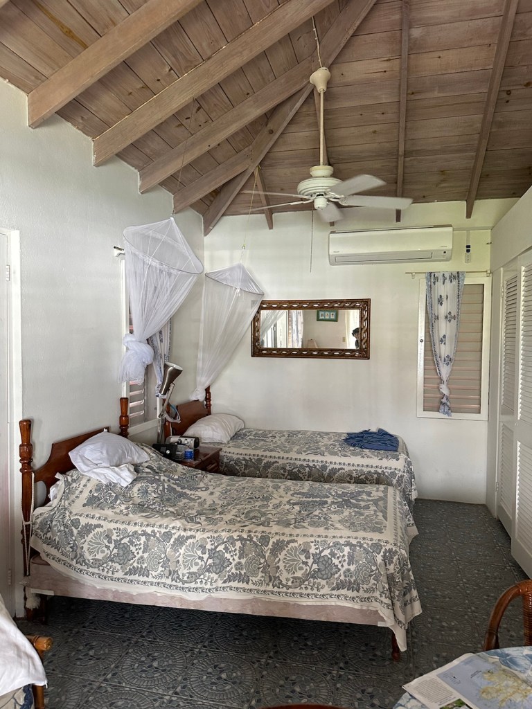
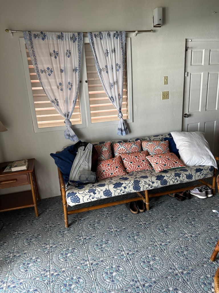
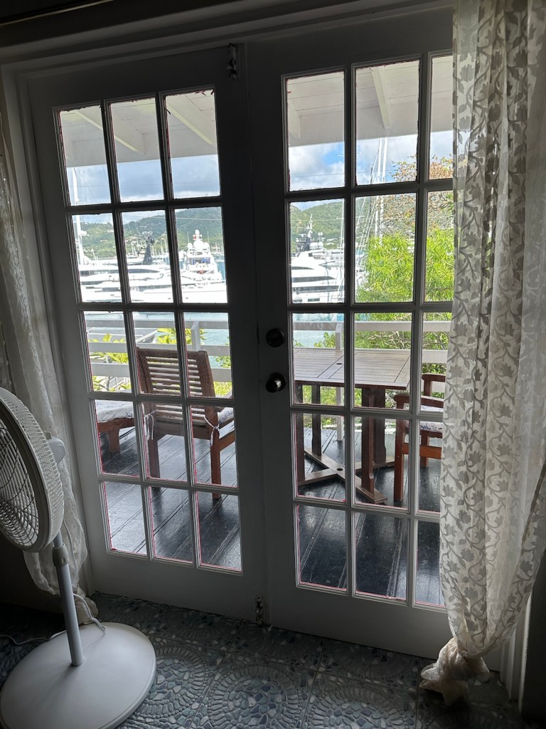
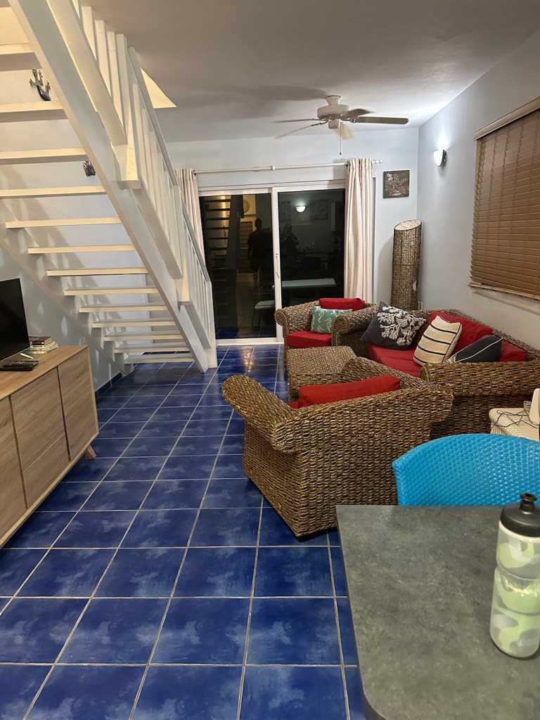
Our studio accommodations are on the 2nd floor which provides a great view of Falmouth harbor.The balcony is the perfect place for waking up with a nice cup of coffee.Fully equipped kitchen for lite meals.Ceiling fan and air-conditionerSofa with an abundance of pillows.French doors leading to the balcony.
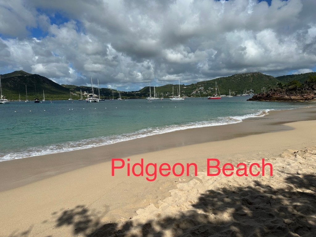
After yesterdays long travel day, we opted for a relaxing beach day. Pigeon beach is a short walk from where we are staying.
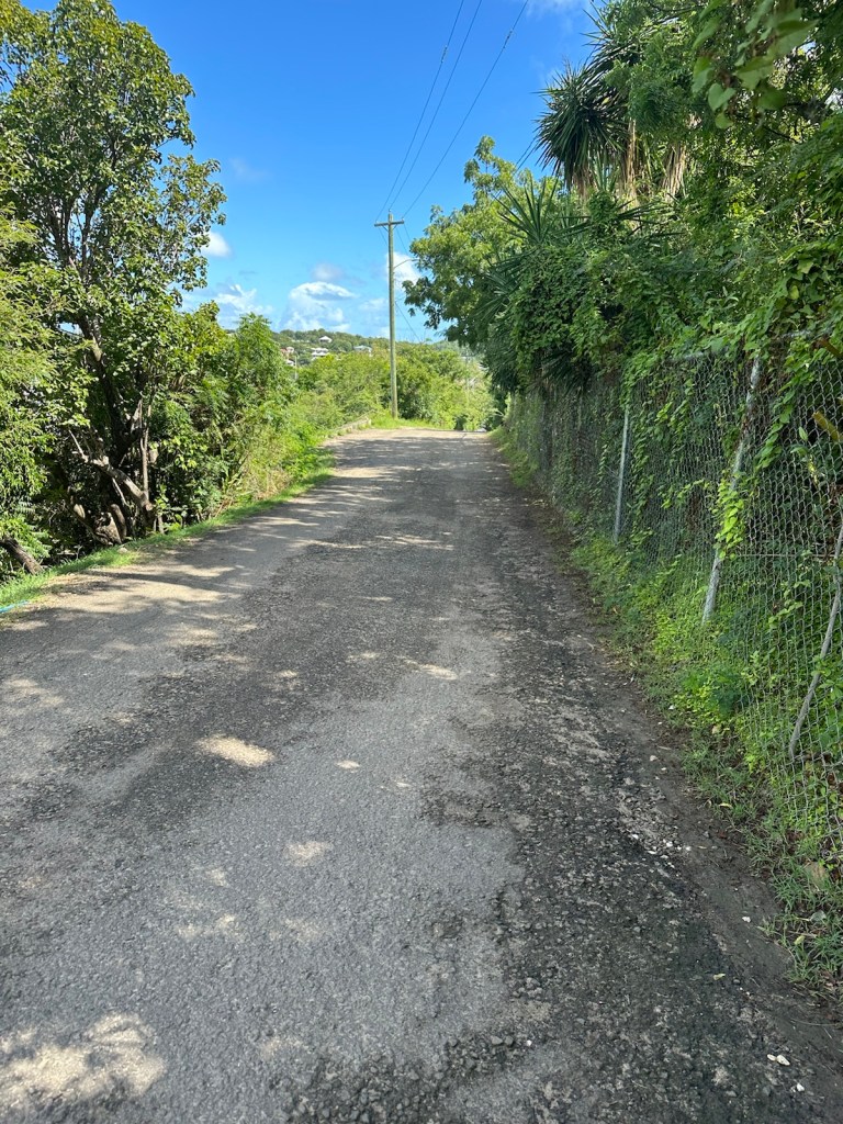
The road to Pidgeon Point Beach is bordered by an assortment of greenery.This beach offers a nice calm vibe. Warm sun and tranquil waters are exactly what we needed today.Calm waters are the perfect place to test snorkeling equipment.
After a nice long rest at Pidgeon Beach we jumped in the car and headed to St. John’s, the capital city and key port.
Steering wheel on the right … it takes two to drive. The navigator and driver each have a big challenge. Both must stay focused and on the watch for potholes, gutters, pedestrians, chickens, dogs and other obstacles.
Still getting used to the reversed British driving but we’re doing great. The turn signal and the windshield wiper stem are reversed so we’re wiping the windshield often. That always brings a laugh.
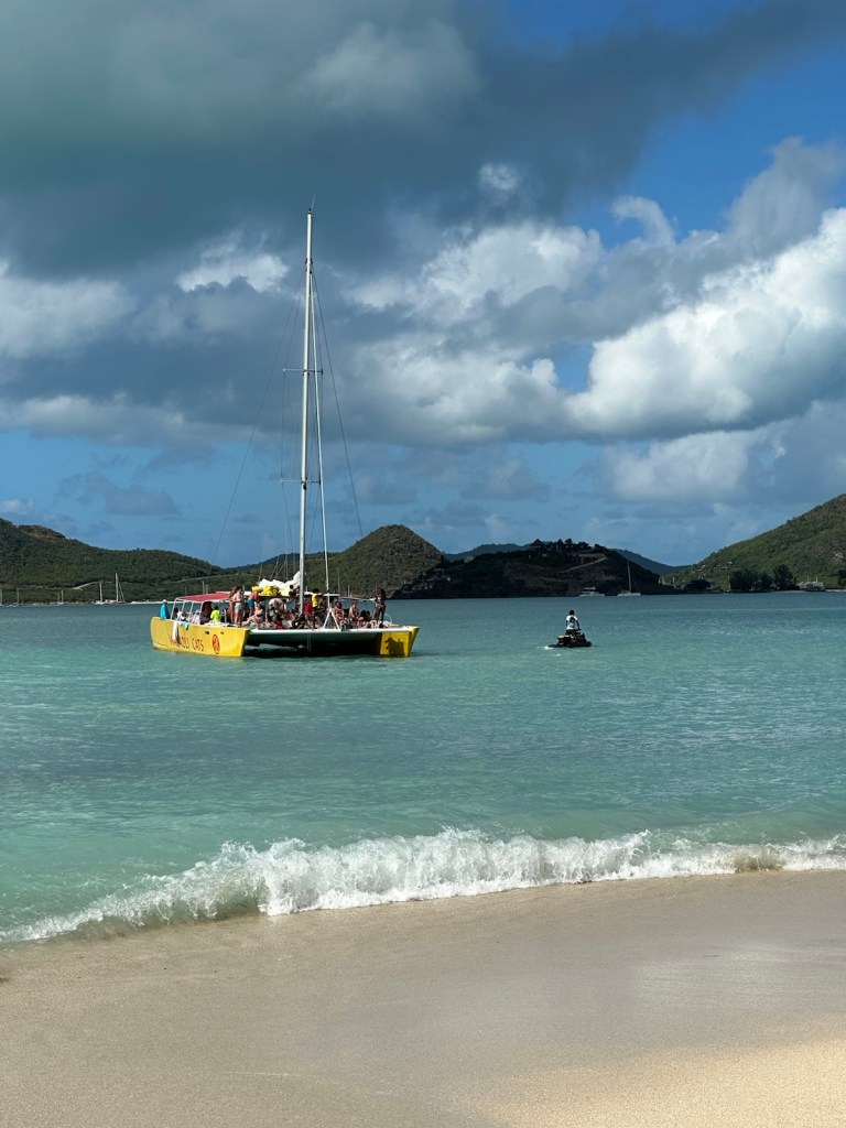
Little Ffryes Beach is on the west coast and a beautiful stop for a swim. Only a few people here today.A catamaran full of tourists drops off passengers at a beach restaurant.
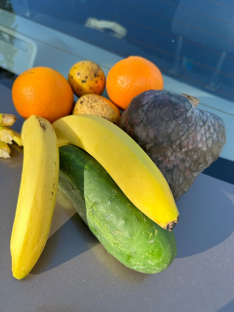
Quick stop to buy fresh fruits and vegetables to nibble on. We trusted the opinion of the vendor to try a few exotic things. We were hoping to find some of Antigua’s black pineapple but it doesn’t come in until Friday.
Here’s my pick of the day.
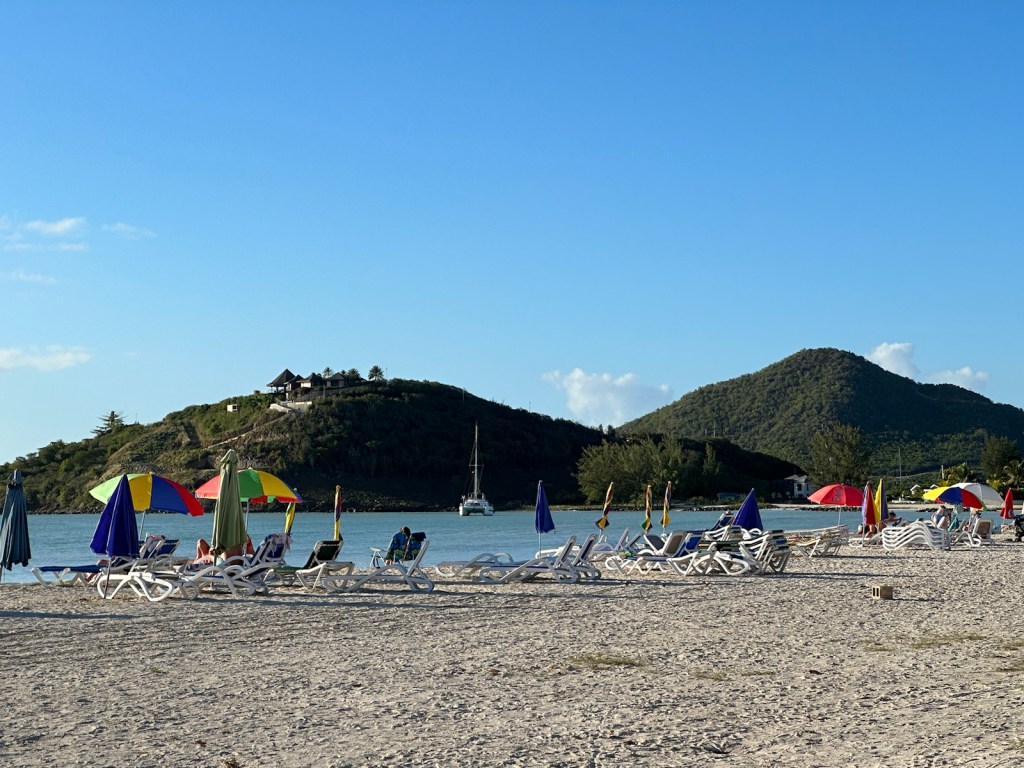
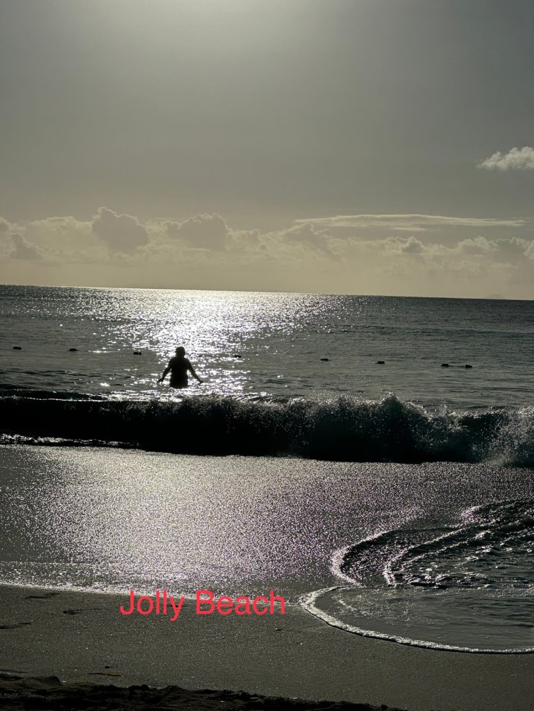
Next stop is Jolly Beach on the southwest coast. They wanted $25 (US) to sit on two beach chairs. We only had two $20 bills which no one will take because they were slightly torn. We told the woman we’d just sit on the sand. She then told us to go ahead and sit in the chairs (free). Maybe we should carry the torn bills with us to all the beaches.
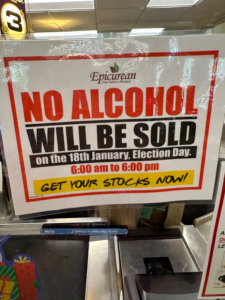
Jolly Beach is a delightful place to end the afternoon.Peggy in the waves.It’s Election Day today! The grocery stores had signs posted and shelves with beer and alcohol were roped off.
We had a hard time finding an early afternoon lunch stop because employees were given four hours off work so they could vote.
The polls closed at 6:00 pm and local stations followed the counting of ballots.
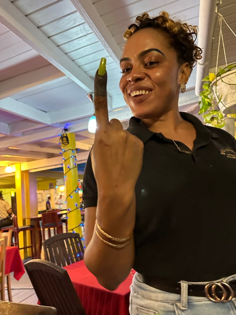
Our waitress Shyrainne very proudly showed us her finger dipped in ink to show that she had voted today. Her hope is that they make the retirement age 60 so it will open up jobs for the youth.
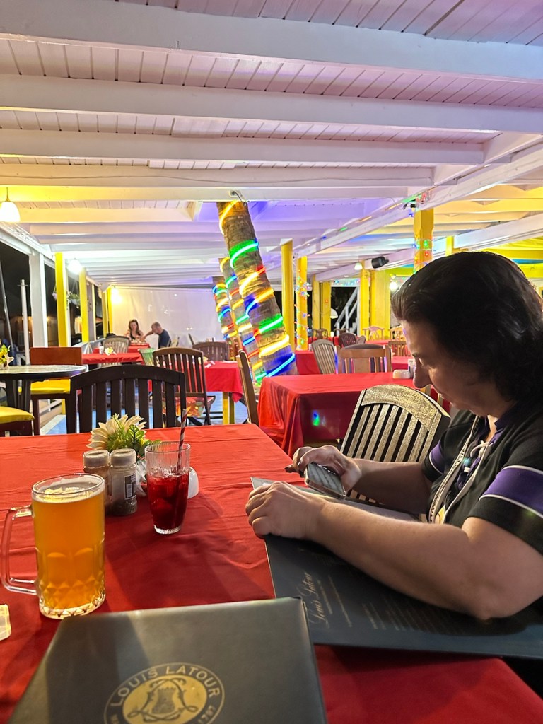
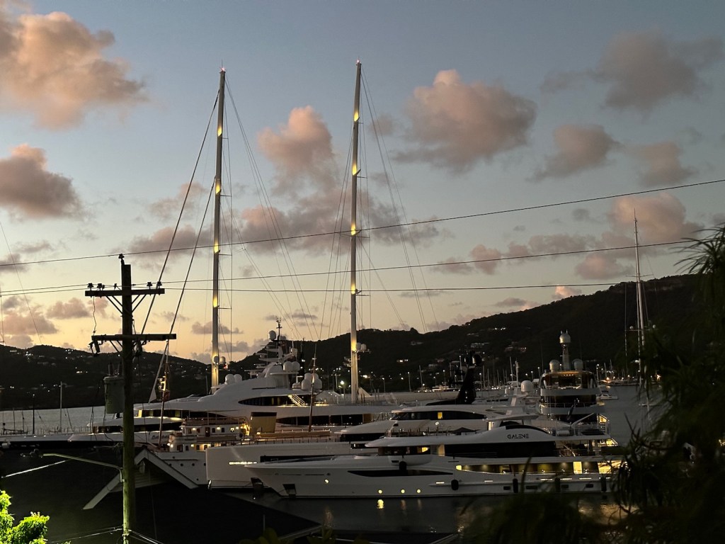
An inked finger means you voted today.Late dinner today … Conch stew on the menu tonight.End of the evening and the super yachts start to light up.
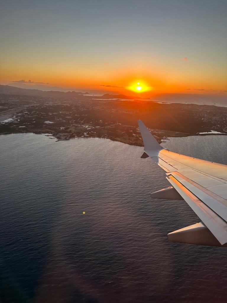
It’s the end of January and we still have about 20” of snow on the ground. And today, when I’m leaving for Antigua-Barbuda, it’s raining on top of the 20” of snow. Not a good combination. The temperature is above freezing so the 3:00 am drive to the airport shouldn’t be too treacherous.
Snow followed by rain = slush.In Miami, the sun was shining and it was warm enough for a Minnesotan to complain about being too hot.
After taking off from Miami it’s about 1,300 miles to Antigua.
Leaving Miami … the dark path is the channel the cruise ships and big boats take out of Miami.Sky was clear so we were able to view several islands just outside of Florida.
We flew over some inhabited islands and some that were not. Beautiful to look at with swirling shades of turquoise blue and soft sand colors.
We circled a couple times before landing at V. C. Bird International airport and the view was spectacular. Pastel colored houses, the craggy shoreline, mountains, islands, beaches.
A view of the St. John’s harbor.
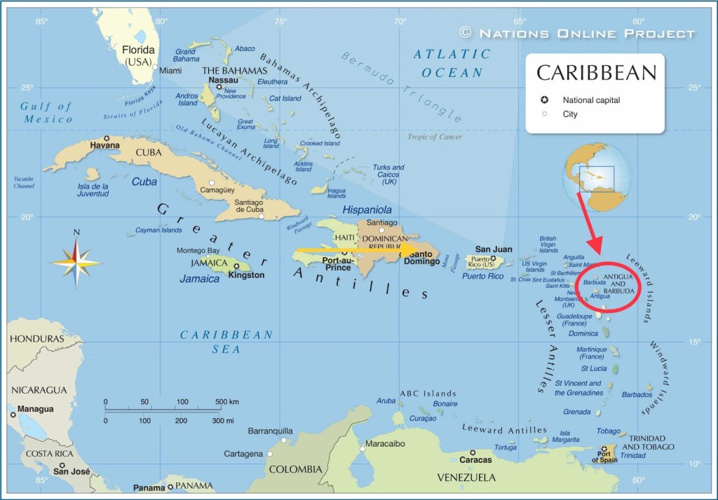
We have arrived! Arrived where? The official name of this country is “Antigua & Barbuda” a pair of islands described in many ways. They are the Leeward islands (a group of islands situated where the Caribbean Sea meets the Atlantic ocean), the Lesser Antilles (a group of Caribbean islands that are part of a long, partially volcanic island arc between Greater Antilles to the north-west and the continent of South America.) Also, you may hear it referred to as the “West Indies” (a combination of the Greater Antilles, the Lesser Antilles, the Bahamas and Turks and Caicos.) Some of these West Indies islands are not physiographically connected but have a common history and cultural ties.
The official name of this country is “Antigua & Barbuda”. Antigua is pronounced, “an·tee·ga”
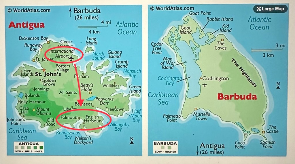
It gets dark around 6:00 pm and we drove across the island to our accommodations near Falmouth Harbor and the English Harbor.
After arriving at the airport we drove to the opposite end of the island.
The island is only 12 miles long x 9 miles yet it took us forever (an hour) to reach our destination. Adding to the fun … we’re in a former British colony which means the car’s steering wheel is on the passenger side and we’re driving on the wrong side of the road. Lots of potholes, pedestrians, dogs, cats, cows and other distractions. It was a very long day.
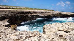
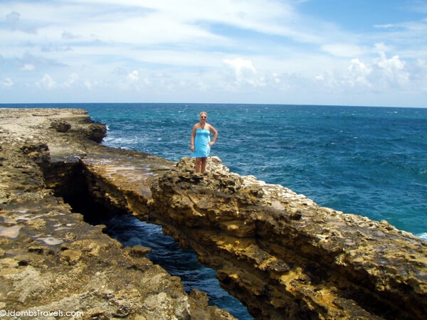
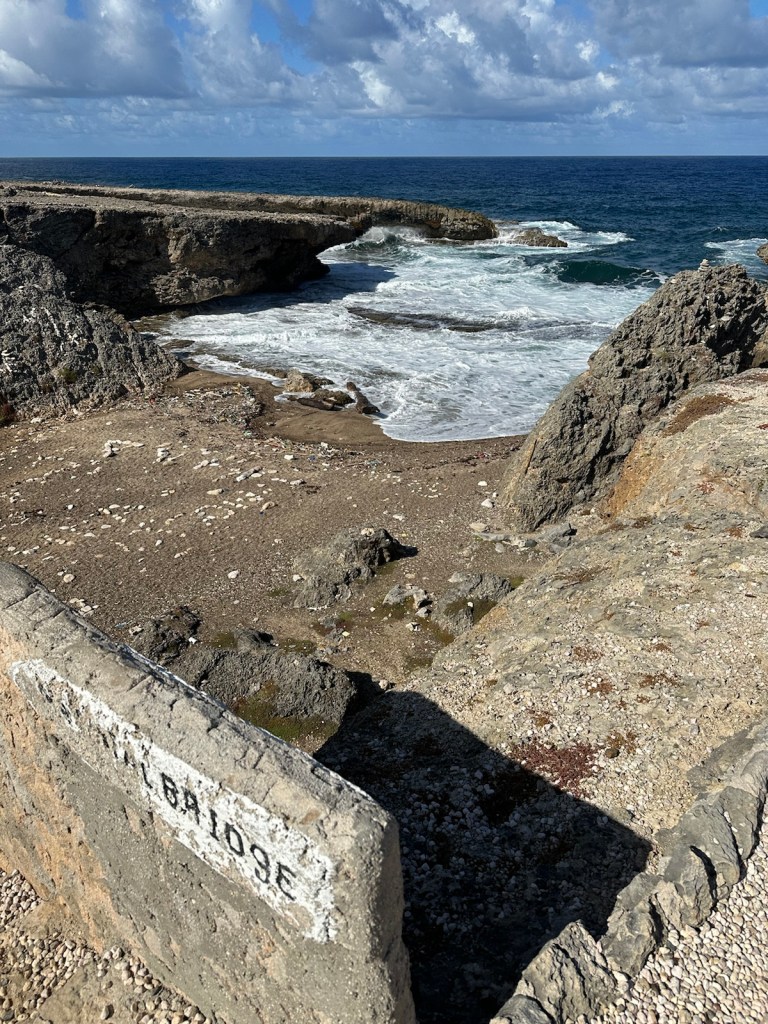
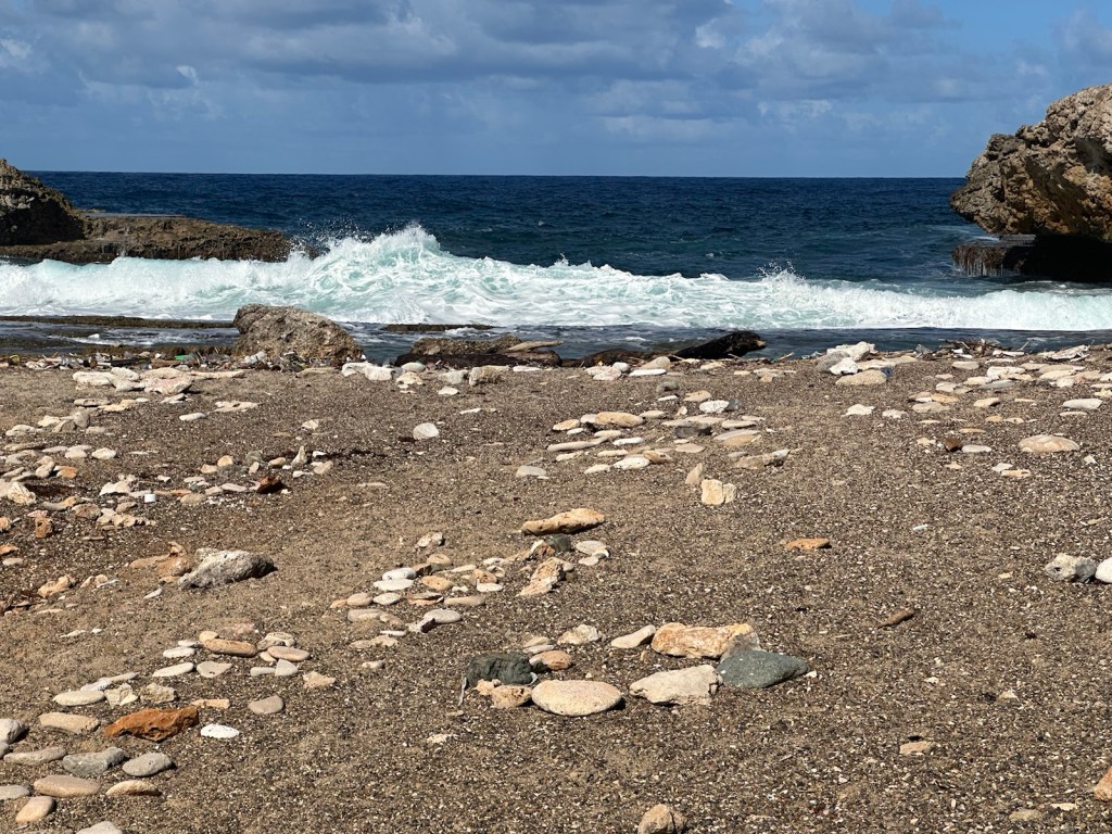
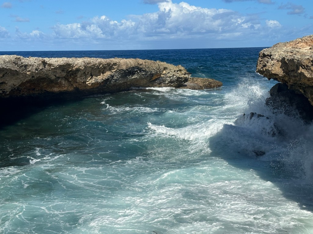
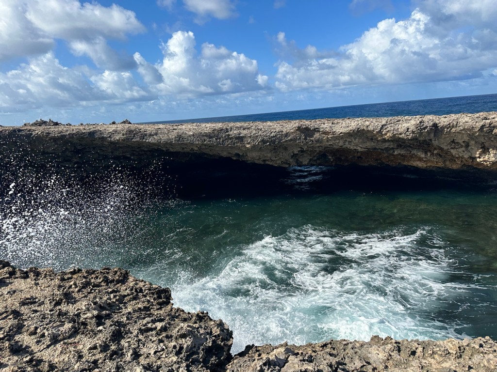
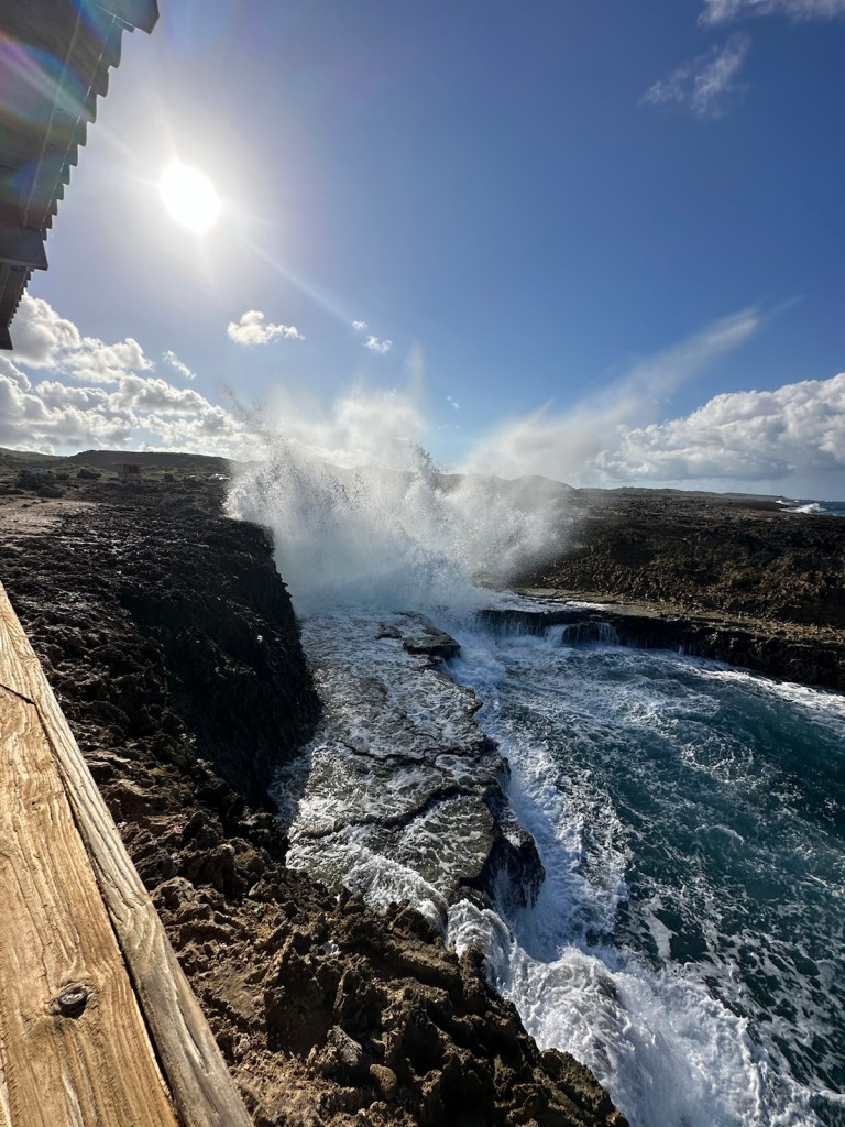
Today’s destination is Shete Boka which means ‘Seven Inlets”. The area actually has more than 10 Boka’s (inlets) where three species of turtles nest. Years ago, an environmental group arranged excursions in this area along seven bays. This is where the name came from, however, there are more than seven coves in this national park.
When we arrived at the entrance, the attendants were very discouraging. They said the road was full of potholes from the rain and dangerous to drive. So we said we would walk not realizing how far apart everything was.
After seeing a couple cars off in the distance, we ended up driving. The attendants were right; deep potholes, puddles and mud slicks made maneuvering the “road” a challenge. But it was worth it.
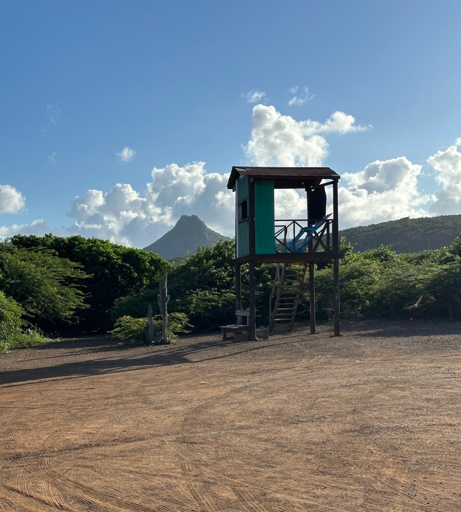
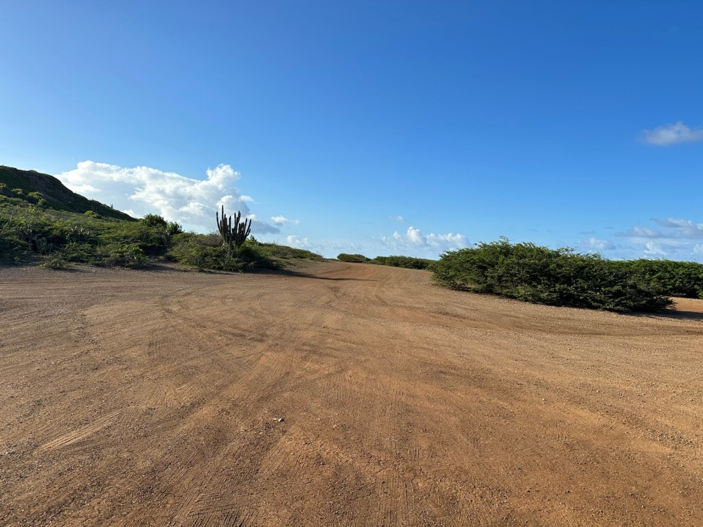
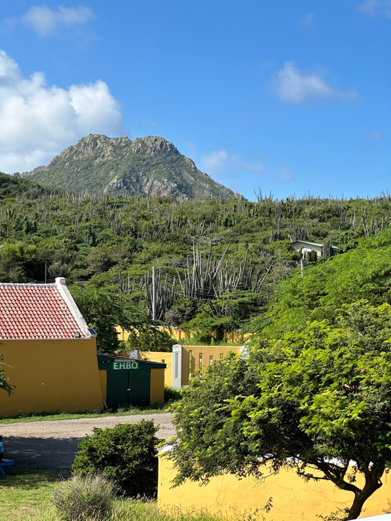
It’s about a mile drive to reach the Wandomi parking lot. Mount Christoffel can be seen in the background.
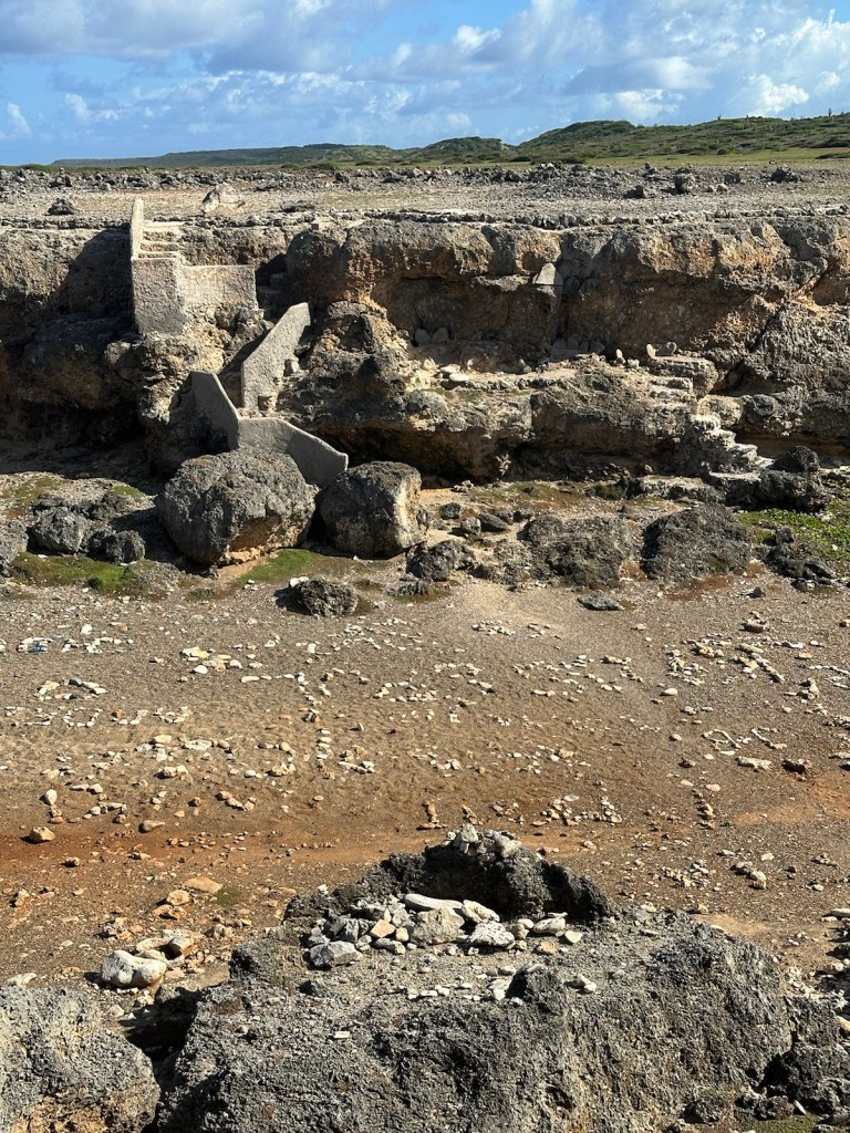
We began our hike to Boka Wandomi. The small dirt parking lot is monitored by a caretaker in a wooden tower-like structure. The final destination features a large natural bridge with lots of wave action.
No shade here and lots of cacti. It’s a dusty walk to the edge of the coast.
To reach the final destination, you need to hike down into a ravine and then hike back up the other side. The ravine has rocks that form letters, words, hearts, etc. Someone with a lot of energy and tolerance for heat created this open-air work of art.
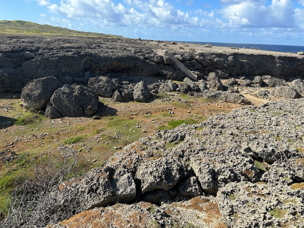
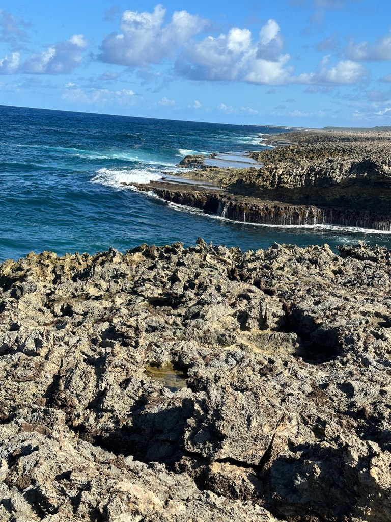
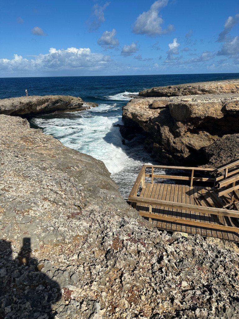
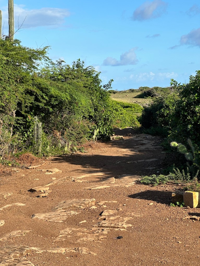
The trail leads down a limestone bluff, through a ravine and up the other side.A pathway with steps leads down into the ravine.Slapping waves lick the shoreline.Intentional arrangement of stone … can’t quite make out what it’s spelling.The trail goes back up the bluff on the other side of the ravine. Rough terrain leads to an observation platform.It’s mesmerizing to watch the waves.The observation platform provides a lower look at the natural bridge.David walking over the natural bridge, Boka Wandomi.Lots of splashing wave action at the foot of the natural bridge.Amazing to watch the colors of the sea.
We hiked back to the car. The air-conditioning revived us. It was a very slow 2-3 mile drive to Boka Pistol parking lot at the other end. The heat along with the bad roads and time limitations forced us to be selective about which boka’s we hiked. The park closes at 4:00 pm.
We didn’t see any cruise ship excursion buses here and not many other tourists. The combination of heat, full sun and long hiking distances made it challenging.
This was the good road … … followed by the bad road. Didn’t see many other tourists but we did cross paths with a herd of goats on our way to the next Boka.
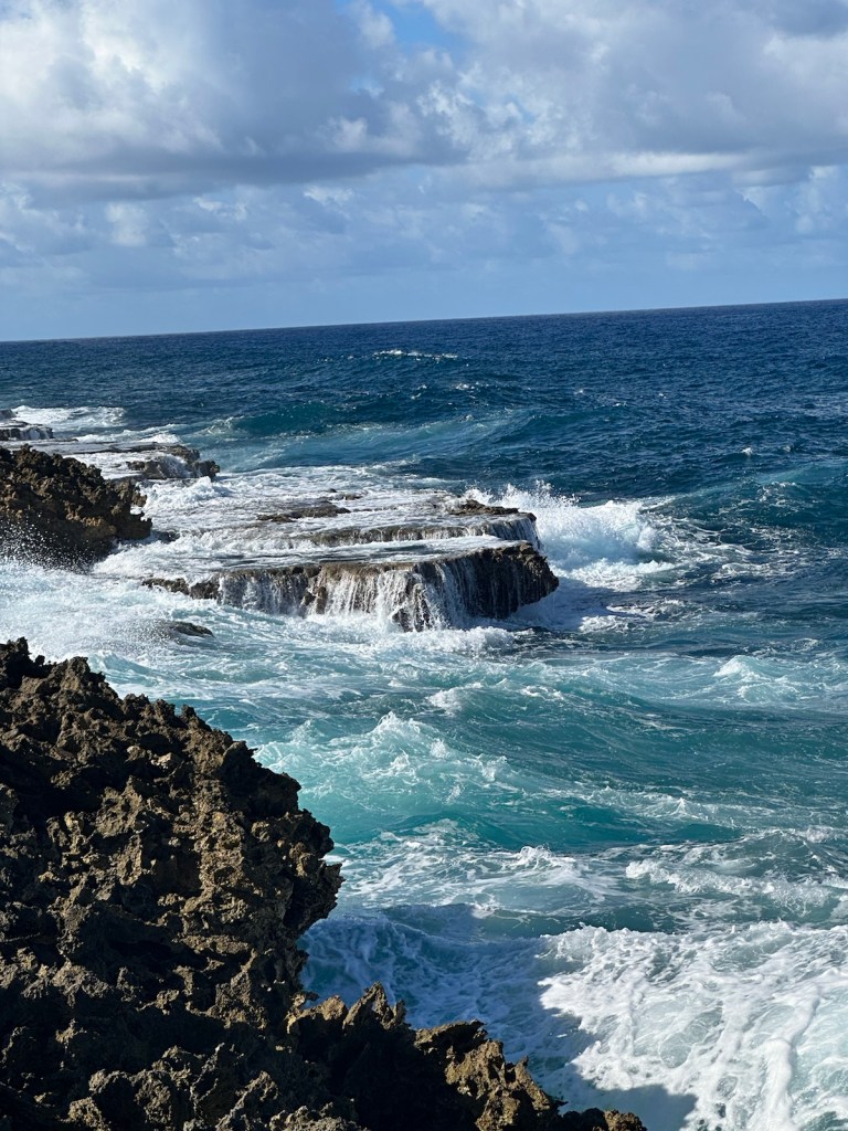
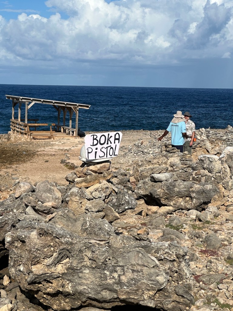
Next stop is Boka Pistol, so named because the waves crash into the cliffs so hard that they reverberate with a sound similar to the sound of a shotgun.
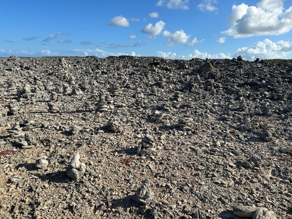
We have reached our destination. Security guard made sure we knew the park was closing in a half hour. Next to the Boka Pistol parking lot, there is a rock field camouflaged with hundreds of cairns.Boka Pistol without waves …Boka Pistol with waves … and the thundering shotgun sound.
Feeling dusty and hot, we changed into our swim wear in the isolated parking lot and headed to the beach. Tomorrow is our last full day in Curacao.
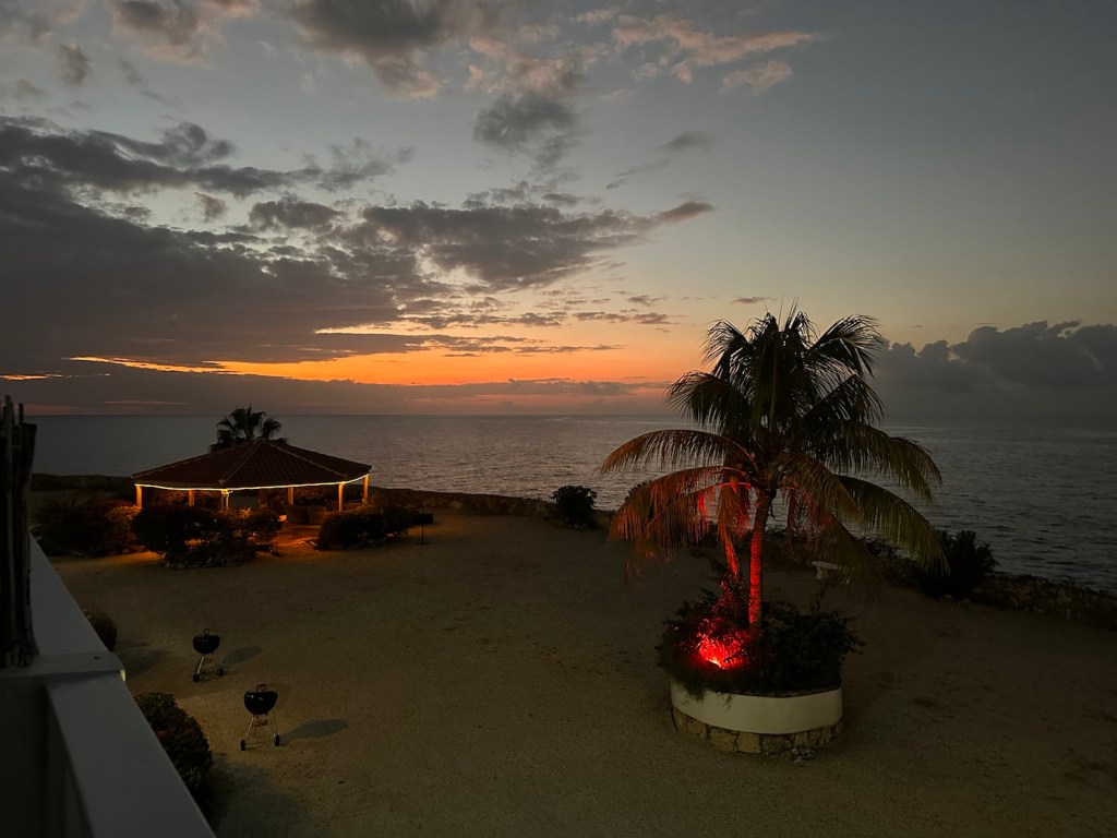
Our new accommodations were at a Scuba Diving resort in Westpunt. We came in late last night when it was dark, so it was exciting to see the natural beauty of this part of the island in full daylight.
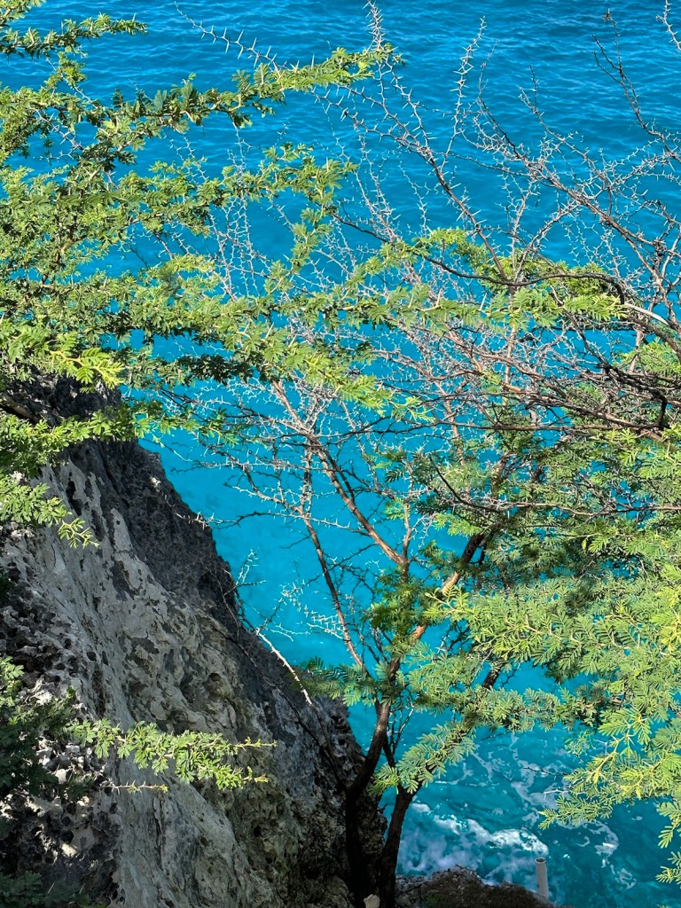
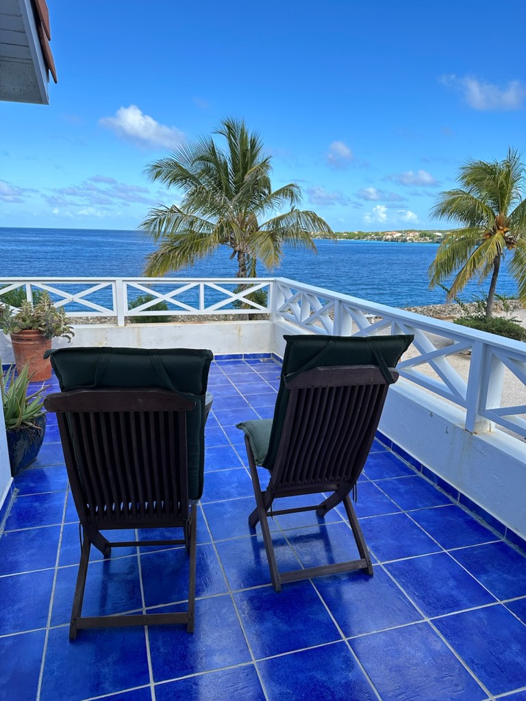
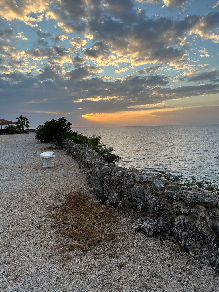
This resort is located on a cliff overlooking the amazing turquoise water.
Looking over the cliff wall down on the beautiful turquoise water. Our accommodations are the left side of this building.The kitchenette was handy for morning coffee. By the time we were were done snorkeling, swimming and watching the sunset, the restaurants were closing.
It was about 7:00-ish by the time we got cleaned-up from the beach. Most of the restaurants close by 8:00 pm. We had cocktails on the patio until the mosquitos arrived followed by light suppers made in the kitchenette. I think the locals tend to watch the sunsets from the restaurants.
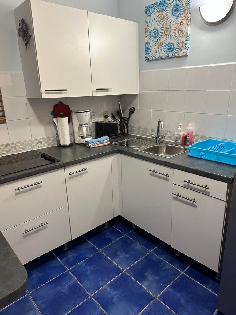
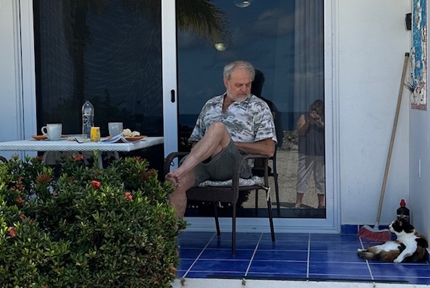
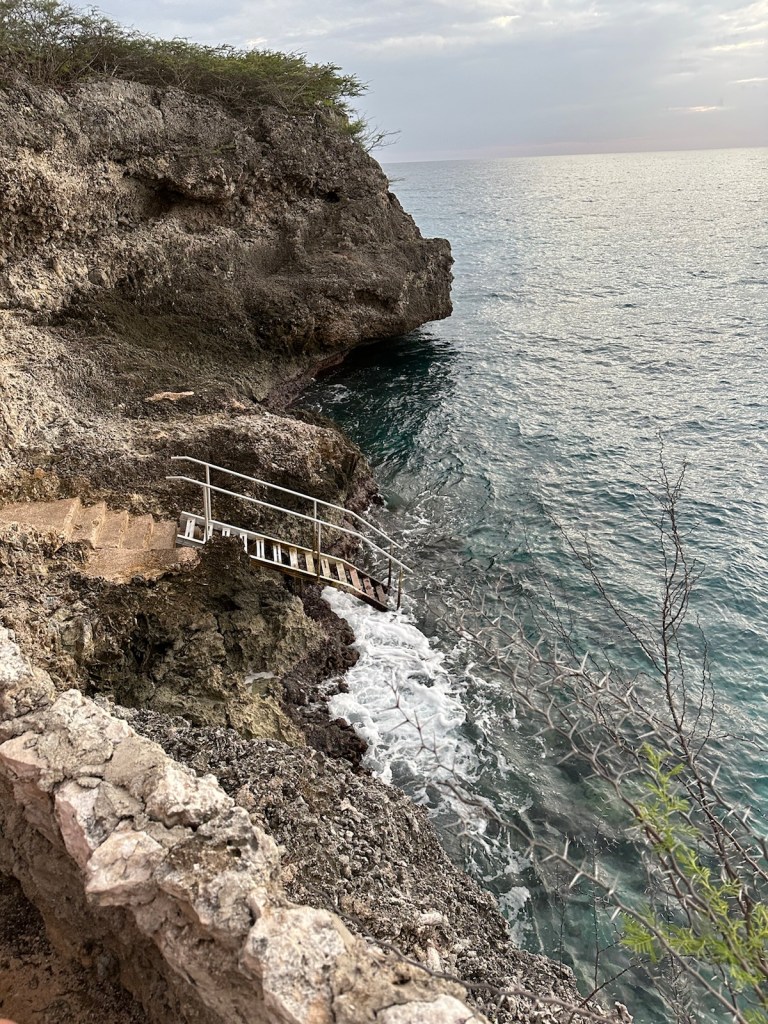
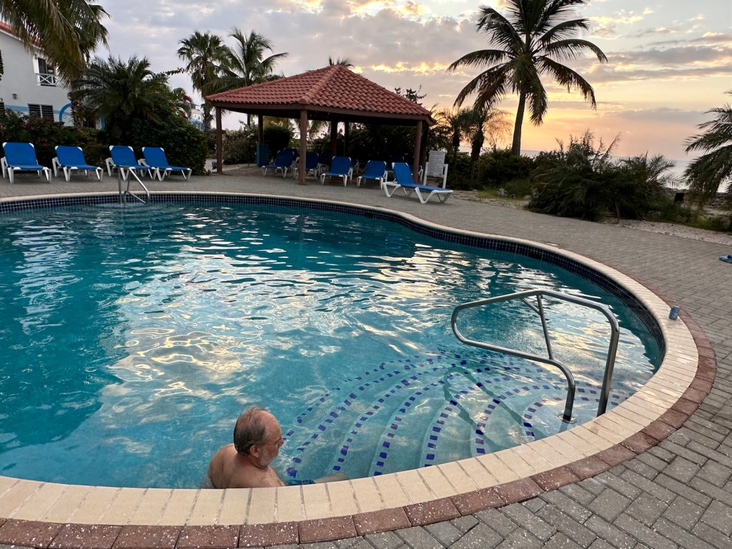
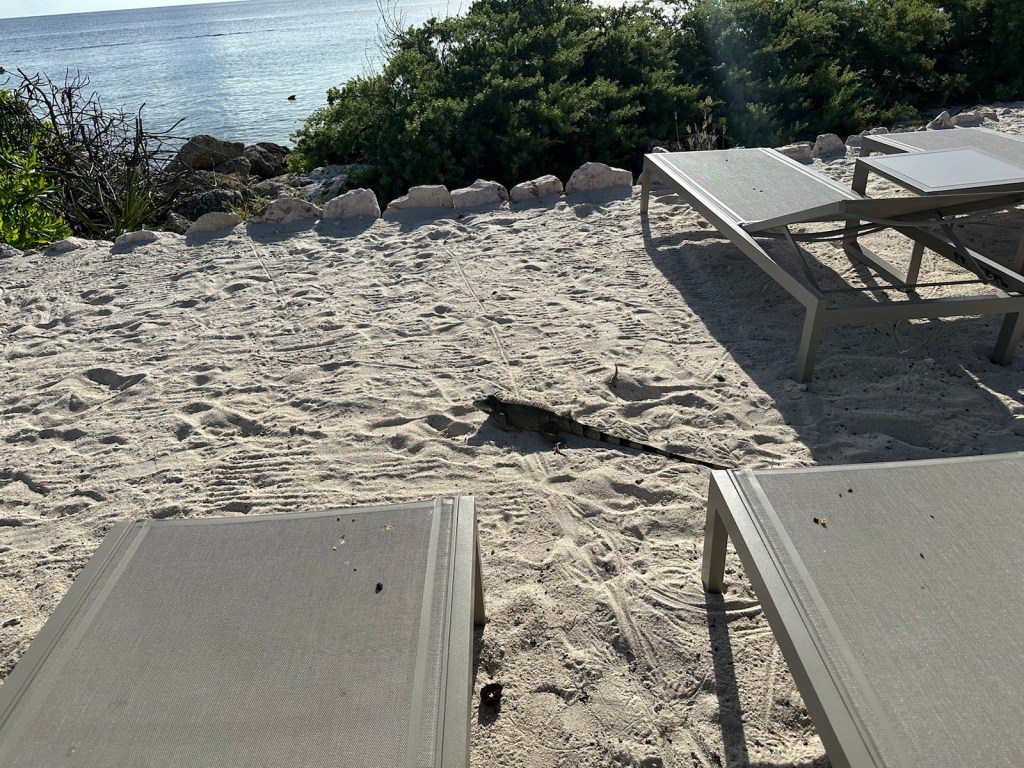
In the evening, the chameleons would cling to the ceiling above our patio table.We were really happy to have a comforter — ceiling air conditioner kept the room cool. It was also nice to have a second bath upstairs. Second floor terrace overlooking the sea.Main floor patio comes with a cat.Beautiful landscaping on the cliff The Iguanas like the view too. Look at the tail on this guy!From the resort, you could climb down the cliff to Scuba or snorkel.We did use the pool. After all the salt water it was nice to relax in fresh water.
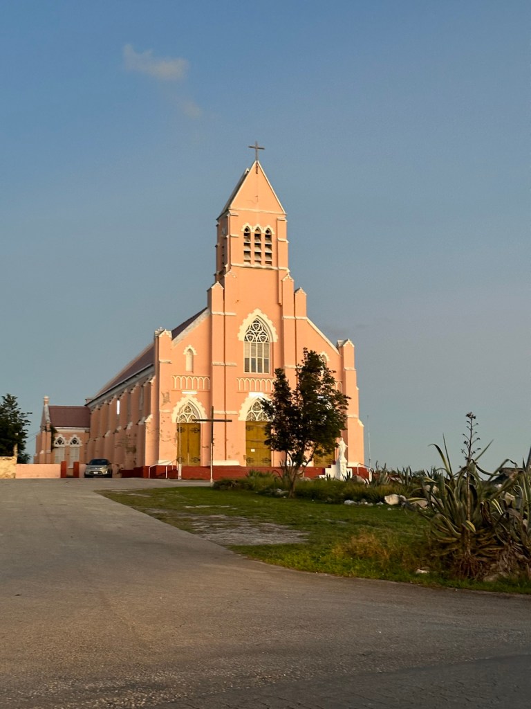
Westpunt first appeared on maps of the Dutch West Indies Company around 1700. In 1849, land was donated to the Catholic Church by plantation Savonet to build a church and school.
A village appeared around the church in the 1860s inhabited by newly freed slaves following the abolition of slavery in the Kingdom of the Netherlands.
Westpunt remained isolated for most of its history due to the 22 miles to Willemstad. There is public bus service around the island. The bus stops are plentiful and most are decorated for the holidays.
The population density is low, and the number of inhabitants has been steadily decreasing. In 2002, the elementary school closed. Tourist resorts and holiday homes have appeared near the coast. To sum it up, let’s say it’s a very quiet but beautiful part of the island.
Westpunt is home to some of the island’s most beautiful coral sand beaches. Three were very near; small Playa Kalki, Playa Forti, and Playa Grandi (aka Playa Piscado and Sabana Wesport). Playa Grandi is the sales center for the local fishing community. The daily catch includes Barracuda, Mahi Mahi, Blacktail Tuna, Yellowtail Tuna, Red Snapper, Queen Snapper, Wahoo, Sailfish, Amberjack, Bluejack, Black Grouper, Lobster, Octopus, and Lion Fish.
We really wanted to try Lion Fish but it was always sold out.
Playa Kalki is a small, very uncrowded beach but it’s one of the best. Occasionally seahorses are seen here by snorkelers and divers.
Playa Kalki is also known as Alice in Wonderland due to mushroom-shaped coral formations. The name Kalki comes from the local Papiamentu word for the white coral rock and limestone, which is abundant on the beach and surrounding cliffs. You wouldn’t want to walk on this barefoot.
Playa Kalki and its surroundings are known for their good scuba conditions. There is a professional dive center located directly on the beach at Playa Kalki.
Our next stop, Playa Grandi. This is the first time I’ve seen roosters and chickens on a beach. This tiny fishermen’s beach is also popular for snorkeling and diving. Entrance to the water is somewhat rocky.
Why did the chicken cross the road? To get to the beach.Playa Grandi had a children’s playground. We especially liked the Octopus tree.
The Sea Turtles appear from 11:00 – 4:00 daily and so do the cruise ship excursions. The sea turtles come for the Fishermen’s scraps that get tossed over.
The cruise ship guests come to see the turtles. The ships are parked outside Willemstad, a good 40 miles away. This is probably a 6 hour tour with a few stops. The motor coaches pull up and the beach fills. The groups march into the water with life jackets and snorkel masks. The sea turtles are everywhere and quite easy to find.
A bus load of cruise ship tourists invade the beach.Sea turtles are plentiful and easy to find.
This is one of the reasons why we hit the beaches after 4:00 pm. We like to watch the sunsets too.
The beach has emptied. Rocky shoreline with a bit of an underwater rock shelf.It’s late afternoon and we have the beach to ourselves.The fishermen have parked their boats and ended their day.The turtles have gone back out to sea. The fish are found close to the reef and cliffs. Another beautiful sunset. It’s dark by the time we load up and leave. Across the road from the beach is a church. They are lit and decorated for the holidays.
We head back to the resort to finish off the evening.
Today we are heading for Mt. Christoffel National Park. David is going to take on the mountain. Hikers need to register with the park office by 10:30 am or they are not allowed to climb. The heat and humidity become an issue later in the morning. The well travelled trail is pretty much one mile straight up the mountain with some rock scrambling toward the top.
A view of Mt. Christoffel from the National Park parking lot. Hikers must register with the office by 10:30 am, pay $15 and carry a minimum of 2-liters of water in addition to signing waivers.I was impressed that the park had an e-car charging station. In addition to banning guns, the park ban slingshots too. Cruise ship excursions arrive in safari trucks.
When David was on his hike, I toured the Savonet Museum located inside Christoffel National Park. This former plantation house built in 1662 is an important cultural site with its well-kept structures and artifacts.
Savonet Plantation at one time produced dairy products, wool, dye and was a popular place for cattle breeding. It has historic significance as the site of the slave rebellion of 1795.
Savonet Landhuis is a unique landmark that allows visitors to recount the social evolution of Curacao through the story of the island’s first inhabitants, the plantation’s owners, and the enslaved people. Different exhibits witness the situations of the distinct groups of the slavery period as well as the evolution of the civilization and customs following emancipation.
After touring Savonet Landhuis, I sat at a picnic table in the shade and started blogging. I was startled by loud birds and looked up to find that I was surrounded by about 20 peacocks.
Peacocks have a very loud high-pitched meow-like call. Males also make a rustling sound almost like a drumroll which is called a “train rattle.”
The Peahens are not nearly as pretty as their Peacock partners.
The females, called Peahens, are also loud. As I found out, they will make a high-pitched scream to alert other birds of predators like me. They will honk in response to a peacock’s display of feathers — I heard that too.A peacock gathering in the park. The peahen on the top step flew to the building’s roof …… she nibbled on a roof cactus and then started honking very loud. This guy is a little scruffy looking. I guess he deserves a honk too.The park also has a few donkeys.
David returned hours later. We didn’t realize it, but there was a small parking lot by the trail head. This would have shortened his hike by an hour or so.
Mt. Christoffel from outside the park.
David took a few photos from the mountain. He said it was a little rough at the very top but a beautiful view.
A mountain trail? Nope … David said it is a dried-up river bed which is used as the route to get to the trail head.A beautiful view of the land and sea from Mt. Christoffel.
When David returned from the hike, it was hot, humid and time to eat. We headed to one of Curacao’s long standing establishments — Jaanchie’s restaurant.
I ❤️ Jaanchie’s! This is the oldest restaurant in Curacao. Pass through the white gates and enter a different world. For starters, the place is a bird sanctuary and surrounded with gardens.
The entrance to Jaanchie’s has gates and lush greenery that lead to an old farmhouse. Interesting decor in the restaurant entrance. Dozens of Bananaquits chirping in a trough of sugar.
Mr. Jaanchie is the menu. He sits down at your table and tells you what’s cooking. He asks what you would like and says he can mix it up so you can try a few specialties of the island.
He also mentions that Iguana is on the menu and that it tastes like chicken but has a lot of bones. Neither David or I could bring ourselves to trying the Iguana.
Mr. Jaanchie tells us what’s cooking. No printed menus here. Looking refreshed after climbing a mountain, David sips on lemonade.Kabritu Stoba is a goat stew accompanied with rice, black beans & plantains and salad.And just to make sure you remember your visit to Jaanchie’s, they give you a little coin-purse souvenir when leaving.
Back at our accommodations we enjoyed warm breezes while sipping rum drinks and watching one last sunset. Time to pack up the shorts, flip-flops and sunscreen.
Tomorrow we head back to Minnesota … land of 10,000 frozen lakes, a couple feet of snow, crisp cold air and countless snow emergencies declared for clearing snow from the streets.
The contrasting winter weather is a welcome change but stay tuned! Our long-time friend Peggy and I are planning an escape to the Eastern Caribbean islands of Antigua & Barbuda at the end of January. Until then, happy trails!
Today we’re moving to the west end of the island. We’ve had a great time in Willemstad but are eager to explore the quieter side of the island.
Westpunt is the western most point and mostly known for being surrounded by beautiful nature, scuba diving and shores.
The whole island from east to west is about 40 miles so it’s not a very long journey even though the roads are slow and winding. We made several stops at nature reserves, beaches and other sites of interest.
The salt flats (Salinas) near Jan Kok is where we found a Sanctuary where flamingos can be seen in their natural habitat.
The Salinas is surrounded by mud flats, shrub land and forests and is a foraging habitat for flamingos and several water birds.
The salt flats were used for salt extraction until the 1960s and salt pans are still present. The area is currently used for recreational purposes of hiking and biking as well as guided eco-tours.
A viewing platform offers a great view of the salt flats and wandering flamingos. Flamingos can also be observed from a small restaurant across from the Salt Flats.
We found no tap beer, let alone Craft beer, in all of Curacao. Most places only carry Dutch brands of bottled beer such as Heineken and Amstel Bright a European Pale Lager style beer. We did find a Venezuelan beer at an isolated small grocery store. Most beer comes in small ‘pony’ size bottles. I’m guessing that the smaller size is used because normal size bottles become warm fast in this climate.
The Williwood sign (a parody of the one found in Hollywood) can be found in St. Willibrordus. The locals of the tiny tropical village were tired of being anonymous so they made the sign which changed the name.
Previously, the town was known for its grand church that dates back to the 1800s but the Williwood sign has taken the spotlight as the ‘can’t miss’ attraction. In 2011, St. Willibrordus officially changed its name to Williwood.
The roadside is bordered with scrubby green bushes with lots of thorns and spikes as well as lots of cactus — it’s lush with greenery but arid with desert and cactus. We were surprised to find mosquitos here … just glad we didn’t encounter sand fleas.
Sunset is coming and we need to find a beach. Bumpy twisty dirt roads took us to Playa Portamari and Daaibooi Baai. A handful of snorkelers and swimmers were waiting for the sunset.
Nice sandy bay with gentle waves good for snorkeling and a starting point for scuba.The colors keep changing for about a half hour after the sun sets.
We drove the rest of the way to Westpunt in the dark and on a paved road but very winding and surrounded with shrub, scrub, cactus and an occasional street light.
We had a late dinner (8:00 pm … considered late here on the west end.) The Cactus Cafe is next door to our accommodations. Very quiet and very decorated for Christmas. We had Barracuda and funghi (polenta) for dinner and tried their African ‘peanut with banana’ soup. It was delicious but not something I’d make at home. Reminded me of Elvis.
All of a sudden David had a purring dinner guest sitting next to him.
We have arrived at Westpunt and so has the full moon.
David started the day with something called the Açaí bowl. It was purple, cold and thick like ice cream. It contained fresh fruit, oatmeal milk, granola nuts and dried fruit. Very refreshing in this hot and humid weather.
Breakfast of champions … the Açaí bowl.The cruise ships are parked just outside of St. Anna Bay. We passed by this scenic overlook as we headed to Hato caves.
Running parallel to most of Curacao’s north coast, are cliffs that were formed 200 million years ago by the same forces that pushed the island up from the Caribbean Sea. These forces caused receding waters to percolate down through the porous limestone terrace, creating a region honeycombed with fissures and grottos. The caves are a dramatic example of this unusual geography.
Our tour guide explained how Curacao is formed in layers going up in height, which are called ‘terraces’. Most caves on the island are found in the second terrace. The Hato Cave is uniquely found in the third terrace of the island. To reach the entrance, you need to go up about 50 steps.
At Hato, you climb up to enter the cave, not down like in most caves.
Over the years, the caves provided shelter for some of the island’s early inhabitants, the Caiquetio Indians (from Northern Venezuela) and then later to escaped slaves who used many caverns to hide from their masters. Several Indian skeletons and 1,500-year-old artifacts have been discovered there.
Cavernous chambers …… Stalagtites, stalagmites and fruit bats. Petroglyphs from the Indian inhabitants. Hato Cave park has a turtle exhibit. The turtles are not native to Curacao, the Indians from Venezuela brought them. The Chobolobo Landhuis is home to Senior Co Curacao distillery.
Next stop is Chobolobo and the Curacao distillery. Landhuis Chobolobo is an iconic 19th-century mansion. The property’s history is rather sketchy but never had any other use than to serve as a country residence for wealthy merchants.
Spaniards came to Curacao around the 1500 and one of the plants they brought with was the Valencia Orange. The arid climate and soil conditions changed the juicy fruit into a bitter, almost inedible produce. The project was forgotten and the Valencia orange grew wild and abandoned, not even touched by the goats.
Decades later, someone discovered that the peels of this orange contained an ethereal oil with an extraordinary pleasing fragrance. This orange is called Lahara and is indigenous to Curacao. The Lahara is inedible. However the dried orange peels are perfect for the production of Curacao liqueur and provides a unique taste.
Today, Senior Co. is the only brand in the world that uses Lahara to make Curacao liqueur. The name “Curacao” is the name of a “place” and therefore cannot be trademarked. This is why there are many brands of “Curacao” liqueur on the market today. Senior also produces other liqueurs than Curacao, like a chocolate and tamarind liqueur.
Curacao has one flavor but comes in five colors … blue, orange, clear, green and red. In addition, there are other flavors such as chocolate, tamarind, coffee, rum raisin.
Since 1946, Chobolobo houses the “Senior Co.” distillery which has produced the famous Blue Curacao. True Curacao is made with the Laraha orange that only grows in Curacao. The entire process is done by hand … everything from picking the oranges, peeling and drying, mixing the recipe and distilling to bottling and labeling.
David and I along with Oliver from Switzerland; Ann Marie from Holland; Blake from Kentucky; Karen from Vancouver with our guide Ely.Ely served everyone their choice of mixed drink from the Chobolobo list. I gave the Tamarind Sunset cocktail a try and David did a Rum Raisin Mai Tai. We ended up buying a bottle of the Tamarind liqueur.
Today’s beach is Jan Thiele which is just outside of Willemstad. All decorated for the holidays, the complex includes five restaurants and three beach clubs. There is a fee for beach entrance, parking and chairs.
Our strategy is to stay away during the hottest part of the day (we are near the Equator after all). We usually roll into the beaches around 4:00 when the crowds have left and there are no charges for entrance, parking or chairs.
A nice size iguana roams the beach. Jan Thiele, like several of the beaches here has a large infinity pool that overlooks the rocky ocean side. The infinity pool features the view of the ocean without the waves or sandy shoreline.But for those who prefer rocky sand and waves there’s also a small beach area at Jan Thiele.Beach bars with tropical beverages match the colors of the sunset.The end of another day in paradise.
First order of the day after coffee, was to find a place to watch the World Cup Soccer match between Holland and the US.
Coffee first, then soccer.David thought that wearing his Twins shirt would be an indicator that he was cheering for the US soccer team but not seriously because baseball is his preferred sport. We did find two seats at a bar that was filled with Holland fans. Everyone in the bar knew we were from the US. There was a lot of hootin’ and hollerin’ and bell ringing when Holland scored.With every Holland goal came a shot of orange rum even for the opposing fans.The US lost 3-1. David spent all day congratulating the Dutch on their win.
We walked through our neighborhood looking at street art. It’s everywhere in this very colorful city.
Delft Blue pottery comes from the city of Delft in the Nederlands. This mural adds a Caribbean flare.This work features a metallic sculpture On the right side of the red statue, electrical boxes are for nearby dwellings become part of the artwork.Colorful Curacao … even a pink tree.Interesting statue of a person with a baseball mit.Finally we found the entrance to the Kura Hulanda Museum.
The Kura Hulanda Museum shows the turbulent period that involved the Slave trade between the Netherlands and Curacao. The museum also houses an extensive collection of African and Antillean (religious) art.
Amid the Kura Huland buildings were a variety of gardens. Banana trees are always intriguing.A sculpture of Africa is in the center courtyard and surrounded by buildings with exhibits …… From the other side, the sculpture looks like a face.
Enough walking … we jumped in the car and headed for Mombo beach. Driving in Curacao is very slow. Traffic lights seem to last over five minutes. There are long lines of cars everywhere. For excitement add the sky view over the Juliana bridge and a few one-way streets.
We had a hard time finding the beach, mostly because you can’t see it. There are blocks of dirt parking lots lining Mombo Beach boulevard. We arrived late afternoon which is when everyone leaves …therefore parking was free as were the entrance and chair fees.
The beach entrance is decorated for Christmas.An anchor made of shiny Christmas ornaments.
We had to walk down a few flights of stairs in a mall-like building filled with shops to get to the beach. The shops, restaurants and bars were endless. We did find the beach eventually.
Located just a few miles from downtown Willemstad, Mambo Beach is one of the country’s most lively stretches of sand, packed end-to-end with palapas, sun beds and white-curtained cabanas. We made it in time for a dip at sunset. Very tranquil and uncrowded. All the beach bars were closed and most of the sun worshipers who had been there all day have now left.We stopped for a cocktail at the ‘Greenhouse’ on our way out. The drink on the left is called a ‘blue greenhouse’ and the other is a Caribbean Mojito.
We had dinner at the Seaside Terrace known for seafood. A lovely way to end the day.